Knooppuntnet
| About | Planner | Analysis | Monitor | Issues | ||||||||||||||||||||||||||||||||||||||||||||||||||
About Knooppuntnet
Knooppuntnet is an OSM-based website for the use of walking and bicycle node networks.
Knooppuntnet offers two main applications: planner and analysis. The planner shows the node networks and offers an international routing node network planner with POI's. It outputs gpx-files, shareable links, QR-code scan links, and printable route descriptions. The analysis part of the website analyses node networks and detects errors. It offers direct links to OSM-editors to repair nodes, routes and networks. Open source: knooppuntnet is an open source project using 100% free OpenStreetMap data. The map data, network data and application are completely crowdsourced. Any user with free registration can correct OpenStreetMap errors, add enhanced POI data, report a bug, map or data error, or suggest a potential enhancement.
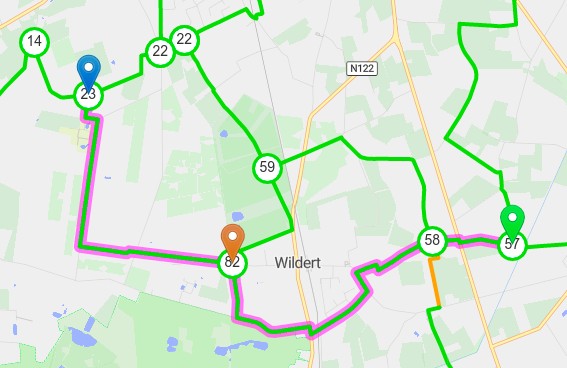
What is a node network?A node network is a network of numbered junctions, called "nodes", interconnected by node-to-node routes. Each numbered node points to adjacent numbered nodes. The node-to-node routes are typically waymarked with simple arrows in both directions. Variants exist, e.g. a network where the user chooses a colour to follow, rather than a number. Some networks use named nodes instead of numbers. Node networks are usually recreational, but commuter cycling networks are being developed in Germany and Belgium. A planned hike, boat trip or ride over a node network uses a list of numbers to follow. Therefore node networks need special planner maps to create a route for a trip. Paper planners and paper network maps were used in the early days; cyclists were seen with wristwraps showing the chain of numbers, special cards in perspex cases with neck cords were available to carry "node cards" on a hike. Nowadays recent paper maps are scarce and limited and people increasingly rely on smartphones and GPS-devices. Many planner apps and sites are appearing on touristic platforms, but most are limited in geographic scope, limited to walking or cycling, cannot handle variants, or need a paid account. That is why a free global node planner app for all types of node networks is a must. knooppuntnet offers one, based on the free and open platform of OpenStreetMap.
Useful linksNode Networks
General
|
||||||||||||||||||||||||||||||||||||||||||||||||||||||


