LinkedGeoData
Jump to navigation
Jump to search
| LinkedGeoData | ||||||||||||||||||||
|---|---|---|---|---|---|---|---|---|---|---|---|---|---|---|---|---|---|---|---|---|
| License: | GNU GPL v3 | |||||||||||||||||||
| Language: | English | |||||||||||||||||||
| Website: | http://linkedgeodata.org/ | |||||||||||||||||||
| Source code: | https://github.com/GeoKnow/LinkedGeoData | |||||||||||||||||||
| Programming languages: | Java and PHP | |||||||||||||||||||
|
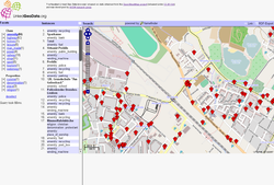
Shows used features of the current map area. RDF export as part of the semantic web analysis |
||||||||||||||||||||
| ||||||||||||||||||||
LinkedGeoData (linkedgeodata.org) is a large spatial knowledge base which has been derived from OpenStreetMap for the Semantic Web. LinkedGeoData currently describes 320 million nodes and 25 million ways (June 2009).
Last commit to the project was in 2022.
