Locus Map
| Locus Map | ||||||||||||||||||||||||||||||||||||||||||||||||||||||||||||||||||||||||||||||||||||||||||||||||||||||||||||||||||||||||||||||||
|---|---|---|---|---|---|---|---|---|---|---|---|---|---|---|---|---|---|---|---|---|---|---|---|---|---|---|---|---|---|---|---|---|---|---|---|---|---|---|---|---|---|---|---|---|---|---|---|---|---|---|---|---|---|---|---|---|---|---|---|---|---|---|---|---|---|---|---|---|---|---|---|---|---|---|---|---|---|---|---|---|---|---|---|---|---|---|---|---|---|---|---|---|---|---|---|---|---|---|---|---|---|---|---|---|---|---|---|---|---|---|---|---|---|---|---|---|---|---|---|---|---|---|---|---|---|---|---|---|
| Author: | menion.asamm | |||||||||||||||||||||||||||||||||||||||||||||||||||||||||||||||||||||||||||||||||||||||||||||||||||||||||||||||||||||||||||||||
| License: | Proprietary (free, paid) | |||||||||||||||||||||||||||||||||||||||||||||||||||||||||||||||||||||||||||||||||||||||||||||||||||||||||||||||||||||||||||||||
| Platform: | Android | |||||||||||||||||||||||||||||||||||||||||||||||||||||||||||||||||||||||||||||||||||||||||||||||||||||||||||||||||||||||||||||||
| Version: | v4.11.0 (2022-07-26) | |||||||||||||||||||||||||||||||||||||||||||||||||||||||||||||||||||||||||||||||||||||||||||||||||||||||||||||||||||||||||||||||
| Languages: | English, Arabic, Czech, Danish, German, Greek, Spanish, Finnish, French, Hungarian, Italian, Japanese, Korean, Dutch, Polish, Portuguese, Russian, and Slovak
| |||||||||||||||||||||||||||||||||||||||||||||||||||||||||||||||||||||||||||||||||||||||||||||||||||||||||||||||||||||||||||||||
| Website: | https://www.locusmap.app/ | |||||||||||||||||||||||||||||||||||||||||||||||||||||||||||||||||||||||||||||||||||||||||||||||||||||||||||||||||||||||||||||||
| Install: | ||||||||||||||||||||||||||||||||||||||||||||||||||||||||||||||||||||||||||||||||||||||||||||||||||||||||||||||||||||||||||||||||
|
Online/Offline map viewer (MapsForge vector map, area downloader, tile cache), support slippy (non-free too) and vector maps (MapsForge library), guiding, routing and basic navigation (online/offline), track recording with detailed POIs (including photos/videos/audio) and elevation correction, extensive geocaching support, WMS maps and more |
||||||||||||||||||||||||||||||||||||||||||||||||||||||||||||||||||||||||||||||||||||||||||||||||||||||||||||||||||||||||||||||||
| ||||||||||||||||||||||||||||||||||||||||||||||||||||||||||||||||||||||||||||||||||||||||||||||||||||||||||||||||||||||||||||||||
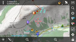
Locus Map is a multi-functional Android navigation app adding advanced online and offline GPS capabilities to Android devices. Primarily it is designed and used for leisure time outdoor activities like hiking, biking, geocaching. Besides its leisure time utilization the app is also used by professionals e.g. for collecting geospatial data, by rescue squad teams, aerial reconnaissance teams etc.
The app was developed in 2009 by Czech developer Jiří Mlavec, founder of Asamm Software company, based in Prague, Czech Republic. Locus Map development is carried out in cooperation with the community of its users-contributors and as such is partially crowd-sourced.
The application has registered almost 3 million installations and has been reviewed in professional media (e.g. Computer Bild or AndroidPIT). It received awards in several app competitions and polls.
Features
Locus Map offers many useful features such as:
- Vast range of online maps (both OSM based and from other providers) - tiles are cached automatically or can be downloaded for offline use (depending on map licence)
- LoMaps (Mapsforge vector maps based on OSM data) supporting on-the-fly change between multiple rendering themes (city, road, hiking/biking, skiing)
- Offline maps provided by commercial cartography publishers
- Navigation with spoken (TTS) directions, calculation online (via GraphHopper) or offline (via BRouter)
- Guiding along a track or to a point, with spoken (TTS) directions
- Hill shading and elevation auto-fill for points & tracks based on altitude database (online and offline)
- WMS service
- Track recorder supporting multiple recording profiles and NMEA raw data recording
- Track management including folders, static & dynamic styles (e.g. elevation dependent track color), track statistics with zoomable elevation & velocity charts
- POI management including folders, filters, icons, attachments like photos, videos & sound recordings
- Limited support of displaying maps in .img format (only one map at a given time, so maps split in multiple layers work poorly)
- Integration of GPSies, Street View and track export to many online services (Strava, Runkeeper, OSM...)
- wide range of Geocaching functions
- Parking assistant (reminds of time limits and helps to find the car)
- Weather forecast service (only online)
- POI alert
- Search by address (online/offline), coordinates, contact, POI name part
- Dashboard - can be created/edited by the user with an integrated dashboard editor
- Map overlays enabling multiple maps over each other
- Image overlays & calibration, e.g. to take a photo of a special map of an information board and use it for orientation in the field
- Several map projections and grids
- Export and import in several formats like KML and GPX (supporting Garmin icon names), TCX, DXF, CSV
- Support of internal (integrated) and Bluetooth GPS, Zephyr and Polar sensors (heart rate etc)
- Customization options, e.g. completely hiding certain features, or changing icon orders
- Locus Store - integrated shop with third party maps, dashboards, icon packs, graphics and features
- Integration with co-apps, e.g. GPS averaging for more precise POI coordinates
- API for developers
Some of the more advanced features like Dashboard or map overlays or NFC and ANT+ support are only available in the paid version of the app - Locus Map Pro.
Add-ons
The features of Locus Map can be extended via add-ons.[1] Some notable add-ons are:
- Augmented Reality addon
- Geocaching4Locus — Load nearby GeoCaches into Locus
- LoPOI — let you contribute POI updates directly to OSM ... the app however has been removed by Google[2]
OpenAndroMaps
Locus Map can display offline maps from OpenAndroMaps, a map optimized for hiking, cycling and mountain biking. To do this users need to install the Elevate map style and download a map region from the OpenAndroMaps website. Both, OpenAndroMaps and using Locus Map for downloading and displaying the map is free of charge.
OpenSeaMap

Locus is compatible OpenSeaMap.
OpenSeaMap can be viewed on Android devices.
Cached charts
Locus automatically saves OpenSeaMap maps that have been viewed online in the device cache. All saved maps are then available offline.
In Locus, OpenSeaMaps can be found in the "Maps" menu (the Map-Icon at the top-right):
Maps > Online > OSM World > OpenSeaMap
This function well in the Heimat-Revier (home-area?). However, because the saved zoom level available offline is only equal to that previously viewed online, it is slightly laborious to save 'foreign regions', if the user wishes to save everything from the large-scale 'overview map' to the Harbour / Port Plan.
Look and Feel
Offline charts

This charts are available in MBTiles-format :
| Area | Download | Size | Coverage |
|---|---|---|---|
| Adriatic Sea | Adriatic Sea | 1,6 GB | 
|
| Bay of Biscay | Bay of Biscay | 0,5 GB | 
|
| English Channel | English Channel | 0,5 GB | 
|
| Strait of Magellan | Strait of Magellan | 0,1 GB | 
|
| Eastern Mediterranean | Eastern Mediterranean | 1,4 GB | 
|
| Western Mediterranean | Western Mediterranean | 1,2 GB | 
|
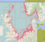
| North Sea | North Sea | 1,5 GB | 
|
| Baltic Sea | Baltic Sea | 1,4 GB | 
|


