| mAPP
|
|
|
| Author:
|
Thorsten Heilmann
|
| License:
|
(InApp Purchases)
|
| Platforms:
|
iOS, iPhone, and iPad
|
| Version:
|
1.1 (2014-01-29)
|
| Languages:
|
German and English
|
| Website:
|
http://www.offlinemap.info
|
| Programming language:
|
Objective-C
|
|
Offline topo vector maps for iPhone and iPad
|
|
Features
| Feature
|
Value
|
| Map Display
|
| Display map
|
yes
|
| Map data
|
vector
|
| Source
|
online;cache;offline
|
| Rotate map
|
yes
|
| 3D view
|
no
|
| Shows website
|
?
|
| Shows phone number
|
?
|
| Shows operation hours
|
?
|
| Routing
|
| Routing
|
no
|
| Create route manually
|
?
|
| Calculate route
|
no
|
| Create route via Waypoints
|
?
|
| Routing profiles
|
no
|
| Turn restrictions
|
no
|
| Calculate route without Internet (Offline routing)
|
no
|
| Routing providers
|
no
|
| Avoid traffic
|
?
|
| Traffic Provider
|
?
|
| Navigating
|
| Navigate
|
no
|
| Find location
|
yes
|
| Find nearby POIs
|
no
|
| Navigate to point
|
yes
|
| Navigation with voice / Voice guidance
|
no
|
| Keep on road
|
no
|
| Lane guidance
|
?
|
| Works without GPS
|
no
|
| Navigate along predefined route
|
yes
|
| Tracking
|
| Make track
|
yes
|
| Customizable log interval
|
yes
|
| Track formats
|
?
|
| Geotagging
|
note
|
| Fast POI buttons
|
yes
|
| Upload GPX to OSM
|
yes
|
| Monitoring
|
| Monitoring
|
yes
|
| Show current track
|
yes
|
| Open existing track
|
yes
|
| Altitude diagram
|
no
|
| Show POD value
|
no
|
| Satellite view
|
no
|
| Show live NMEA data
|
no
|
| Show speed
|
no
|
| Send current position
|
no
|
| Editing
|
| Add POIs
|
no
|
| Edit / Delete POIs
|
no
|
| Add way
|
no
|
| Edit geometries
|
no
|
| Edit arbitrary tags of existing OSM objects
|
no
|
| Edit relations
|
no
|
| View notes
|
?
|
| Create notes
|
?
|
| Edit notes
|
?
|
| Work offline
|
no
|
| Support imagery offset DB
|
?
|
| Upload to OSM
|
no
|
| Rendering
?
|
| Accessibility
|
| Accessibility support
|
no
|
| Complete non graphics text output
|
no
|
| Braille interface
|
no
|
| Exploration modus
|
no
|
| Public Transport mode
|
no
|
| Danger Warnings
|
no
|
| Screenreader
|
no
|
| Screenreader languages
|
no
|
|
|
Description
mAPP is right for everyone how needs offline mapping on iOS. Download OSM vector maps on your device and use it in dead spots or in other countries without roaming costs.
Pure mapping:
Pure offline maps in a clear surface. No bells and whistles, no social, no restaurant suggestions. Just orientation! Ideal for hobby and travel.
Offline topo maps:
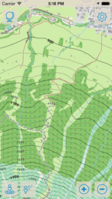
Load whole countries or states and view them later without internet connection. The maps includes full OSM detail down to small pathways. As well contour lines included in the topo maps.
Tracks:
Record tracks and store them on the device or share them as a gpx file. You can also import gpx tracks provided by several platforms for hiking and cycling and display them on the map.
Waypoints:
Enter waypoints to mark a location. So you can use mAPP also for hobbies like geocaching. Use the link options in other apps like Looking4Cache or Geosphere to share waypoints.
