Maa-amet
Maa-amet (EN: Estonian Land Board) - is an official authority which manages cartography and cadastre in Estonia.
Provided Datasets
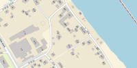
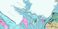
- Modern maps of Estonia
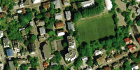
- Satellite imagery with good resolution
- Databases with address information
- Nautical maps
- Historical maps
and lots of other stuff.
Ways to obtain the information
- Online maps: http://xgis.maaamet.ee/xGIS/XGis
- WMS server: http://geoportaal.maaamet.ee/est/Teenused/Avalik-WMS-teenus-p65.html
- Address databases: http://xgis.maaamet.ee/adsavalik/ads?xBTN.newvalja
Permission to use
Currently an official permission for usage in OSM was obtained: http://www.maakaart.ee/docs/Maa-amet_vastus_OSM.pdf (mirror). Modern usage is also governed by spatial data license: https://geoportaal.maaamet.ee/docs/Avaandmed/ETAK_ruumiandmete_litsentsileping.pdf.
Translation
Reply to your inquiry
Based on your inquiry, Maa-amet provides you with the following reply.
You may use open cartographical services of Maa-amet, as well as the data provided by them and use derivative of these data in OpenStreetMap in accordance with the following conditions. Since these are public cartographic services, currently the usage conditions are not regulated by any license, however, in the future this could be changed. In case when policy of Maa-amet in regards of providing the public services will change, you will be informed about this.
When you will be using Maa-amet service, you will need, just as you mentioned in your letter, to specify in the metadata of data derived from Maa-amet services, the web-site Maa-amet as the original data source. Also please specify the year when Maa-amet services were used.
When using cartographic services of Maa-amet, it is recommended to take into account that when there are a lot of requests from a specific IP to the cartographic services, wich could prevent the system from normal functioning, we may block the corresponding IP from access to the services without prior notice.
Tagging
Please see Et:Key:addr for details on how to map Maa-amet address entities to OSM tags.
Import
Below is the (incomplete) list of Maa-amet imports which were performed or are being performed. There is at least one more import using Maa-amet's data and one suspected import using data vectorized from Maa-amet's map (by Verbatium in 2008).
Addresses
- Started: Q1 2013
- Import type: automated import
- Source: Maa-amet address database from 26.12.2012 and later
- Subject: All OSM buildings (areas with building=* tag) that do not have addr:* tags
- Account name: SviMik_import [1]
- Forum discussion (in Russian): http://forum.openstreetmap.org/viewtopic.php?id=11750
- Status: Complete
- Updates: periodic updates
- Special tags: source:addr=Maa-amet 2012 (the year may vary), maaamet:ETAK=*, maaamet:orig_tunnus=*
- Maa-amet DB reference: It is possible to match the records by IDs maaamet:ETAK=* and maaamet:orig_tunnus=*
Buildings
- Started: Q1 2013
- Import type: with full manual validation
- Source: Maa-amet WMS layer and address database from 26.12.2012 and later
- Subject: Places where buildings are missing completely
- Account name: SviMik_import [2]
- Forum discussion (in Russian): http://forum.openstreetmap.org/viewtopic.php?id=11750
- Validation tool: http://osm.svimik.com/btrace_verify.php
- Status: In progress
- Updates: only address data is updated, no geometry updates are planned
- Special tags: source=Maa-amet 2012 (the year may vary), maaamet:ETAK=*, maaamet:orig_tunnus=*
- Maa-amet DB reference: It is possible to match the records by IDs maaamet:ETAK=* and maaamet:orig_tunnus=*
Maintaining imported data
- Import type: automated import
- Source: Maa-amet address database
- Subject: All OSM buildings which were not touched by other users since the initial import (i.e. the last way editor is SviMik_import)
- Account name: SviMik_import [3]
- Status: performed in Q3 2019
- Special tags: source:addr was bumped to "Maa-amet 2019" to indicate that the address is up to date
- Fix-ups: Minor adjustments were made to conform with the most recent Et:Key:addr tagging guidelines
Post-import checks
Several tools were made to check both import integrity and OSM integrity in general after the import was done.
- There is a street name validation tool [4] that locates all places where a street mentioned in building's addr:street tag cannot be found in 1200m range. Usually it indicates that a street is missing in OSM and needs to be mapped, or its name needs to be checked and updated. The 2019 year update revealed 1705 new street names, which were promptly added to OSM by other editors in a matter of weeks.
- Another tool [5] helps to find buildings with no roads around. Unless the building is disused, it is expected to have some driveways. It may be a mere path, but visible nonetheless. If a building has no roads in 250m range it is considered suspicious and the place is marked on the map.
- The address validation tool [6] checks all the addresses, including the ones entered by other editors manually. Since it is strictly discouraged for a bot to overwrite things entered by humans, the only thing it can do is to list these records. When editing, keep close attention to addr:housename, it is sometimes mistakenly used instead of the 'name' tag. Instead of removing, replace the tag key with a proper one (name, operator, etc.)
Map samples
References
- http://www.maaamet.ee/ - Main site, contain information about organisation, project list and news
- http://geoportaal.maaamet.ee/ - Geo-portal containing cartographic services
- http://geoportaal.maaamet.ee/est/Teenused/Avalik-WMS-teenus-p65.html - List of WMS services including URLs


