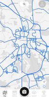
Mapilio
Jump to navigation
Jump to search
| Mapilio | ||||||||||||||||||||
|---|---|---|---|---|---|---|---|---|---|---|---|---|---|---|---|---|---|---|---|---|
| Author: | Mapilio | |||||||||||||||||||
| License: | proprietary (server backend/apps) and CC-BY-SA (images) (free of charge) | |||||||||||||||||||
| Platforms: | Web, Android, and iOS | |||||||||||||||||||
| Version: | 1.2.0 (iOS); 1.0.56 (Android) (2024-06-02) | |||||||||||||||||||
| Website: | mapilio.com | |||||||||||||||||||
| Install: | ||||||||||||||||||||
| Source code: | github | |||||||||||||||||||
|
Collect street level imagery |
||||||||||||||||||||
| ||||||||||||||||||||
This article is a stub. You can help OpenStreetMap by expanding it.
Another service for sharing geotagged photos.
It consists of:
- a web site (proprietary)
- mobile apps (proprietary)
- server back end (proprietary)
- CLI uploading tools (under MIT license as of January 4th 2024).
Terms and Conditions
Terms and conditions are available at: Terms, Privacy Policy.
License
The images on Mapilio can be used under the Creative Commons Attribution-ShareAlike (CC-BY-SA, unspecified version) and are cleared for OSM use.[1]
See also
- Street-level imagery services - alternatives
- ↑ section "Right To Use For OpenStreetMap", retrieved 24 aug 2023

