My:Highway Mapping Myanmar
မြန်မာနိုင်ငံရှိ အဝေးပြေးလမ်းကွန်ယက်အမျိုးအစား
မြန်မာနိုင်ငံတွင် OpenStreetMap အတွက် အကိုးအကားအဖြစ် အလွယ်တကူ ဘာသာပြန်နိုင်သည့် အသေးစိတ် တရားဝင် လမ်းအမျိုးအစား ခွဲခြားသည့်စနစ် မြန်မာနိုင်ငံတွင် မရှိသေးပါ။ ဤ Myanmar OSM အဝေးပြေးလမ်း အမှတ်အသားပြုလုပ်ခြင်း လမ်းညွှန်သည် သက်ဆိုင်ရာအစိုးရဌာနများအသုံးပြုသည့် လက်ရှိအခြေခံလမ်းအမျိုးအစားခွဲခြားစနစ်နှင့် ကိုက်ညီစေရန် ကြိုးပမ်းထားပြီး မြန်မာနိုင်ငံရှိ လမ်းများ၏ လုပ်ငန်းဆိုင်ရာ၊ စီးပွားရေးနှင့် လူမှုရေးဆိုင်ရာ အခန်းကဏ္ဍနှင့် အသင့်လျော်ဆုံး OSM အဝေးပြေးလမ်းအမှတ်အသားနှင့် ကိုက်ညီရန် ကြိုးစားထားပါသည်။
ဤအမြန်လမ်းများ အဘိဓာန် ကို မြန်မာနိုင်ငံအတွက် အသုံးပြုသော်လည်း ကမ္ဘာတစ်ဝှမ်းမှ အလားတူ အဘိဓာန် များကို လိုက်နာပါသည်။ ၎င်းသည် နိုင်ငံအသီးသီးရှိ မြေပုံဆွဲခြင်းအတွေ့အကြုံများ၊ နိုင်ငံအသီးသီးရှိ NGO များနှင့် OSM အသိုင်းအဝိုင်းများနှင့် ဆွေးနွေးမှုများအပေါ် အခြေခံထားသည်။ အချို့နေရာများတွင် လားရာပေါင်းစုံမှ လမ်းကြောင်းများစွာ သွယ်တန်းထားသော လမ်းများ အလွန်ထူထပ်ပါသည်။ ထိုသို့သောအခြေအနေမျိုးတွင်၊ စီးပွားရေးလုပ်ငန်းများအတွက် ပို၍အရေးကြီးသောလမ်းများကို မီးမောင်းထိုးပြသည့် လမ်းဖွဲ့စည်းပုံ ရှိရန် အရေးကြီးပါသည်။ အဝေးပြေးလမ်း=တတိယတန်း အဆင့်ကို ပိုမိုကြီးမားသောကျေးရွာများကြား ဆက်သွယ်ပေးသည့်လမ်းများကို မီးမောင်းထိုးပြရန်၊ သို့မဟုတ် ကျေးရွာများကို မြို့နယ်ဗဟိုများနှင့် ချိတ်ဆက်ပေးရန်အတွက် အသုံးပြုသည်။ ထို့အပြင်၊ အဝေးပြေးလမ်း = အမျိုးအစားခွဲမထားသောလမ်းသည် လမ်းငယ်များနှင့် သက်ဆိုင်သည်။ ၁) ကျေးရွာများနှင့် ဆက်သွယ်ထားသော ကျေးလက်လမ်းများ သို့မဟုတ် ၂) လယ်ကွင်းများနှင့် သစ်တောဧရိယာများသို့သာ သွားသည့်လမ်းများ သို့မဟုတ် ၃) သိသာထင်ရှားသော အဆောက်အဦများဆီသို့ ဦးတည်ကာ ဝန်ဆောင်မှုလမ်းများ (များသောအားဖြင့် ပုဂ္ဂလိက သို့မဟုတ် တစ်ပိုင်းပုဂ္ဂလိက လမ်းများ) နှင့် အဆောက်အဦများသို့ တိုတောင်းသောအကွာအဝေးသို့ သွားသော သို့မဟုတ် တည်ရှိသော ဝန်ဆောင်မှုလမ်းများနှင့်လည်း ခွဲခြားရန် အရေးကြီးပါသည်။ အဝေးပြေးလမ်း= track လမ်းကြောင်းသည် လူနေအိမ်လမ်းတစ်ခု၏ ပိုမိုအဆင့်မြင့်သော လမ်းအတန်းအစားမဟုတ်ပါ စိုက်ပျိုးရေးနယ်ပယ်သို့ ဝင်ရောက်ရန်အတွက်သာ အသုံးပြုသည်ကို သတိပြုပါ။ မရှင်းလင်းပါက အမြန်လမ်း= unclassified ကို သုံးပါ။
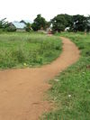
အမြန်လမ်းများစွာကို ခြေလျင်နှင့် တိရိစ္ဆာန်အသွားအလာများ ထပ်ခါတလဲလဲဖြင့် ဖွဲ့စည်းထားပြီး အမြဲတမ်းဖြစ်နေသောလမ်းများကိုသာ ပုံဖော်သင့်သည်ဟု မှတ်သားထားပါ။ Track များနှင့် Path လမ်းကြောင်းများသည် (ဥပမာ၊ သစ်ခုတ်ခြင်း သို့မဟုတ် ရိတ်သိမ်းရာတွင် လွယ်ကူချောမွေ့စေရန်) ရေတိုအတွက် သာဖြစ် သောကြောင့် ၎င်းတို့အား မြေပုံဆွဲခြင်း လုံးဝမပြုသင့်ပါ။
လမ်း၏စီးပွားရေးနှင့်လူမှုရေးအတိုင်းအတာအပေါ်အခြေခံသော တန်ဖိုးများ
Highway Tag သည် လမ်း၏ စီးပွားရေးနှင့် လူမှုရေး အတိုင်းအတာကို ထင်ဟပ်စေသည်။ အသုံးများသောတန်ဖိုးများ၏အသေးစိတ်အချက်အလက်များကိုအောက်တွင်ကြည့်ရှုပါ။
| Tag-Value | Name | ဖော်ပြချက် | ပုံဖေါ်ခြင်း | ဓာတ်ပုံ | |
|---|---|---|---|---|---|
| လမ်းများ | |||||
| highway=motorway | မော်တော်ယာဉ်သွားလမ်းမကြီး | ပုံမှန်အားဖြင့် လမ်းကြောင်း ၂ ခု သို့မဟုတ် ထို့ထက်ပိုသော ပြေးလမ်းများနှင့် အရေးပေါ် မာကြောသော လမ်းပခုံးများပါရှိသော ဝင်ရောက်ခွင့် ကန့်သတ်ထားသော အဓိက အဝေးပြေးလမ်း။ အတန်းလမ်းဆုံများ သို့မဟုတ် driver ways များမရှိပါ။ လမ်းလွှဲများတွင်သာ ဝင်ရောက်ခွင့်ရှိပါသည်။ လမ်းသွားလမ်းလာများ၊ ဆိုင်ကယ်များနှင့် စက်ဘီးများကို တားမြစ်ထားသည်။ အများအားဖြင့် လမ်းအသုံးပြုခ ပေးရလေ့ရှိသည်။
လက်ရှိ မြန်မာနိုင်ငံတွင် တစ်ခုတည်းသော မော်တော်ကားလမ်းမှာ ရန်ကုန်-မန္တလေး ဖြစ်သည်။ |

|
||
| highway=trunk | ပင်စည် လမ်း | မော်တော်ယာဉ် လမ်းမကြီးမဟုတ်သော နိုင်ငံတစ်နိုင်ငံ၏ အရေးကြီးဆုံးလမ်းများ။
မြန်မာနိုင်ငံတွင် အဆိုပါ ပင်စည်လမ်းများသည် အာဆီယံ အဝေးပြေးလမ်းကွန်ရက်၏ တစ်စိတ်တစ်ပိုင်းဖြစ်သော အဝေးပြေးလမ်းမကြီးများဖြစ်ပြီး အများအားဖြင့် "AH" (ဥပမာ AH1၊ AH14၊ AH112) ဟု သတ်မှတ်ကြသည်။ |

|
||
| highway=primary | မူလ လမ်းမကြီး | နိုင်ငံတစ်နိုင်ငံ၏ စနစ်အတွက် ဒုတိယ အရေးကြီးဆုံးသော လမ်းများ။
နိုင်ငံတွင်းရှိ မြို့ကြီးများသို့ သို့မဟုတ် မြို့ကြီးများ အကြား ဆက်သွယ် ပေးသောအဓိက သယ်ယူပို့ဆောင်ရေး လမ်းကြောင်းများ။ မြန်မာနိုင်ငံတွင် အဆိုပါ "အဓိကလမ်းမကြီးများ" သည် ပြည်နယ်နှင့် တိုင်းဒေသကြီး မြို့တော်များကို ဆက်သွယ်ထားပြီး ခရိုင်မြို့တော်များကိုလည်း ဆက်သွယ်နိုင်သည်။ ၎င်းတို့ကို အများအားဖြင့် "National Roads" အဖြစ် ဦးဆောင် "NR" မှ သတ်မှတ်ပေးပါသည်။ ဥပမာ (NR8) ref/number. လမ်းကိုးကားနံပါတ် ။ |

|
||
| highway=secondary | အလယ်တန်းလမ်းမကြီး | နိုင်ငံတစ်နိုင်ငံ၏ စနစ်အတွက် တတိယအရေးကြီးဆုံးသော လမ်းများ။
မြို့နှင့်မြို့ငယ်များကို ဆက်သွယ်ပေးသည့် အရေးကြီးသော သယ်ယူပို့ဆောင်ရေးလမ်းကြောင်းများ။ မြို့ပြများတွင် အများအားဖြင့် ၎င်းတို့သည် သွေးကြောကြီးများ ဖြစ်ကြသည်။ မြန်မာနိုင်ငံတွင် အဆိုပါလမ်းများကို အများအားဖြင့် လမ်းခင်းထားသော်လည်း ဖွံ့ဖြိုးမှုနည်းသော အချို့နေရာများတွင်မူ မခင်းရသေးသော မျက်နှာပြင်များလဲ ဖြစ်နိုင်ပါသည်။ |

|

| |
| highway=tertiary | တတိယတန်းလမ်း | နိုင်ငံတစ်နိုင်ငံ၏ စနစ်အတွက် နောက်ထပ် အရေးကြီးဆုံးသော လမ်းများ။
မြို့နှင့် ရွာများသို့ ဆက်သွယ်ပေးသည့် အဓိကလမ်းမကြီးများ နှင့် ရွာကြီးများကြားရှိ လမ်းများ။ မြို့ပြများတွင် များသောအားဖြင့် ၎င်းတို့သည် သွေးကြောငယ်များ ဖြစ်ကြသည်။ ၎င်းတို့ကို မကြာခဏ လမ်းခင်းထားသည် သို့မဟုတ် မခင်းရသေးသော သိပ်သည်းသည့် မျက်နှာပြင်များလဲဖြစ်နိုင်သည်။ |

|

| |
| highway=unclassified | Minor/Unclassified Road | The least important through roads in a country's system – i.e. minor roads of a lower classification than tertiary, but which serve a purpose other than access to properties.
Non-residential or mixed-use minor roads providing access to small villages, hamlets and public roads providing access to significant commercial, economic, religious, recreational or similar facilities. In urban areas they usually form streets in a commercial area or central business district (CBD) and form public roads in industrial areas.
Can be paved but more often feature an unpaved compacted or ground surface. |

|

| |
| highway=residential | Residential Road | Roads which serve as an access to housing, without function of connecting settlements. Usually lined with housing.
Roads navigable by motorized traffic whose primary purpose is access to houses and residential lots without function of connecting settlements. Located usually inside settlement and built-up areas. Where regular motorized traffic is impossible, limited, or disallowed see highway=path. Note: highway=living_street has been used sometimes to tag smaller residential roads in Myanmar. Living streets (residential streets where pedestrians have legal priority over cars and speeds are kept very low) are not common in Myanmar and this tag should only be used if the road is unanimously designated as a road matching with the highway=living_street criteria. Usually smaller roads in residential areas are better tagged as highway=residential though. |

|

| |
| highway=service | Service Road | Roads providing access to a facility with specific function, usually partly or fully managed by the facility. Often featuring a gate or having restricted access (temporaily or permanently). Usually for a few hundred meters maximum.
Commonly found as:
|

|
||
| highway=track | Unmaintained Track Road | Permanent road (track) for mostly agricultural or forestry uses, wide enough for cars. Unpaved roads, often only passable by 4x4. Tends to turn muddy during rainy season.
Commonly found as:
Note: Although tracks are often rough with unpaved surfaces, this tag is not describing the quality of a road but its use. Consequently, if you want to tag a general use road, use one of the general highway values instead of track. Should not be used for unpaved minor roads that connect to important facilities or have connection function between settlements. See highway=unclassified or highway=service Should not be used for tracks only passable by motorbikes. See highway=path Consider adding
to specify track quality and seasonal usage impediments. Note: Temporary tracks (logging tracks, makeshift field tracks only used during dry/harvest season, short-lived plantation and mining tracks, short lived construction site access tracks, ...) should not be mapped at all. |

|

| |
| Paths | |||||
| highway=path | Path | A non-specific path used as a route between dwellings, settlements, facilities which is not wide enough for cars.
May be used by motorbikes, bicycles and on foot. Residential way or connection way by foot or motorbike within an urban areas. May be the primary access route for some isolated settlements. Common in Myanmar in all environments (urban, rural) and may have different function and condition. May feature steep grades, narrow width, irregular alignment, obstacles, boulders, stream crossings, and seasonal use. Consider adding addtional tags to further specify path such as
Note: highway=footway has been used sometimes to tag paths in Myanmar. Footways (designated footpaths i.e., mainly/exclusively for pedestrians.) are not common in Myanmar and most narrow ways can be used by pedestrians, animals, motorcycles, biciycles etc alike and should be tagged as highway=path. |

|

| |


