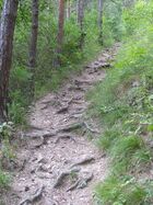
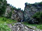
Tag:highway=path
| Description |
|---|
| A generic path used by pedestrians, small vehicles, for animal riding or livestock walking. Not designated for use by two-track vehicles. Very broad, non-specific meaning. |
| Rendering in OSM Carto |

|
| Group: highways |
| Used on these elements |
| Implies |
|
Typically not used by four-wheeled (two-track) vehicles |
| Useful combination |
|
| See also |
| Status: approved |
| Tools for this tag |
|
highway=path indicates a generic path. The tag was envisaged as a bottom building block to supersede the tags highway=footway, highway=cycleway and highway=bridleway by means of specifying intended usage via *=designated attributes. Without additional tags, highway=path is a way that people use to move around, possibly in a small vehicle or using an animal, but not in a car. All further information is in additional tags.
Current usage of highway=path: Ways used by pedestrians, small vehicles like bicycles, for animal riding or livestock walking. This includes walking and hiking trails, bike paths, horse and stock trails, mountain bike trails, as well as multi-use paths for cyclists and pedestrians or similar combinations. Certain types of paths are tagged more specifically with highway=footway, highway=cycleway, and highway=bridleway, but in many cases none of those quite fit so highway=path is used instead.
For urban paths which are intended primarily for pedestrians (potentially with bicycle=yes), some argue it's better to use highway=footway. Others prefer to only use highway=footway for formal footways (with a footway-traffic sign or sidewalks). Actual usage of highway=footway vs highway=path differs between mappers and areas.
A highway=path is not for use by four-wheeled (two-track) vehicles. Often the path is simply too narrow. Other times it is wide enough but such vehicles are prohibited (except for official maintenance or emergency use). A path-like way where four-wheeled vehicles are allowed, is likely better tagged as a highway=track or highway=service.
Tagging
Additional tagging is highly recommended for paths. Without access and surface tags, routing engines may penalise the use of a path. Difficult hiking paths should be tagged with a sac_scale difficulty, to prevent people unwittingly choosing a route which is too difficult for them.
| Key | Value | Comment |
|---|---|---|
| access foot bicycle horse |
yes private designated ... |
Which modes of transport are allowed to use the path. All paths should ideally have access tags; without these, data users must make an assumption about which default access rules apply. |
| surface | * | Information about the physical surface of the path. Recommended for all paths, very useful for routing engines.[1] |
| sac_scale | hiking mountain_hiking demanding_mountain_hiking alpine_hiking demanding_alpine_hiking difficult_alpine_hiking |
A difficulty rating scheme for hiking trails. Recommended for mountain trails. |
| mtb:scale | 0–6 | A difficulty rating scheme for mountain-biking. |
| dirtbike:scale | 0–6 | A difficulty rating scheme for dirt-biking. |
| trail_visibility | excellent good intermediate bad horrible no |
How visible the trail is on the ground. |
| incline | -∞% – ∞% up down |
For marking a way's incline (or steepness/slope). |
| width | Length, numeric | Describes the actual width of a way. The default unit is metres. |
| informal | yes no |
Distinguish purposely built paths from informal ones, a.k.a. path=desire. |
| operator | * | The name of the organization that maintains the path. Data consumers may use the presence of an operator tag as an indication that the path is an official trail. |
| symbol | * | Describes the symbol that is used to mark the way along the route |
Legal access
- For the mapping of public rights of way in the UK (specifically England and Wales), see UK public rights of way.
- closed to public traffic (access=private or access=no)
- only open for a single mode of transport (e.g. foot=yes; vehicle=no; horse=no)
- open for some, but not all kinds of non-motorised traffic (e.g. foot=permissive; bicycle=no; horse=no; motor_vehicle=no)
- open for all forms of non-motorised traffic (e.g. foot=permissive; bicycle=designated; horse=permissive; motor_vehicle=no)
- open for (some or all) forms of two wheeled motorised traffic (e.g. foot=yes; bicycle=designated; horse=no; mofa=yes; motor_vehicle=no)
Only use the general access=* key when an access restriction applies to all transport modes. If only specific transport modes are forbidden, for example, at a vehicle no-entry sign, use a more specific restriction like vehicle=no or motor vehicle=no.
Examples
| Example | Mapping | Description |
|---|---|---|

|
highway=path
+ width=1 |
A recreational path with explicit tags for width, surface, smoothness, walking ease and legal access (based on either signs or regulations that apply on location.) |
 |
A path with no additional tags. Data consumers can only guess if it is legally accessible or practically usable for a certain mode of transport. Note that merely adding bicycle=yes will not tell data users about physical conditions and thus the difference between the path in the first picture -- that will be acceptable for a much larger portion of cyclists -- and the one in the second picture -- that might force many cyclists to dismount. | |

|
highway=path + surface=paved + foot=designated + bicycle=designated + segregated=yes + footway:surface=paving_stones + cycleway:surface=asphalt |
Segregated cycle- and footway. |
Considerations for data consumers
Usage of this tag varies regionally, and paths without any additional tags are common. Consequently, paths require careful interpretation by data consumers to avoid causing map users inconvenience, or worse. [2][3][4][5]
Major pitfalls when consuming this data include:
- Sending map users down paths which are legally off-limits, invisible, or which have an unsuitable surface.
- Not adequately representing the difficulty of hiking paths, and causing map users to choose a path which is too difficult or dangerous for their skill level. This can present a serious safety risk.[6]
When displaying paths, especially in rural areas, maps should make clear which paths are tagged as more difficult on the sac_scale to avoid leading users along difficult routes. Also consider using the trail_visibility, informal, access and surface tags to prioritise rendering.
Routers should carefully consider the weighting of paths which don't have access or surface tags, as these could be legally off-limits or have an unsuitable surface.
Disputed usage

highway=path is described as a generic path usable by pedestrians, non-motorized vehicles such as bicycles, and livestock such as horses. The flexibility comes with a cost. All the essence of who is served by the path, how it behaves on the ground etc. can only be learned from parsing a number of attributes attached to the data entity.
The attributes sac_scale=* and trail_visibility=* e.g. allow for representing pathless mountain routes as a highway=path. The community is split on the issue (Community Forum Poll) whether such use is in line with what the fine article here describes as the meaning of highway=path. Regardless the concept of Verifiability, there is no specific tag for pathless routes, so path gets used in the wild. Data users (consumers) urged to control for the two mentioned attributes, especially the upper rsp. lower values.
In a similar manner, for lack of a more specific tag, highway=path has also become commonly used for steep, rugged routes that do not fit above description. On these routes (or sections) an able bodied person does not walk upright, but instead scrambles using hands and feet to proceed up or down the slope. Riding a bicycle or horse on a scramble is functionally impossible in most cases.
Because of this, usage of highway=path for scrambles is disputed and there is a lack of consensus on how to properly tag them. A proposal for a new tag highway=scramble has been made but has not gained enough support for approval: Proposed features/highway=scramble
See also
- highway=via_ferrata - to represent a
 via ferrata for traversing a mountainside. Usually very exposed and gear required.
 - Path controversy - gives explanation how this is different/similar from highway=footway and other types of ways.
- area:highway=path - for marking, in addition also exact shape/area of a path
- piste:type=* - ski runs, sled / snowmobile routes, and similar winter "paths".
- A list of theories people have as to why this tag was introduced at https://lists.openstreetmap.org/pipermail/talk-au/2019-October/013031.html and https://www.openstreetmap.org/user/Hungerburg/diary/405153#comment58202 for the "aerial imagery was too blurry in the olden days" theory.
- Guidelines for pedestrian navigation
References
- ↑ "For the love of God, if you must use highway=path, please, please, please, please add a surface tag with a commonly-used value."
- ↑ "Right now I am consuming data for a cycling router and highway=path is the bane of my life."
- ↑ "Horridly complex tag, everyone uses it differently."
- ↑ "Just as an example, from a data-consumer POV, here's my current rules for rendering highway=path (...) I have seen highway=path used to mean anything from something that is not even visible on the ground, to something that is impossible to distinguish from a small road (...) Map renderer's frustration, I suppose..." https://lists.openstreetmap.org/pipermail/tagging/2020-May/052747.html
- ↑ New road style for the Default map style - highway=path is evil (search for "highway=path, highway=footway problems")
- ↑ “Concerns raised over crowdsourced maps used by popular hiking apps”. The Great Outdoors. 2023-01-10.
| ||||||||||||||||||||||||||||||


