Naviki
| Naviki | ||||||||||||||||||||||||||||||||||||||||||||||||||||||||||||||||||||||||||||||||||||||||||||||||||||||||
|---|---|---|---|---|---|---|---|---|---|---|---|---|---|---|---|---|---|---|---|---|---|---|---|---|---|---|---|---|---|---|---|---|---|---|---|---|---|---|---|---|---|---|---|---|---|---|---|---|---|---|---|---|---|---|---|---|---|---|---|---|---|---|---|---|---|---|---|---|---|---|---|---|---|---|---|---|---|---|---|---|---|---|---|---|---|---|---|---|---|---|---|---|---|---|---|---|---|---|---|---|---|---|---|---|
| Author: | FH Münster | |||||||||||||||||||||||||||||||||||||||||||||||||||||||||||||||||||||||||||||||||||||||||||||||||||||||
| License: | Proprietary | |||||||||||||||||||||||||||||||||||||||||||||||||||||||||||||||||||||||||||||||||||||||||||||||||||||||
| Platforms: | Android, iPhone, and Windows | |||||||||||||||||||||||||||||||||||||||||||||||||||||||||||||||||||||||||||||||||||||||||||||||||||||||
| Version: | 4.2410 (Android), 4.2411.1 (iOS) (2024-11-25) | |||||||||||||||||||||||||||||||||||||||||||||||||||||||||||||||||||||||||||||||||||||||||||||||||||||||
| Language: | German
| |||||||||||||||||||||||||||||||||||||||||||||||||||||||||||||||||||||||||||||||||||||||||||||||||||||||
| Website: | http://www.naviki.org | |||||||||||||||||||||||||||||||||||||||||||||||||||||||||||||||||||||||||||||||||||||||||||||||||||||||
| Install: | ||||||||||||||||||||||||||||||||||||||||||||||||||||||||||||||||||||||||||||||||||||||||||||||||||||||||
|
Only Germany supported |
||||||||||||||||||||||||||||||||||||||||||||||||||||||||||||||||||||||||||||||||||||||||||||||||||||||||
| ||||||||||||||||||||||||||||||||||||||||||||||||||||||||||||||||||||||||||||||||||||||||||||||||||||||||
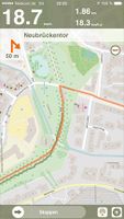
Naviki is an online cycling planner and cycling navigation and track logging application for Android and iOS.
General Information
| Online since: | February 2009 |
|---|---|
| Update Routing-Data: | every Week |
| Manager: | Gernot Bauer, Achim Hennecke, Sven Luzar (User:sven_luzar) |
| Initial Idea: | Sven Luzar (User:sven_luzar) |
| Developer: | Stefan Becker, Sven Luzar (User:sven_luzar), Mirko Werner |
| Public Relations: | Achim Hennecke |
| Currently supported Countries: | Germany |
| Supported Languages for RouteInstructions: | German |
| Routing algorithm: | A* (A-Star); Dijkstra; |
| Implementation and Server: | The Naviki Routing services are implemented by using cloud technologies.
The Applicationserver is implemented in C++. HTTP is used to communicate between the nodes. PostGIS is used to store the routing-network. The server has 2 fast quad core CPUs with 64 bit architecture, 48 GB RAM, 1 TB HD. |
Attempts to find practical, and particularly beautiful, routes for bicycles with the help of a navigation system often ended in disappointment, since many of the best cycle routes follow less wellknown roads and paths that are outside the common road system. Until now, these innumerable “hidden paths” could rarely be found by someone travelling in an area where they did not already know their way around.
Naviki is a new type of navigation system based on OSM data as well as on tracks contributed by Naviki users. Naviki is specialised on bike routing. With Naviki it is possible to find ideal bike routes, even in unfamiliar areas - conveniently and quickly on www.naviki.org
When you make a routing enquiry you can indicate whether you prefer the quick or the scenically beautiful way of travelling. Naviki then combines different bike routes so that you obtain a suitable route from your given starting-point to your destination - as easily as in road navigation, and designed specifically for the bike.
In Naviki any cyclist can publish their recommended routes online. In this way a comprehensive collection will develop. Apart from information about the route itself, you can also enter hints about any major or minor notable detail along the way. OSM data plus this information forms the basis on which new routes are calculated for other Naviki users.
Who is the developer?
Naviki is being developed and contineously improved by Münster University of Applied Sciences, Germany. The beta version is available since the end of 2009.
More information on the About page on www.naviki.org (in German).
- highway=primary
- highway=primary_link
- highway=secondary
- highway=secondary_link
- highway=tertiary
- highway=unclassified
- highway=road
- highway=residential
- highway=living_street
- highway=service
- highway=track
- highway=services
- highway=path
- highway=cycleway
- highway=footway
- highway=bridleway
- highway=byway
- highway=steps
- cycleway=lane
- cycleway=track
- cycleway=opposite_lane
- cycleway=opposite_track
- cycleway=opposite
- tracktype=grade1
- tracktype=grade2
- route=bicycle
- route=mtb
- bicycle=yes
- bicycle=designated
- bicycle=private
- bicycle=permissive
- bicycle=dismount
- bicycle=destination
- bicycle=delivery
- bicycle=agricultural
- bicycle=forestry
- bicycle=unknown
PermaLink
In order to show just the map in a certain position and zoom level you may skip the start and end parameters and use the permalink parameters (otherwise you'll see a map of Germany):
- lon = longitude (centre of the map)
- lat = latitude (centre of the map)
- zoom = zoom level
Example URL
http://www.naviki.org/de/maps/#lat=51.68617954855624&lon=12.48046875&zoom=6
Supported Webbrowsers
- Firefox
- Safari
- InternetExplorer
- Google Chrome
Optimized for resolution 1280x1024 or higher.
Help!
- Contact Sven (User:sven_luzar)
