OSMnx
Jump to navigation
Jump to search
OSMnx is a Python package to "Retrieve, model, analyze, and visualize street networks and other spatial data from OpenStreetMap."
The OpenStreetMap-Data are retrieved with Overpass and stored in a Geopandas Dataframe.
Code Example
Download street network data of the Area of San Francisco and build a topologically-corrected street network:
import osmnx as ox
bbox = -122.43, 37.78, -122.41, 37.79
G = ox.graph.graph_from_bbox(bbox, network_type="drive_service")
Download all Buildings from the city of Basel:
import osmnx as ox
buildings = ox.features_from_place("Basel, Switzerland", tags = {'building': True})
Documentation
The documentation is available from: https://osmnx.readthedocs.io
Find examples: https://github.com/gboeing/osmnx-examples
github.com/gboeing/osmnx - Github repo gives the overview description, instructions, and downloads
Created by Geoff Boeing. See his blog post overview and academic publication about OSMnx.
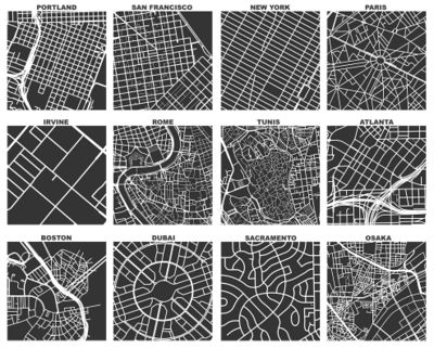
Example renderings from OSMnx

