Organised Editing/Activities/Operation Fistula Madagascar Mapping/Quality Assurance
In order to guarantee a certain quality of created map data, several levels of quality control are being done:
Error check at a changeset level
While editing OpenStreetMap data, the validation tool within JOSM is launched and the mapper will check every error and warning, and try to solve them. Via the Tasking Manager, the mapper who validates the task also performs the same operation to make sure that the data within the task is clean.
Error check and harmonization at a project level
At a project scale (most often a project corresponds to a commune), the JOSM validator is once again used and the coherence of data through all the tasks is verified. At the edges of tasks, it is frequent to find unconnected ways or duplicate features. Also, at this level, large areas spawning multiple tasks are merged.
An overview of the data within the whole commune (or multiple neighboring communes) allows to distinguish the hierarchies of hydrography and roads. The mapper can refine those features by using his/her knowledge in geography and with consideration of local context (with support of GPS tracks and geotagged photos collected by field workers).
Error check, database queries and analysis on all previously mapped areas
On all areas that have been mapped by the team, periodic operations are performed to make sure the data is clean and most importantly, usable. There are potential errors and mapping mistakes that have not been detected by previous quality control operations.
Osmose
Osmose is a tool that highlights multiple types of potential errors both related to geometry and attributes of OpenStreetMap data. Warnings are fetched using the Osmose API and are checked using QGIS and JOSM. This operation is performed every six months.
Database queries
To detect further anomalies in the attributes, database queries are occasionally performed on copies of OpenStreetMap data imported into PostgreSQL/Postgis. Such requests allow to find unusual attribute values that are often caused by a typing error within JOSM (Figure 1). As long as they don’t cause a significant problem, a cleanup of such errors can be done once a year for a small team of 5 mappers.
Analysis of routable ways
Several potential mapping mistakes of routable linear features (road network, water course) can be detected by performing spatial analysis within a GIS. Some potential mistakes that can be located are:
- Floating islands: parts of a linear network that is not connected to the belonging main network. This includes parts of higher hierarchy ways isolated within lower hierarchy ways (Figure 2).
- Remarkably unrealistic routes between multiple points within the network. Deviating routes can happen when there are barriers, like bodies of water for example, but often they are caused by mappers omitting parts of the way that might have been hard to identify on the imagery: paths through an area of rice fields or through a group of houses, paths following the bed of the river, paths or roads covered by trees… (Figure 3).
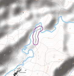
- Water flowing uphill: the way was drawn in the wrong direction (Figure 4). Elevation of start points and end points of way segments can be extracted from a digital elevation model (DEM) so segments with positive slopes can be detected.
Once their locations are extracted, each case is verified using satellite imagery in JOSM and connected/inverted if needed. Those are quite frequent errors; analyses and error check operations are performed every month on all areas that have been mapped by the team. This also affects the use of the data as it can lead to erroneous distance calculations.


