OsmInEdit
Jump to navigation
Jump to search
| OsmInEdit | ||||||||||||||||||||||||||||||||||||||||||||||||||||||||||||||||||||||||||||||||||||||||||||||
|---|---|---|---|---|---|---|---|---|---|---|---|---|---|---|---|---|---|---|---|---|---|---|---|---|---|---|---|---|---|---|---|---|---|---|---|---|---|---|---|---|---|---|---|---|---|---|---|---|---|---|---|---|---|---|---|---|---|---|---|---|---|---|---|---|---|---|---|---|---|---|---|---|---|---|---|---|---|---|---|---|---|---|---|---|---|---|---|---|---|---|---|---|---|---|
| Author: | User:PanierAvide | |||||||||||||||||||||||||||||||||||||||||||||||||||||||||||||||||||||||||||||||||||||||||||||
| License: | ISC License | |||||||||||||||||||||||||||||||||||||||||||||||||||||||||||||||||||||||||||||||||||||||||||||
| Platform: | Web | |||||||||||||||||||||||||||||||||||||||||||||||||||||||||||||||||||||||||||||||||||||||||||||
| Version: | 1.0.15 Changelog (2024-03-19) | |||||||||||||||||||||||||||||||||||||||||||||||||||||||||||||||||||||||||||||||||||||||||||||
| Languages: | ||||||||||||||||||||||||||||||||||||||||||||||||||||||||||||||||||||||||||||||||||||||||||||||
| Website: | https://osminedit.pavie.info/ | |||||||||||||||||||||||||||||||||||||||||||||||||||||||||||||||||||||||||||||||||||||||||||||
| Source code: | https://framagit.org/PanierAvide/osminedit | |||||||||||||||||||||||||||||||||||||||||||||||||||||||||||||||||||||||||||||||||||||||||||||
| Programming language: | JavaScript | |||||||||||||||||||||||||||||||||||||||||||||||||||||||||||||||||||||||||||||||||||||||||||||
|
Simple indoor editor |
||||||||||||||||||||||||||||||||||||||||||||||||||||||||||||||||||||||||||||||||||||||||||||||
| ||||||||||||||||||||||||||||||||||||||||||||||||||||||||||||||||||||||||||||||||||||||||||||||
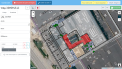
OsmInEdit (OpenStreetMap Indoor Editor) is a web editor, focused on indoor mapping, developed by Adrien Pavie and improved by a whole community. Its homepage is located at osminedit.pavie.info.
Features
OsmInEdit is intended to be simple as iD editor, and focused on mapping what's inside buildings. OsmInEdit offers indoor-dedicated functionalities.
Floor plan & imagery
- Import images building plans as background imagery
- Rotate, scale, distort, change opacity
- Export all floor plan settings in a single file to reuse it later
- Access to all available aerial imagery in your area
- Add custom TMS imagery
Indoor data editing
- Simple editing of indoor data
- 3 edit modes
- Building : edit metadata of building itself (name, amount of levels)
- Floors : edit floor contours, level by level
- Features : add or edit every single object in a particular level of a building
- Dedicated presets : room, corridors, doors, furniture... And all common features (amenities, shops, offices...) !
Indoor data viewer
- Browse through existing and created data through all buildings and levels (similar to OpenLevelUp)
Contribute
As it's an open source project, you are welcome to help us improve the editor. There are several ways to contribute :
- Use it and send us feedbacks, so we can add more features and fix bugs
- Translate in your language, to bring indoor mapping to more people worldwide
- Help improve the code or add new features
If you are interested, you can find more details on how to help us here.
Source code is available at Framagit (main repository) or GitHub (read-only mirror).
See also
- Tips and tricks on using the editor
- Indoor mapping - Introduction to the topic
- Simple Indoor Tagging - Tagging scheme allowing indoor mapping
- OpenLevelUp - Web map of OSM indoor data

