Project of the week/2011/Feb 23
Bridges and Tunnels
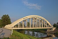
Bridges and tunnels assist travel. They span barriers that otherwise impede travel such as mountains and ravines. They also reduce the interaction between travelers in cases such as grade-separated railway crossings, and motorway interchanges.
The Project of the Month is to add local bridges and tunnels to the map.
Tagging suggestions
Bridges and tunnels are linear features in OpenStreetMap.
Required tags
Both bridge and tunnel tags are modifiers to existing ways. The only required tag for a bridge or tunnel is either
or
but generally not both.
Some mappers use more detailed classifications, rather than yes.
- bridge=aqueduct,viaduct,draw,swing, # Some mappers add detailed classifications.
- tunnel=culvert # tunnel=culvert is often used for streams under roadways via a pipe.
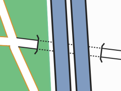
In the illustration, one road way is shown passing beneath two motorway ways in a tunnel. Depending on construction methods and mapper preference, this area might be mapped as two parallel bridges rather than one tunnel.
Either bridge or tunnel is added to an existing way
- highway=* # or railway,etc...
Positioning
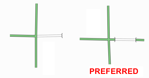
The start and end of a tunnel or bridge should be horizontally separated from an adjacent junction.
Layers
A layer tag is added to a bridge or tunnel way to provide additional information for complex interchanges and hints for renderers. Bridges over other ways are assigned higher layer values. Tunnels under other ways are assigned lower layer values.
- layer=-5 to 5
Results
These graphs show the number of bridge and tunnel objects* in the OpenStreetMap database and are updated approximately once per hour.
http://rweait.dev.openstreetmap.org/osmbridge-day.png
http://rweait.dev.openstreetmap.org/osmbridge-week.png
http://rweait.dev.openstreetmap.org/osmtunnel-day.png
http://rweait.dev.openstreetmap.org/osmtunnel-week.png
- The "recent" line shows the number of objects added recently. It is a rough indication of PotM activity over the last little while, nominally an hour. The "PotM" line indicates the start and end of the project period.


