skp2osm
Jump to navigation
Jump to search
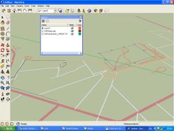
skp2osm lets you use OpenStreetMap in SketchUp.
Motivation
Create 2D outline of a building using 1-2 photos. This is to be a useful tool for areas where high resolution satellite imagery is not available.
| You are not allowed to trace Google satellite imagery in SketchUp and submit the results to the OSM database! |
| You are not allowed to use SketchUp 3D Warehouse to derive 2D outline of a building to be submitted to the OSM database! |
Main features
| Google Sketchup Plugin | ||||||||||||||||||||||||||||||||||||||||||||||||||||||||||||||||||||||||||||||||||||||||||||||||||||||||
|---|---|---|---|---|---|---|---|---|---|---|---|---|---|---|---|---|---|---|---|---|---|---|---|---|---|---|---|---|---|---|---|---|---|---|---|---|---|---|---|---|---|---|---|---|---|---|---|---|---|---|---|---|---|---|---|---|---|---|---|---|---|---|---|---|---|---|---|---|---|---|---|---|---|---|---|---|---|---|---|---|---|---|---|---|---|---|---|---|---|---|---|---|---|---|---|---|---|---|---|---|---|---|---|---|
| Author: | user:vvoovv | |||||||||||||||||||||||||||||||||||||||||||||||||||||||||||||||||||||||||||||||||||||||||||||||||||||||
| License: | BSD | |||||||||||||||||||||||||||||||||||||||||||||||||||||||||||||||||||||||||||||||||||||||||||||||||||||||
| Platforms: | Windows and macOS | |||||||||||||||||||||||||||||||||||||||||||||||||||||||||||||||||||||||||||||||||||||||||||||||||||||||
| Version: | (2011-02-22) | |||||||||||||||||||||||||||||||||||||||||||||||||||||||||||||||||||||||||||||||||||||||||||||||||||||||
| Language: | English
| |||||||||||||||||||||||||||||||||||||||||||||||||||||||||||||||||||||||||||||||||||||||||||||||||||||||
| Website: | https://github.com/vvoovv/skp2osm/ | |||||||||||||||||||||||||||||||||||||||||||||||||||||||||||||||||||||||||||||||||||||||||||||||||||||||
| Source code: | https://github.com/vvoovv/skp2osm/ | |||||||||||||||||||||||||||||||||||||||||||||||||||||||||||||||||||||||||||||||||||||||||||||||||||||||
|
Plugin to use OSM in the SketchUp editor |
||||||||||||||||||||||||||||||||||||||||||||||||||||||||||||||||||||||||||||||||||||||||||||||||||||||||
| ||||||||||||||||||||||||||||||||||||||||||||||||||||||||||||||||||||||||||||||||||||||||||||||||||||||||
- Import of OSM files to SketchUp
- Import of GPS tracks in NMEA and GPX formats to SketchUp
- Export from SketchUp to OSM file
Prerequisites
- You should know how to do 3D modelling in SketchUp. You should know how to reconstruct 3D buildings from photos using SketchUp's Photo Matching tool
- The photos used for 2D outline reconstruction should not be cropped!
Installation
Download the plugin from here and unpack to Program Files\Google\Google SketchUp 8\Plugins
On mac the folder is: /Library/Application Support/Google SketchUp 8/SketchUp/Plugins
Usage
- Reconstruct 2D outline of a building using Photo Matching tool. The outline should be parallel to XY plane otherwise it will not be exported to OSM file.
- Prepare OSM files and GPS tracks to be imported to SketchUp. Their extent should be quite small.
- File -> Import... to import the files to SketchUp.
- Place the reconstructed 2D outline to an appropriate location inside OSM ways and/or GPS tracks using Tape Measure, Move, Scale and Rotate tools
- Export the 2D outline to OSM file: File -> Export to OpenStreetMap file... The outline will be exported with the tags building=yes and source=skp2osm
- Open the just exported OSM file in JOSM for final editing and sending to the OSM database.
Limitations
- Non-latin characters in the path to imported and exported files are not supported
- Export of grouped objects is not supported. If you group objects in SketchUp, remove grouping before exporting to OpenStreetMap file.
Feedback
Please submit it to the OSM forum. Use the same login and password as at osm.org. There is also Russian forum thread.
See also
- Mapbox Map Importer – proprietary SketchUp extension for importing Mapbox maps, including those based on OSM
