Spanish Cadastre/Buildings Import/Data Conversion/Problems
| Import guide | Projects management | Results | Documentation | |||||||||||||||||
 Problems describes the problems encountered in the data conversion for this buildings import and their solution. Data simplificationIssues related to the reduction of the data set. Buildings with multipart geometriesThe Building data set contains two types of geometries.
 For more information consult the wikipedia: WKT Solution: Buildings with multipart geometry are separated by this algorithm. Building parts below ground levelThe building parts layer contains geometries with the fields:
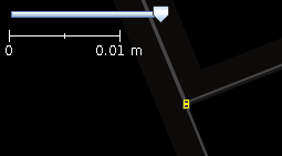
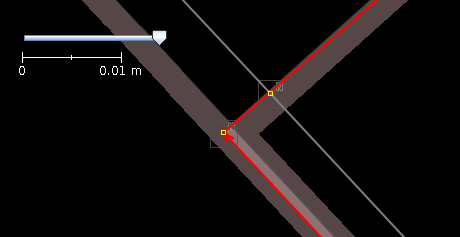
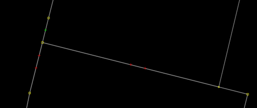
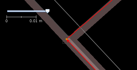
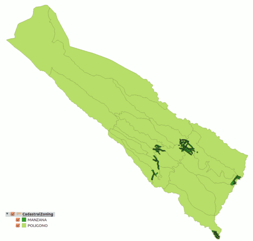
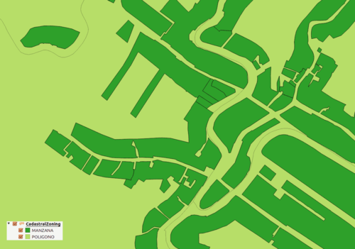
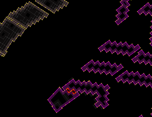
There are parts of buildings that do not have levels above the ground. These are generally parts that are outside the footprint of the building or that correspond to elements such as stairs. If both the number of levels above and below ground is zero, the part corresponds to a porch. 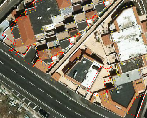 Solution: During tag transformation it will be assigned building:part=roof to the building parts without levels above and below ground ('numberOfFloorsAboveGround' = 'numberOfFloorsBelowGround' = 0). The algorithm building parts outside the building footprint removes the rest of the building parts below ground. Reduction of building partsIn the data set of building parts, only two attributes are imported, the number of levels above and below ground. The set contains buildings with adjacent parts that have the same level values. Their number can be reduced by merging the geometries of these parts into one. Another strategy to further reduce data is to delete those building parts whose levels match the maximum and minimum value for the building. These values can be transferred to the building footprint and the parts, as they do not contain any other information, are redundant and can be deleted. In these cases, the building parts will not cover completely the footprint. The resulting 3D scheme worked correctly (2017) on some renders, but not on others. 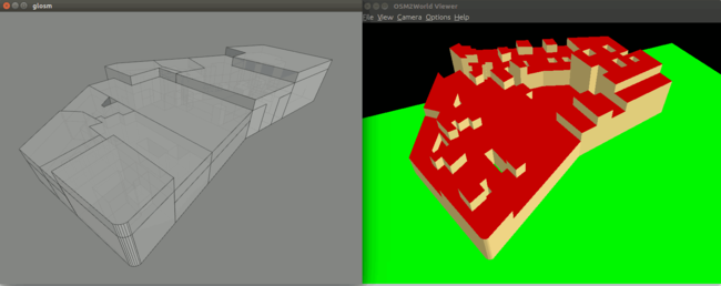 This simplification was abandoned as of March 2021 (from CatAtom2Osm 1.3) to better fulfil the Simple 3D Buildings scheme that requires the entire building outline should be filled with building part areas. However, when the level is even for all the building, the parts are not incorporated (there would only be one and it coincides with the outline). The CatAtom3Dfix tool has been developed to correct the data already imported. Solution: Algorithm for reduction of building parts. Detection of swimming pools inside buildingsSome pools may appear located within the building footprint. In these cases, the Cadastre data contains two entries with identical geometry, one in the pool data set and another in the buildings parts data set. The building part with the same shape of the swimming pool is used to define the cavity that holds the water on the roof of the building. Using the tags Sometimes, these swimming pools are not located on the roof of the building, but inside. There is no way to identify these cases automatically and they are left for manual review. Solution: Algorithm for detection of swimming pools inside buildings. Building parts outside the footprintIn the 3d model in use, the parts of buildings must be contained within the building's outline. However, in the Cadastre data we can find parts outside the footprint, even after removing the underground parts. The image shows an example. In green the contour of two buildings and in red external parts, on the left the seen from the front and on the right seen from above. 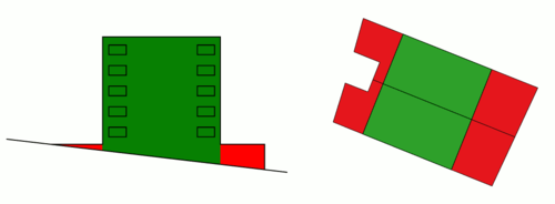 They correspond to building parts on a sloping ground that are below ground to one side and above ground to another. There are two possible solutions. The first is to expand the footprint of the building to encompass the external annexed parts and promote the part to building when it is not attached to the footprint. The second is to eliminate these parts of the import. You can also find 'orphan' building parts, that is, there is no associated building.  Solution: The algorithm building parts outside the building footprint deletes the parts outside the building footprint if it exists. If it finds parts without an associated building, it does not eliminate them and generates an outline from the union of the parts. Duplicated nodesIn most cases, the Cadastre building layer has an estimated accuracy of 0.1 meters. We can find closely spaced nodes separated by a few centimeters. They can be consecutive in the same geometry or belong to two adjacent buildings. Its existence can imply topology errors and complicates the resolution of this problem and that of unneded nodes. Solution: algorithm to add topological nodes and simplify duplicate nodes. Unneded nodesThe Cadastre data contains an excessive number of nodes for each geometry.  Solution: To identify and delete an algorith to simplify geometries is used. Errors correctionIssues related with data quality. Topological errorsThe Cadastre data may contain topological errors. Topological errors can result in overlapping geometries instead of being adjacent. Solution: algorith to simplify geometries. Vertices with too low angleThe original data contains geometries with vertices that form an angle with the adjacent vertices too small. They look like the result of having made a difference between two polygons with segments that should be adjacent but topologically incorrect. This problem is not detected by the JOSM validation tests. 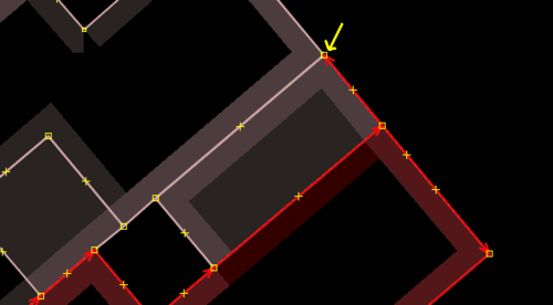 Another variant is to find two consecutive vertices with low angle (in 'zig-zag'). 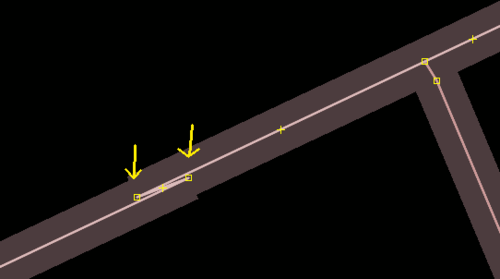 Solution: The algorithm to delete invalid geometries also deals with this problem. Junk geometriesThe original data contains buildings or parts that seem to be the result of having made a difference between polygons with sections that should be adjacent but topologically incorrect. This problem is not detected by the JOSM validation tests 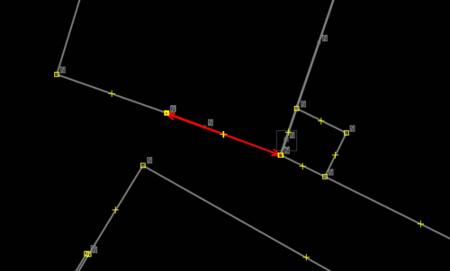 Solution: The algorithm to delete invalid geometries deletes geometries that do not pass the validation tests GEOS and marks with a warning those wich area is below a threshold. Data managementIssues related to the import preparation Split of data in tasksIt's no convenient to upload to the OSM servers big amounts of data at a time. That's why it is necessary to divide Cadastre data, which cover an entire municipality, into smaller fractions or tasks. It is proposed to use the task manager to create projects for the data to be imported. We can use the <CadastralZoning> elements to split the data in tasks. These elements can be of two types according to the value of the field <cp:levelName>:
It is important that the ways contained in each task do not share nodes with the ways contained in another task. If not, before uploading a task, it would be necessary to check if there are matches with the existing nodes and merge them to avoid duplicates. For this reason, adjacent blocs are merged before using them. Soluction: First it is necessary to generar ficheros wich each task represented by an area. Then the buildings are splitted into a OSM file for each task. Througfare names correctionThrougfare names in the addresses dataset are in capital letters, without accent marks, they contain abbreviations and information not belonging to the name. It is necessary to correct the names according to the normalization rules (es). In addition, the name of the througfare in the Cadastre data may contain errors or discrepancies with respect to the information collected on the ground. Solution: Process for througfare names conflation. Problems with addresses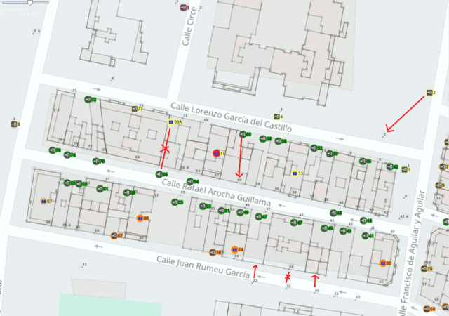 This image shows some of the problems we can find with the addresses. It is a combination of the OSM map, Cartociudad portal numbers (the small labels) and the converted Cadastral data for buildings and addresses. The addresses of type "entrance" show the icon of a door and those of type "parcel" a blue icon of the number plate.
Solution: Addresses are asigned to diferent elements according to this table: | ||||||||||||||||||||
