File list
Jump to navigation
Jump to search
This special page shows all uploaded files.
| Date | Name | Thumbnail | Size | User | Description | Versions |
|---|---|---|---|---|---|---|
| 05:39, 15 April 2025 | OSM Canada logo.svg (file) | 61 KB | Undearius | Rebased from the official OpenStreetMap logo. Reduced glare for visibility | 3 | |
| 22:58, 14 April 2025 | Snap-py Talk 2025-04 VMPanes better-osm-org.pdf (file) |  |
984 KB | GOwin | {{Information | description=Snap-py Talk presentation during Map-py Wednesday March 2025 session on using better-osm-org script s for the browser for add-on features for the OSM.org website. | source=Own work | date=2025-04016 | author=Vince Panes }} | 1 |
| 22:49, 14 April 2025 | Snap-py Talk 2025-03 Uzair-Ahmad OSM & Climate Change.pdf (file) |  |
1.4 MB | GOwin | {{Information | description=Snap-py Talk session for March 2025 on utilizing OSM data for Climage Change action in Pakistan | source=Own work | date=2025-03-19 | authors=Uzair Ahmad | other_versions= }} | 1 |
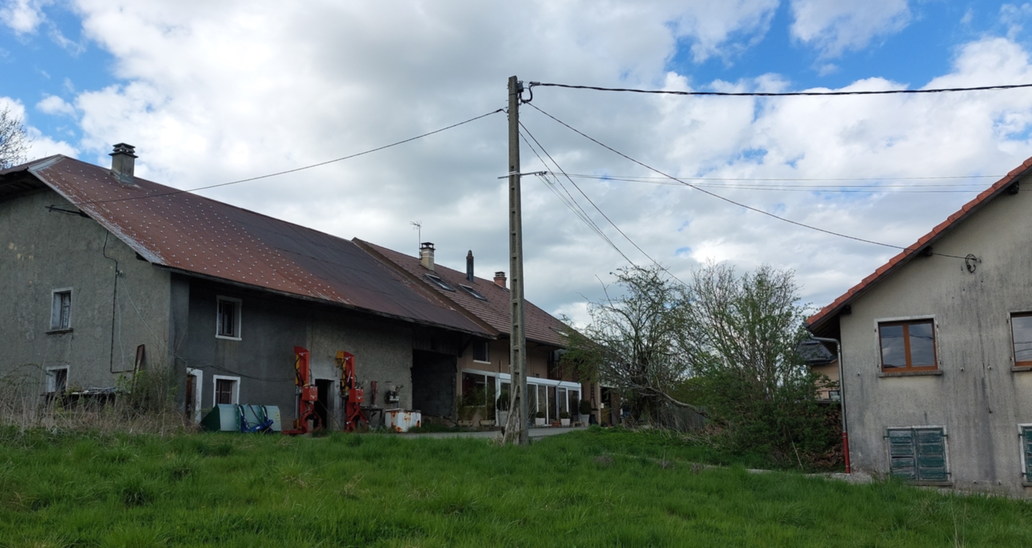
| 20:49, 14 April 2025 | Power overhead service supply buildings france.jpg (file) |  |
1.05 MB | Fanfouer | {{Information | description=Two buildings are connected to the same power pole with their independant service lines | source= | date=2025-04-12 | author=François Lacombe | other_versions= }} | 1 |
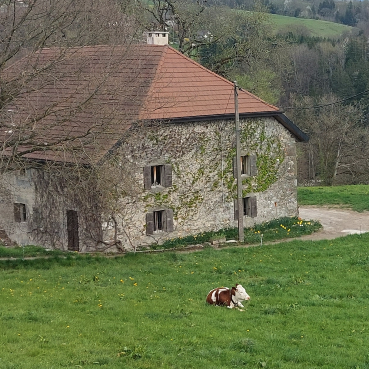
| 20:42, 14 April 2025 | Power overhead service supply rural france.jpg (file) |  |
1,023 KB | Fanfouer | {{Information | description=An overhead power service supply to a building in rural area | source= | date=2025-04-12 | author=François Lacombe | other_versions= }} | 1 |
| 20:14, 14 April 2025 | Power circuits sections segments.svg (file) |  |
28 KB | Fanfouer | More consistent segments section | 3 |
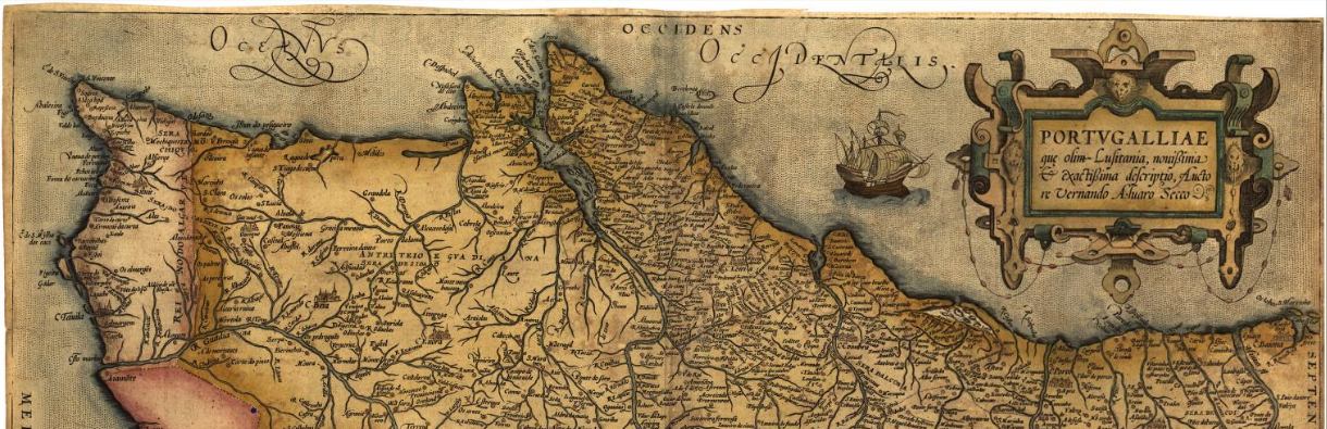
| 19:48, 14 April 2025 | Portvgalliae.png (file) |  |
1.38 MB | AntMadeira | {{Information | description= | source= | date= | author= | other_versions= }} | 1 |
| 19:43, 14 April 2025 | Line arrangement delta.svg (file) |  |
3 KB | Fanfouer | {{Information | description= | source= | date=2025-04-14 | author=François Lacombe | other_versions= }} | 1 |
| 19:38, 14 April 2025 | Line arrangement triangular.svg (file) |  |
3 KB | Fanfouer | {{Information | description=Triangular arrangement of line bundles | source= | date=2025-04-14 | author=François Lacombe | other_versions= }} | 1 |
| 19:32, 14 April 2025 | Line arrangement square.svg (file) |  |
3 KB | Fanfouer | {{Information | description=Square arrangement of line bundles | source= | date=2025-04-14 | author=François Lacombe | other_versions= }} | 1 |
| 19:22, 14 April 2025 | Line arrangement semi-vertical.svg (file) |  |
3 KB | Fanfouer | {{Information | description=Semi vertical arrangement of line bundles | source= | date=2025-04-14 | author=François Lacombe | other_versions= }} | 1 |
| 19:12, 14 April 2025 | Line arrangement vertical.svg (file) |  |
3 KB | Fanfouer | {{Information | description=ertical arrangement of line bundles | source= | date=2025-04-14 | author=François Lacombe | other_versions= }} | 1 |
| 18:03, 14 April 2025 | Line arrangement semi-horizontal.svg (file) |  |
3 KB | Fanfouer | {{Information | description=Semi-horizontal arrangement of line bundles | source= | date=2025-04-14 | author=François Lacombe | other_versions= }} | 1 |
| 17:51, 14 April 2025 | Line arrangement horizontal.svg (file) |  |
3 KB | Fanfouer | {{Information | description=Horizontal arrangement of line bundles | source= | date=2025-04-14 | author=François Lacombe | other_versions= }} | 1 |
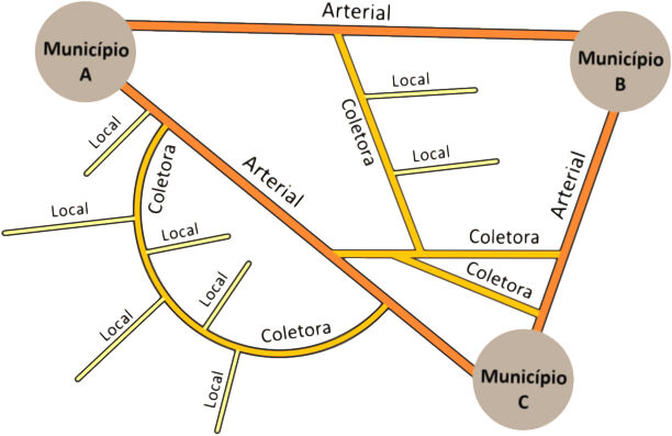
| 15:25, 14 April 2025 | Br-sp-der-hierarquia-funcional-regional.jpg (file) |  |
41 KB | Ftrebien | Hierarquia funcional das vias regionais e rurais no Brasil, segundo o Manual Básico de Estradas e Rodovias Vicinais do DER/SP, pág. 13. | 1 |
| 11:06, 14 April 2025 | Ohmygridlogo.png (file) |  |
1 MB | Andreas Hernandez | 1 | |
| 23:04, 12 April 2025 | State of High-Voltage Network Map in Tanzania.png (file) |  |
2.24 MB | Ben Dynartio | {{Information | description=State of the High-Voltage Network map in Tanzania | source=OpenEnergyTransition, with Bing & JOSM | date=2025-03-21 | author= | other_versions= }} | 1 |
| 20:49, 12 April 2025 | Electrical High-Voltage Network Components OpenInfraMap.png (file) |  |
71 KB | Ben Dynartio | {{Information | description=OpenInfraMap Screenshot of electrical high-voltage components. Place : https://openinframap.org/#16.43/-5.352648/38.655164 | source=OpenInfraMap | date= | author= | other_versions= 2025-04-12 }} | 1 |
| 20:37, 12 April 2025 | Electrical High-Voltage Network Components.png (file) |  |
101 KB | Ben Dynartio | Adding explanation | 2 |
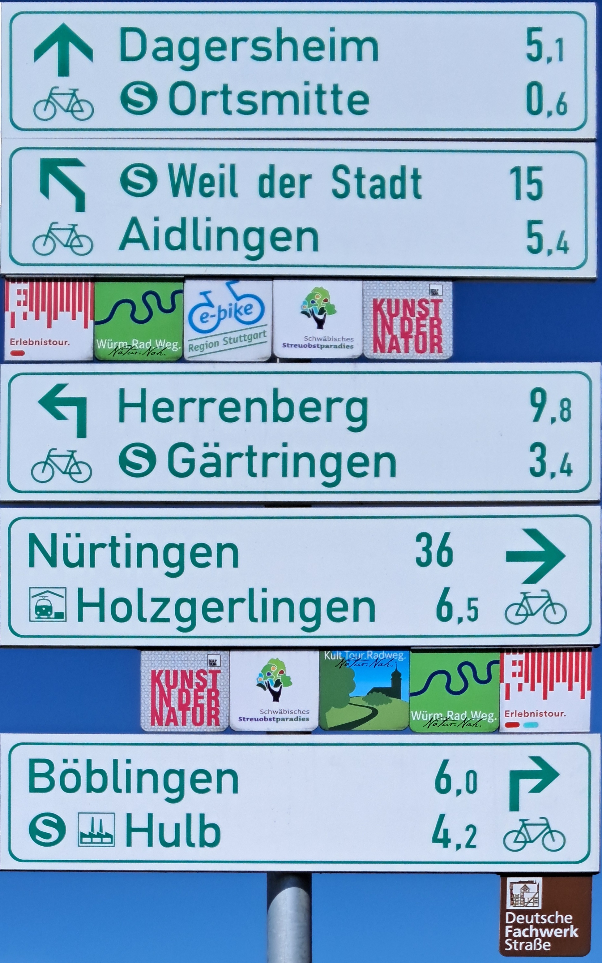
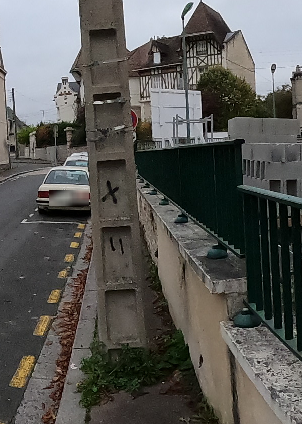
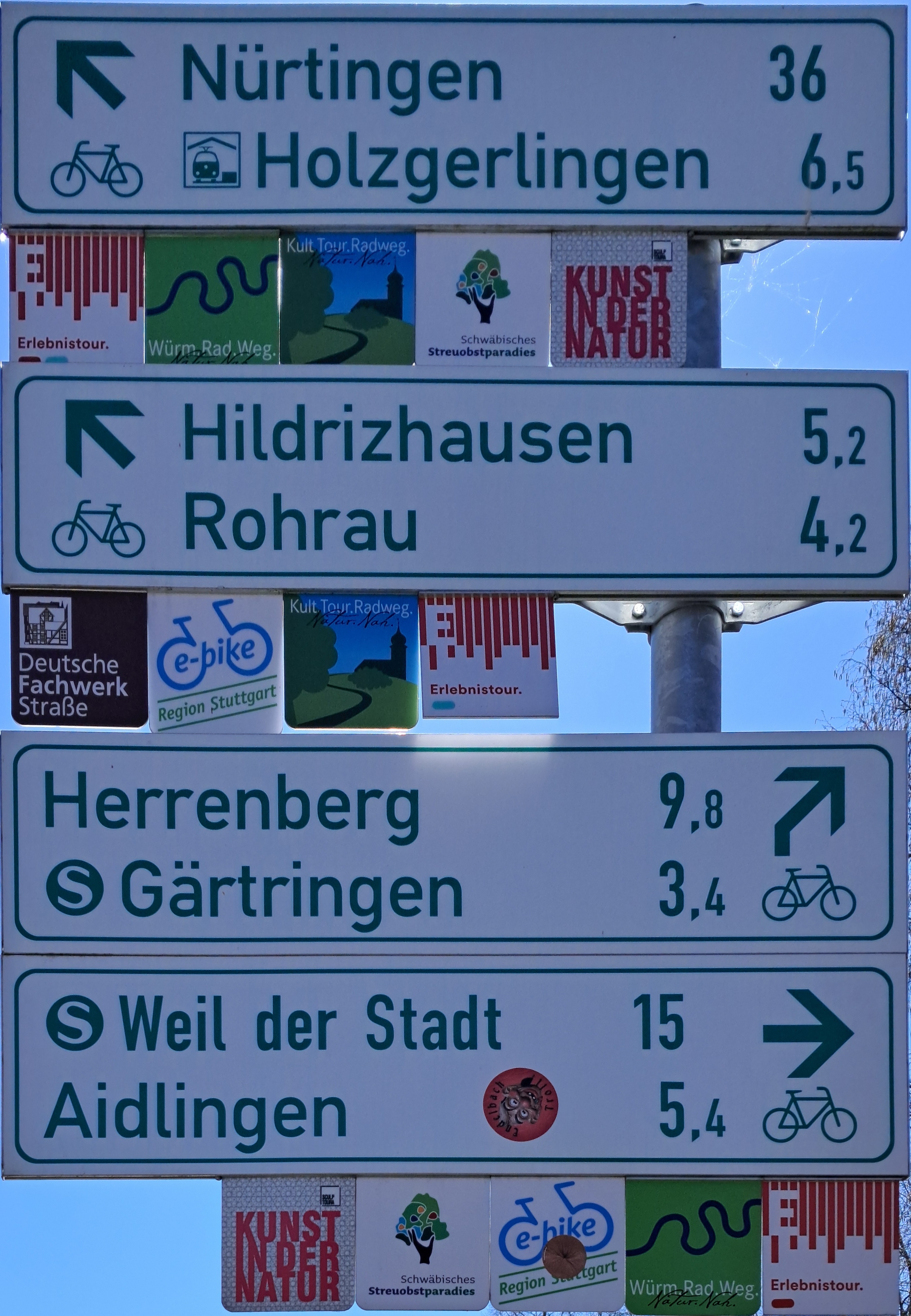
| 07:52, 12 April 2025 | Node11495396580.jpg (file) |  |
1.5 MB | Fx99 | {{Information | description=guidepost near Ehningen | source=won foto | date=2025-04-07 | author=fx99 | other_versions= }} | 1 |
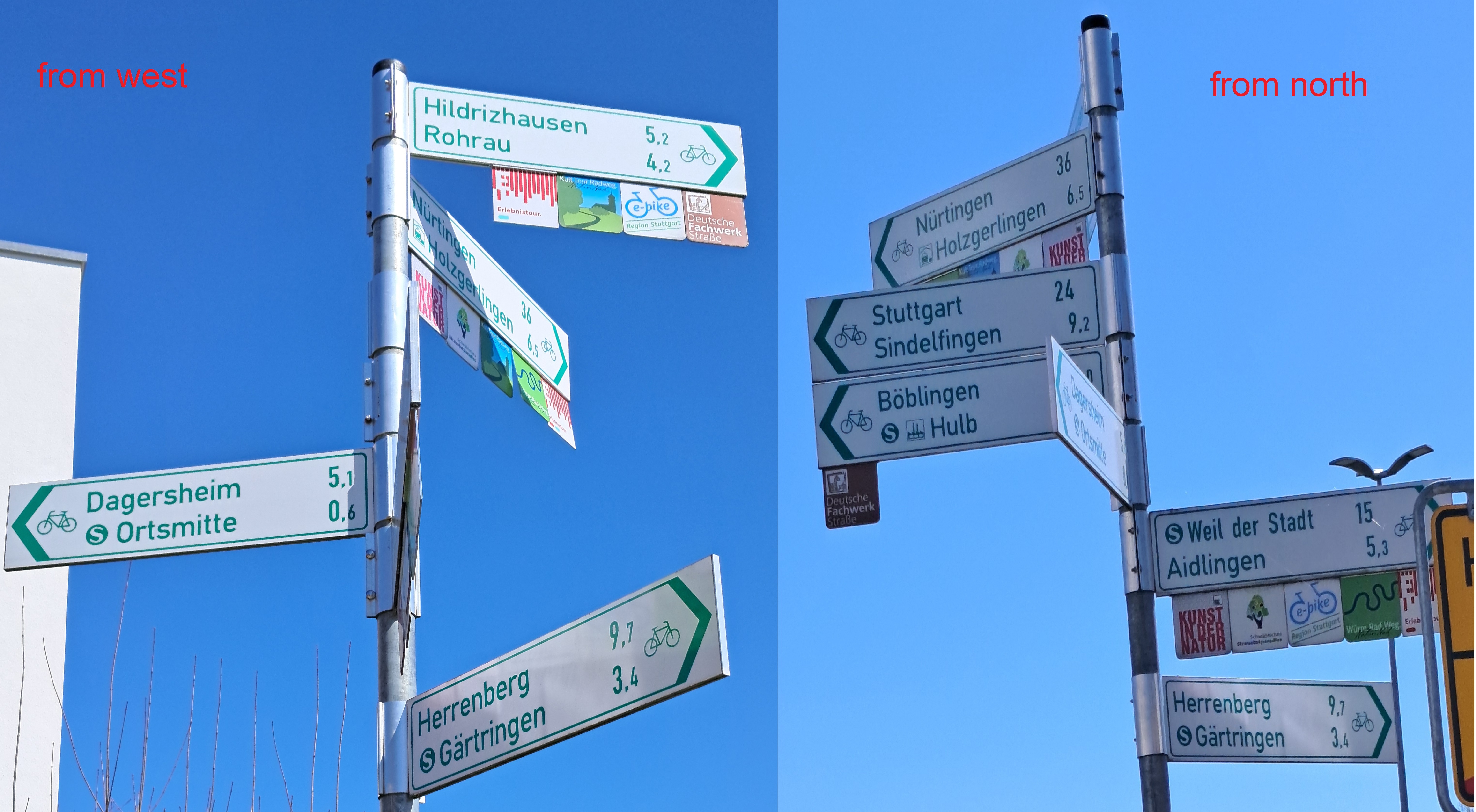
| 07:46, 12 April 2025 | Node12738718653.jpg (file) |  |
1.42 MB | Fx99 | {{Information | description=guidepost near Ehningen | source=own foto | date=2025-04-07 | author=fx99 | other_versions= }} | 1 |
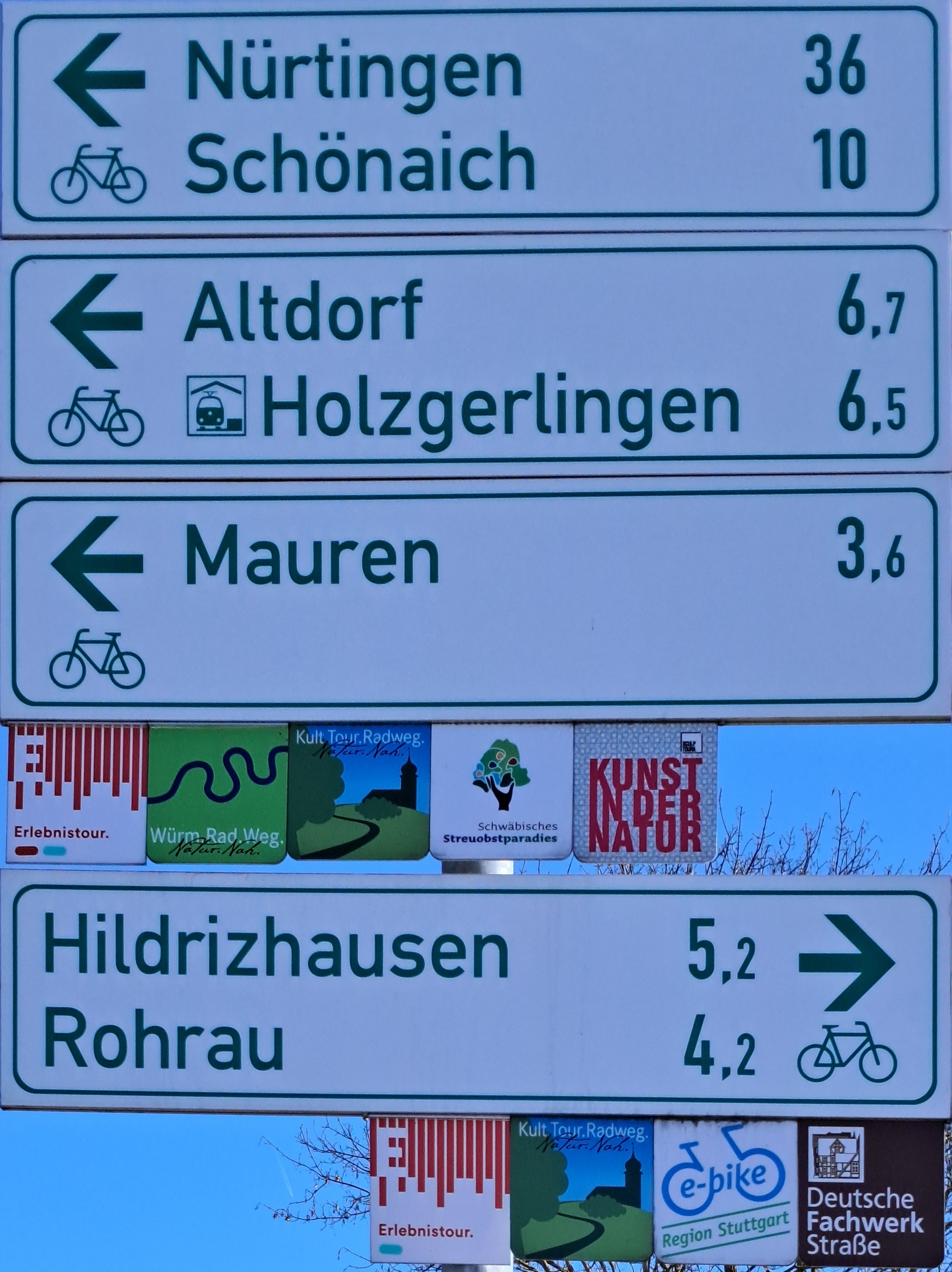
| 07:41, 12 April 2025 | Node3874733873.jpg (file) |  |
1.12 MB | Fx99 | {{Information | description=guidepost near Ehningen | source=own foto | date=2025-04-07 | author=fx99 | other_versions= }} | 1 |
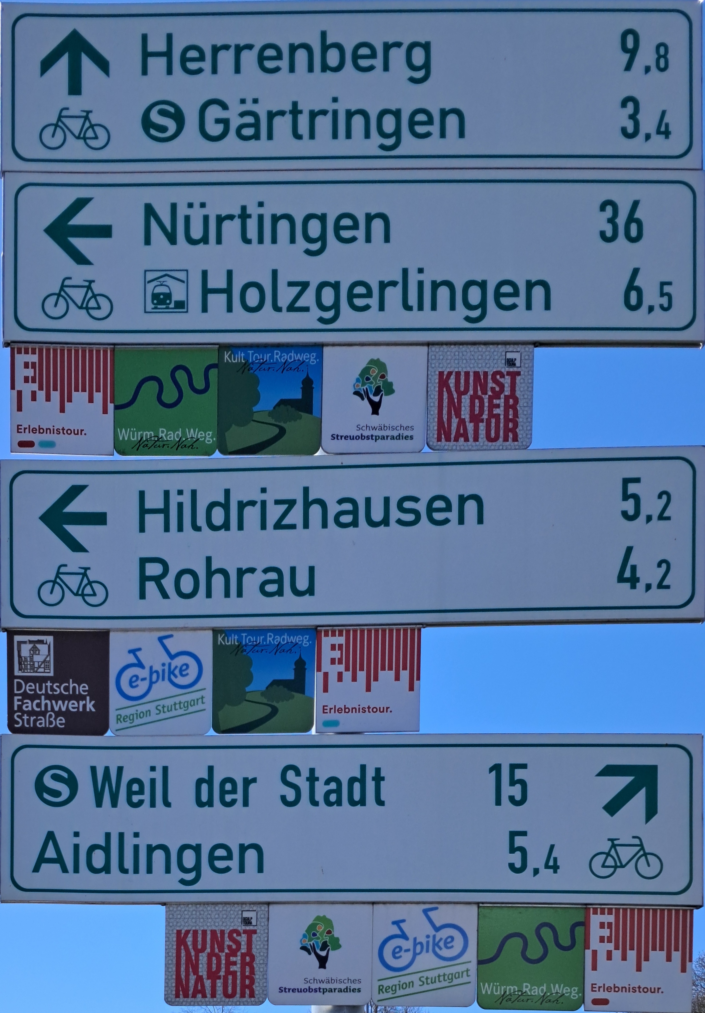
| 07:36, 12 April 2025 | Node11495396581.jpg (file) |  |
1.79 MB | Fx99 | {{Information | description=guidepost near Ehningen | source=own foto | date=2025-04-07 | author=fx99 | other_versions= }} | 1 |
| 15:14, 11 April 2025 | Capture d’écran du 2025-04-11 17-10-38.png (file) |  |
576 KB | Singing-Poppy | Une jardiniere au milieu du trottoir | 2 |
| 15:08, 11 April 2025 | Un lampadaire au milieu du trottoir.png (file) |  |
588 KB | Singing-Poppy | {{Information | description=un lampadaire au milieu du trottoir | source=https://api.panoramax.xyz/#focus=pic&map=18.9/49.1751396/-0.3841624&pic=70601b51-ac99-4659-be3b-a4d4dfe18305&speed=250&xyz=270.00/0.00/30 | date=2024-11-06 | author=nlehuby | other_versions= }} | 1 |
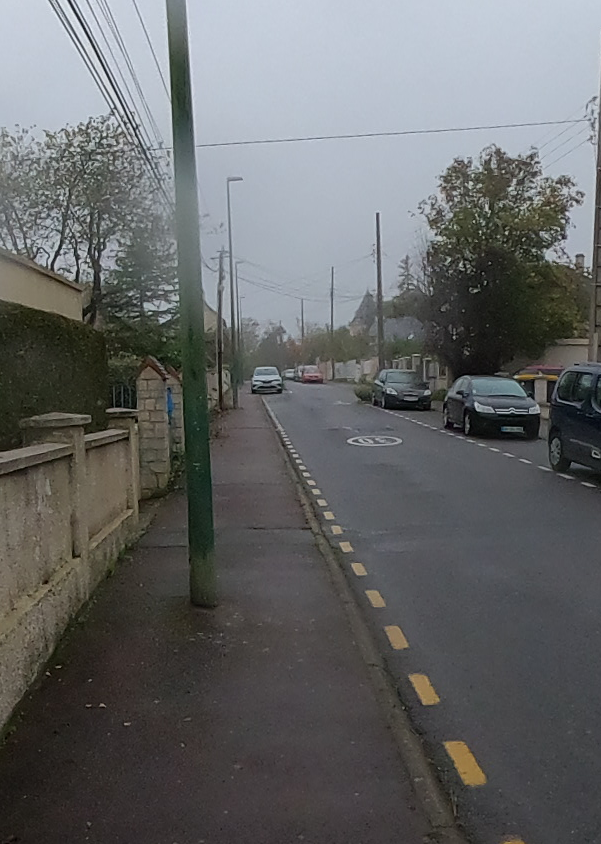
| 15:06, 11 April 2025 | Un poteau au milieu du trottoir.png (file) |  |
713 KB | Singing-Poppy | {{Information | description=un poteau au milieu du trottoir | source=https://api.panoramax.xyz/#focus=pic&map=19/49.184657/-0.3733306&pic=3c5526cc-1134-4582-8447-3eb89d6fa2ee&speed=250&xyz=304.00/0.00/30 | date=2024-11-07 | author=Carto’Cité pour Jungle Bus | other_versions= }} | 1 |
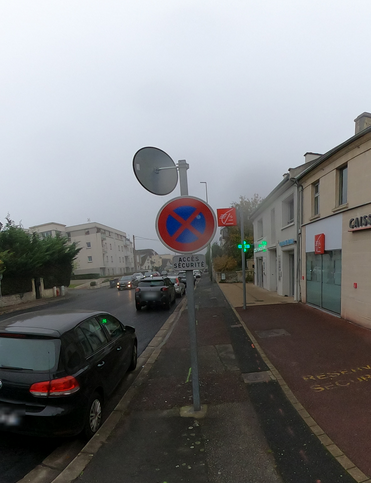
| 15:04, 11 April 2025 | Un panneau au milieu du trottoir.png (file) |  |
245 KB | Singing-Poppy | {{Information | description=un panneau au milieu du trottoir | source=https://api.panoramax.xyz/#focus=pic&map=18.89/49.1721975/-0.396646&pic=98faaa77-25ec-433e-bfc2-2cbe8b4d664d&speed=250&xyz=246.92/2.20/30 | date=2024-11-06 | author=nlehuby | other_versions= }} | 1 |
| 15:00, 11 April 2025 | Mf ref.svg (file) |  |
3 KB | Chris2map | Text converted to path. Public Domain (below treshold of originality), if license needed then CC0 public domain dedication. | 3 |
| 14:59, 11 April 2025 | Un hydrant au milieu du trottoir.png (file) |  |
524 KB | Singing-Poppy | {{Information | description=un hydrant au milieu du trottoir | source=https://api.panoramax.xyz/#focus=meta&map=18.97/49.1565161/-0.4492974&pic=fade46a3-08f3-41bd-937c-e8fca0f35410&speed=250&xyz=326.06/-15.68/30 | date=2024-11-06 | author=Carto’Cité pour Jungle Bus | other_versions= }} | 1 |
| 22:47, 10 April 2025 | Line arrangement horizontal vs triangular.svg (file) |  |
28 KB | Fanfouer | {{Information | description=Difference between triangle and horizontal arrangements for lines | source= | date=2025-04-11 | author=François Lacombe | other_versions= }} | 1 |
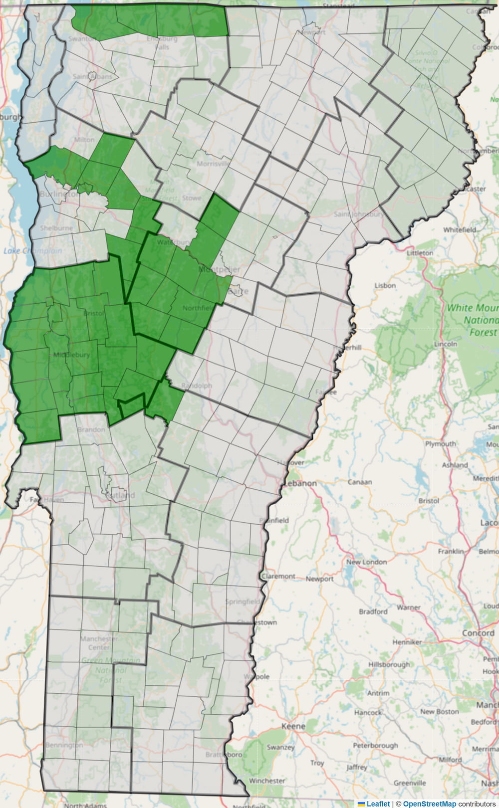
| 04:03, 10 April 2025 | Vt-address-import-progress-map.jpg (file) |  |
401 KB | Adamfranco | Eden, Lowell | 13 |
| 21:19, 9 April 2025 | Line management compose transition service.svg (file) | 3 KB | Fanfouer | {{Information | description= | source= | date=2025-04 | author=François Lacombe | other_versions= }} | 1 | |
| 21:18, 9 April 2025 | Line management compose termination service.svg (file) |  |
4 KB | Fanfouer | {{Information | description= | source= | date=2025-04 | author=François Lacombe | other_versions= }} | 1 |
| 21:17, 9 April 2025 | Line management compose service transition.svg (file) | 3 KB | Fanfouer | {{Information | description= | source= | date=2025-04 | author=François Lacombe | other_versions= }} | 1 | |
| 21:17, 9 April 2025 | Line management compose service termination.svg (file) |  |
4 KB | Fanfouer | {{Information | description= | source= | date=2025-04 | author=François Lacombe | other_versions= }} | 1 |
| 21:16, 9 April 2025 | Line management compose service transpose.svg (file) | 6 KB | Fanfouer | {{Information | description= | source= | date=2025-04 | author=François Lacombe | other_versions= }} | 1 | |
| 21:16, 9 April 2025 | Line management compose service split.svg (file) |  |
3 KB | Fanfouer | {{Information | description= | source= | date=2025-04 | author=François Lacombe | other_versions= }} | 1 |
| 21:14, 9 April 2025 | Line management compose service branch.svg (file) |  |
3 KB | Fanfouer | {{Information | description= | source= | date=2025-04 | author=François Lacombe | other_versions= }} | 1 |
| 21:13, 9 April 2025 | Line management compose branch service.svg (file) |  |
3 KB | Fanfouer | {{Information | description= | source= | date=2025-04 | author=François Lacombe | other_versions= }} | 1 |
| 21:12, 9 April 2025 | Line management compose service straight.svg (file) |  |
2 KB | Fanfouer | {{Information | description= | source= | date=2025-04 | author=François Lacombe | other_versions= }} | 1 |
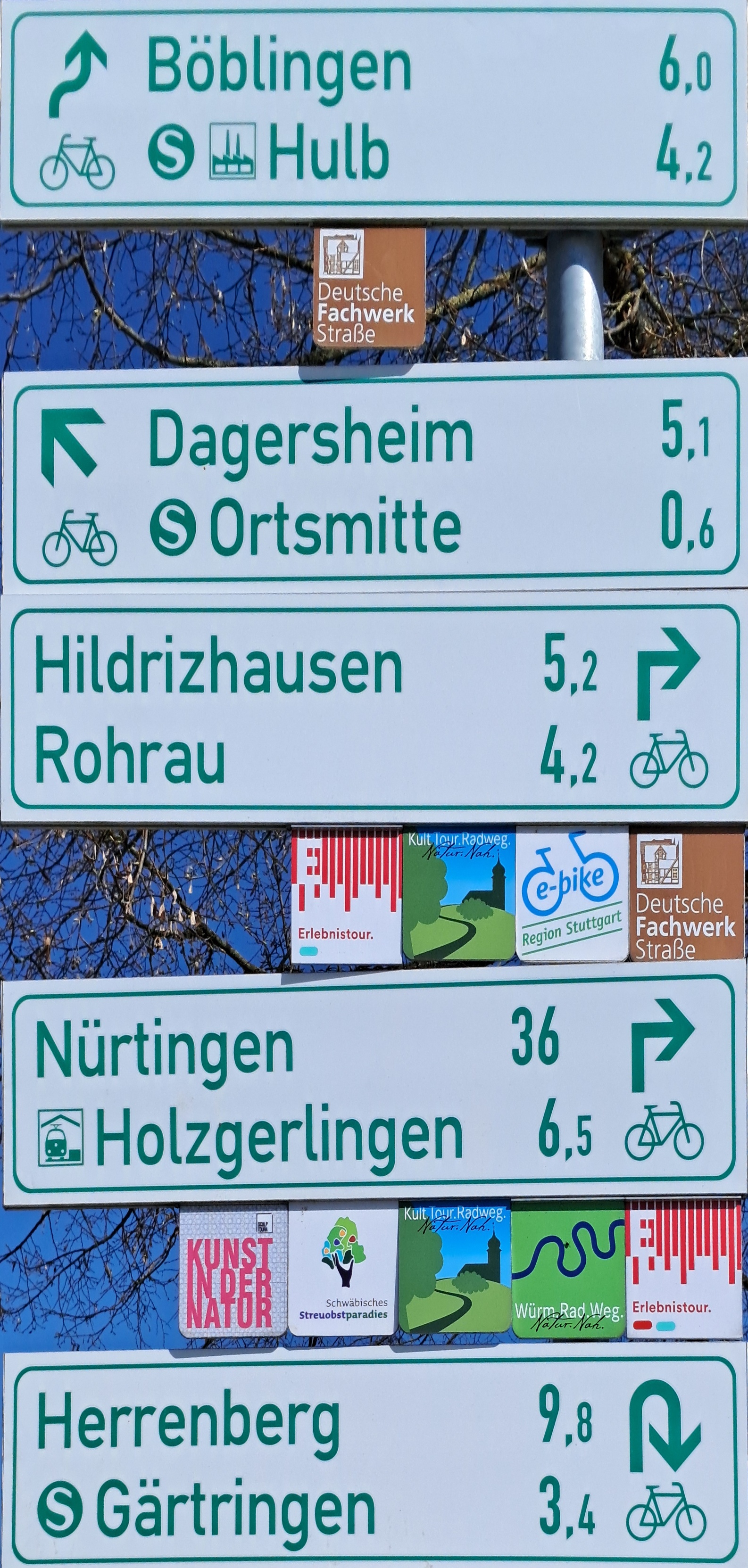
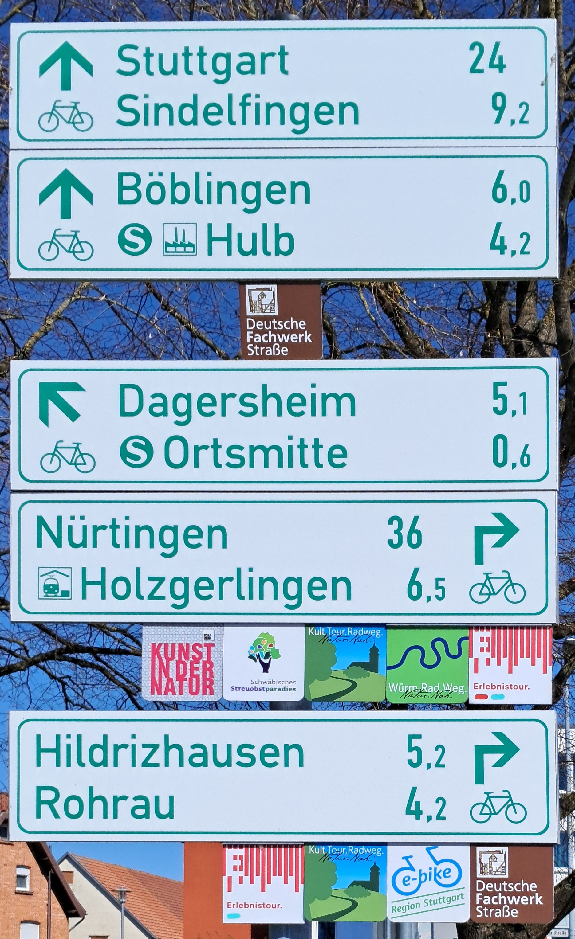
| 08:22, 9 April 2025 | Node3874733874.jpg (file) |  |
3.14 MB | Fx99 | {{Information | description=guidepost near Ehningen | source=own fotos | date=2025-04-07 | author=fx99 | other_versions= }} | 1 |
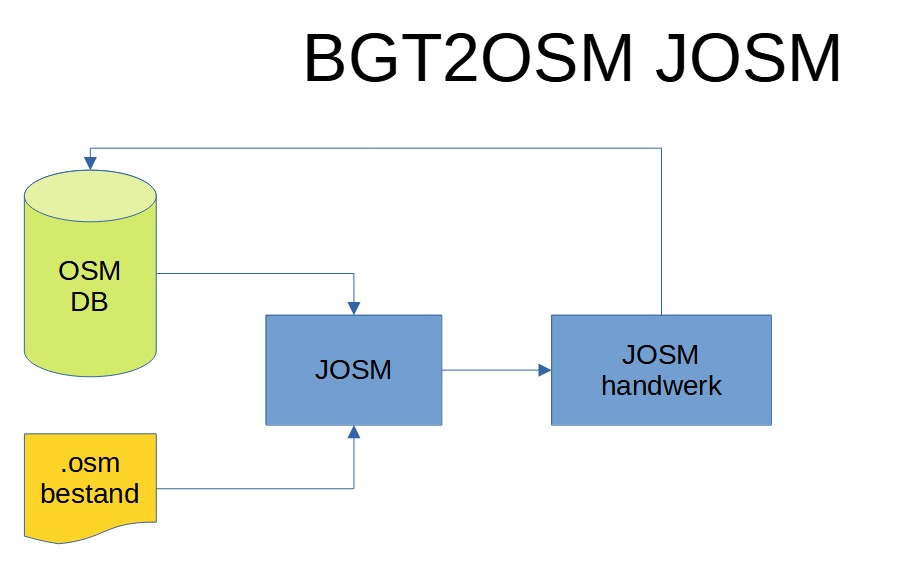
| 08:06, 9 April 2025 | BGT flow2.jpg (file) |  |
43 KB | PeeWee32 | 1 | |
| 07:54, 9 April 2025 | BGT flow1.jpg (file) |  |
58 KB | PeeWee32 | 1 | |
| 07:37, 9 April 2025 | Node3874733875.jpg (file) |  |
2.22 MB | Fx99 | {{Information | description=guidepost near Ehningen | source=own foto | date=2025-04-07 | author=fx99 | other_versions= }} | 1 |
| 07:32, 9 April 2025 | Node5589076522.jpg (file) |  |
1.54 MB | Fx99 | {{Information | description=guidepost near Ehningen | source=own foto | date=2025-04-07 | author=fx99 | other_versions= }} | 1 |
| 07:26, 9 April 2025 | Node3869735236.jpg (file) |  |
1.67 MB | Fx99 | {{Information | description=Fahrradwegweiser bei Ehningen | source=own pciture | date=2025-04-07 | author=fx99 | other_versions= }} | 1 |
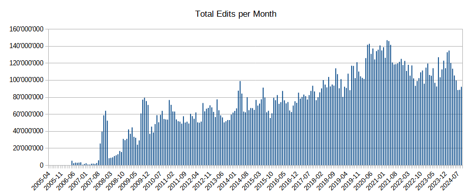
| 06:40, 9 April 2025 | Edits per month.png (file) |  |
35 KB | SimonPoole | Q1 2025 | 28 |
| 00:35, 9 April 2025 | Mistsignalering.jpg (file) |  |
194 KB | JeroenvanderGun | {{Information | description=An electronic fog warning traffic sign on Rijksweg 16 near Prinsenbeek, Noord-Brabant, the Netherlands. | source=[https://proxy.archieven.nl/0/5609B9D32C994444932554F99142264F Rijkswaterstaat Beeldarchief] (original photo) | date=1996-01-17 (original photo) | author=Bart van Eyck (cropped and edited by Jeroen van der Gun) | other_versions=File:135278.jpg }} | 1 |
| 17:54, 8 April 2025 | Power circuit trunk vs section.svg (file) |  |
24 KB | Fanfouer | Update colors and fonts | 2 |
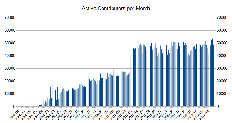
| 16:55, 8 April 2025 | Active contributors month.png (file) |  |
31 KB | SimonPoole | Q1 2025 | 44 |