Sudan Crisis 2023–
| General Information | ||||||||||||||
Context of the Activation A civil war between two major rival factions of the military government of Sudan, the Sudanese Armed Forces (SAF) and the paramilitary Rapid Support Forces (RSF), began on 15 April 2023. At least 61,000 people have been killed in Khartoum State alone and over 7.7 million have been internally displaced and more than 2.1 million others have fled the country as refugees. On 1 August 2024, the Integrated Food Security Phase Classification (IPC) Famine Review Committee (FRC) concluded famine conditions in parts of North Darfur. Later that month, Médecins Sans Frontières said that "international humanitarian organizations and donors" had failed to address "the country’s escalating medical needs, from catastrophic child malnutrition to widespread disease outbreaks." A report published at the end of 2024 with predictions for 2025 states that 30.4 million people in Sudan are in need of humanitarian aid. See more info here: Sudanese civil war Wiki and here Humanitarian impact of the civil war Wiki. Information about H2H support package: https://h2hnetwork.org/h2hsupport-package-conflict-sudan/ Most of the coordinated OSM mapping efforts are within Sudan, but several projects have focused on mapping refugee camps in Chad and are included below. | ||||||||||||||
Contacts
- Jessie Pechmann (HOT)
- Jorieke Vyncke (MSF)
- Rebecca Chandiru (Open Mapping Hub Eastern and Southern Africa)
- Hassan Arara (OSM Sudan)
Hashtags
Due to the long duration of this conflict and mapping efforts by multiple entities in Sudan several tracking tags have been used differently across varied projects:
#sudanroads
#WestDarfur2023
#2023sudanconflict (stats)
#tawiladistrict & #tawila
#darfur
#H2HMappingforSudan2024
For the Chad projects the following hashtags have been used - most are names of locations with refugee camps:
#mile #touloum #iridimi #dougui #koukouangarana #Djokoro #DaguessaCamp #AnderessaCamp #adrefeb24 #andrecamp #OurangCamp #GozAchies #mechécamp
Timeline
- Start: 28 April 2023
- End: Unclear, 2025 onwards
Map and Data Services
Accessing OpenStreetMap data
OpenStreetMap data can be downloaded from HDX. Scroll through this filtered HDX list to access OSM data for Sudan.
About This Disaster Activation
History of this Activation
- 28 April 2023: First Tasking Manager project published by MSF
- 23 June 2023: First Tasking Manager project published under the Missing Maps banner
- 18 December 2024: First Tasking Manager project published by Open Mapping Hub Eastern and Southern Africa
- 20 December 2024: First Tasking Manager project published by OSM Sudan
- 9 January 2025: This Wiki page created to improve coordination between organizations mapping in Sudan
Validation
Validation permissions for Tasking Manager projects are restricted to particular Tasking Manager Teams / users to ensure high quality validation. Visit each project page and scroll down to the permissions section to check on access.
For Mappers
How You Can Contribute
MapSwipe
Go to https://web.mapswipe.org/#/en and look for a Sudan project. This is a very easy way to contribute, but please follow the tutorial if you have not used MapSwipe before.
Learn to Map
Most of the volunteer needs are for remote OSM contributors, visit LearnOSM.org to get started.
Mapping Priority
- Please choose from highest priority first.
- We call for local mappers to prioritize local knowledge on the area.
HOT Tasking Manager
HOT Tasking Manager projects and their progress can be seen here. For any projects that are marked 'Published', select the link in the Project ID column and it will launch the project and you will be able to contribute.
See this uMap for the extent of all Tasking Manager projects under this campaign. Click on a project extent to see more information about it.
Check Disaster Ninja to see all Tasking Manager projects in and around Sudan including projects created before this campaign.
Methodology for Mapping Wadis, Roads, and Bridges in Sudan
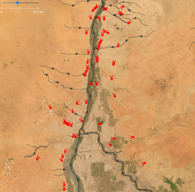
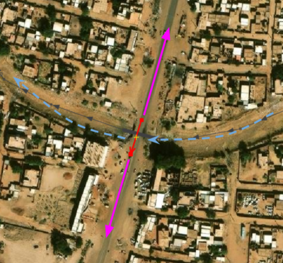
The goal of this project is to improve the completeness and accuracy of wadi/waterway, road, and bridge features in OSM for Sudan, using WFP’s GIS for Good Zooniverse data as a reference.
Summary as of End of March
- Wadis (Khartoum only)
* 127 km of Wadis in Khartoum.
* 5 km of residential highways mapped.
* 56 bridges mapped.
Overview and Objectives
- Goal: Improve the completeness and accuracy of wadi/waterway, road, and bridge data in OpenStreetMap (OSM) for Sudan, particularly in areas with limited existing information.
- Data Source: Polylines representing intersections of roads crossing wadis, derived from a Zooniverse project and provided by WFP's GIS for Good initiative.
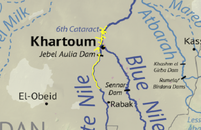
- Geographic Focus: Initially Khartoum, with expansion to other regions of Sudan.
Data Acquisition and Pre-processing
- Data Download: Raw polyline data was downloaded from the WFP Zooniverse Project through collaborative efforts with HOT.
- Software: QGIS (or similar GIS software) was used for data pre-processing.
- Pre-processing Steps:
 * Data Cleaning: Inspect and clean data for topological errors, inconsistencies, or duplicate geometries.
 * Coordinate System Verification: Ensure data is in a suitable coordinate reference system (e.g., WGS 84) for OSM compatibility.
Mapping Workflow (JOSM)
- Software: JOSM (Java OpenStreetMap Editor) was used for its advanced editing and validation tools.
- Workflow:
 * Area Selection: Start with Khartoum and systematically move to other areas.
 * Data Import: Import pre-processed polyline data into JOSM.
Wadi/Waterway Mapping
- Trace wadi/waterway based on polyline intersections, interpreting satellite imagery and local knowledge (if available).
- Use appropriate OSM tags for waterways (e.g., waterway=stream + intermittent=yes).
- Create waterway relations as needed.
Road Mapping
- Trace roads based on polyline intersections and satellite imagery.
- Use appropriate OSM tags for roads (e.g., highway=*).
Bridge Mapping
- Map bridges along highway segments where roads cross wadis.
- Use appropriate OSM tags for bridges (e.g., bridge=yes + layer=1).
- Data Attribution: Since features were derived from the WFP Project dataset rather than imported, no source information was added.
Quality Assurance and Validation
- JOSM Validator: Identify and correct topological errors, tagging inconsistencies, or other data quality issues.
- Relation Validation: Ensure waterway relations correctly represent wadi flow.
- Local Knowledge: Where possible, incorporate local knowledge for verification.
Data Upload and Documentation
- Upload to OSM: Validated data is uploaded to OpenStreetMap.
- Changeset Documentation: Detailed changeset comments include mapping activities and data sources.
- Project Hashtags:
* #h2hmappingwadisforsudan2024
* #h2hmappingbridgesforsudan2024
* #h2hmappingroadsforsudan2024
* #h2hmappingforsudan2024
Expansion and Future Work
- Expansion: Extend mapping efforts to other regions of Sudan, prioritizing areas with limited OSM coverage.
- Data Maintenance: Establish a process for ongoing updates.
Progress as of March 2025
- Wadi/Waterway Mapping:
 * 127 km of waterways mapped in OSM for Khartoum.
 * Includes a mix of streams and canals.
- Road Mapping:
 * 5 km of roads mapped in OSM for Khartoum.
 * Most major roads are mapped, with some residential roads unmapped.
- Bridge Mapping:
* 56 bridges mapped in OSM for Khartoum.
General Mapping Instructions
- For mapping buildings see here
- For mapping building damage see here
- For mapping roads and residential areas see here.


