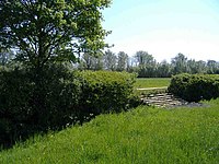
Tag:barrier=horse_jump
| Description |
|---|
| Artificially placed obstacle for horse riders in the countryside. |
| Group: barriers |
| Used on these elements |
| Status: in use |
| Tools for this tag |
|
A horse jump is an artificially placed obstacle designed to provide an interesting challenge for horse riders in the countryside. Usually they consist of tree trunks placed across a broad ride or field edge. Others might include a section of hedgerow replace by a hurdle. Such jumps are likely to be densest in areas with a large number of horse riders (often identifiable on aerial imagery by the presence of exercise paddocks, many small grass paddocks for grazing etc.), or where there are very active ![]() Fox Hunts (e.g., rural Leicestershire).
Fox Hunts (e.g., rural Leicestershire).
The tag is also appropriate for specifically designed jumps for ![]() cross-country eventing, for instance at
cross-country eventing, for instance at ![]() Badminton or the equestrian centre at Billingshurst.
Badminton or the equestrian centre at Billingshurst.
For jumps on equestrian racecourses, barrier=steeplechase_jump is suggested, or alternatively use horse_jump=steeplechase.
Normally ![]() show jumping fences will not remain at fixed positions and therefore it is not appropriate to map them.
show jumping fences will not remain at fixed positions and therefore it is not appropriate to map them.

