Tag:boundary=postal_code
Jump to navigation
Jump to search
| Description |
|---|
| A postal code boundary |
| Group: boundaries |
| Used on these elements |
| Useful combination |
| See also |
| Status: de facto |
| Tools for this tag |
|
This tag page is a stub. You can help OpenStreetMap by expanding it.
Similar pages for structural reference: Tag:railway=tram, Tag:waterway=dock.
Similar pages for structural reference: Tag:railway=tram, Tag:waterway=dock.
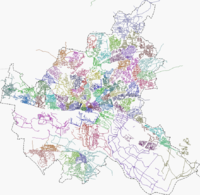
boundary=postal_code is used to specify a dedicated type=boundary area with a consistent national postcode.
This tag should not be used in countries where a postal code does not represent a precise area (for example, in the United States). It also may not be verifiable in many countries.
How to map
Using a relation, add these tags:
 type=boundary
 boundary=postal_code
 postal_code=*
This kind of postal mapping is widely used at least in Germany and Belgium.
