Tag:bridge:support=pier
Jump to navigation
Jump to search
| Description |
|---|
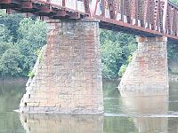
| An intermediate, upright support beneath a bridge. |
| Group: bridges |
| Used on these elements |
| Status: approved |
| Tools for this tag |
|
An intermediate, upright support beneath a bridge. Known as a "bent" in trestle bridges. Is also used with the cantilever bridge.
How to map
Draw the outline of the support and add:
Do not add man_made=pier unless the bridge support also meets that description.
Example
See also
- bridge:support=pylon - A tower supporting a suspension or cable-stayed bridge.

