Tag:crossing_ref=pelican
 |
| Description |
|---|
| Pelican pedestrian crossings. |
| Group: crossings |
| Used on these elements |
| Requires |
|
When tagged as When tagged as |
| Useful combination |
| Status: approved |
| Tools for this tag |
|
This tag is used for a pelican crossing, a type of traffic signal controlled pedestrian crossing developed in the United Kingdom.
How to map
Set a node ![]() on the highway where the transition is and add
on the highway where the transition is and add
Draw a way ![]() which can be used by pedestrians to cross the road and add
which can be used by pedestrians to cross the road and add
Nearby can also be a traffic light(s) (highway=traffic_signals) on an adjacent node.
Tags to use in combination
- button_operated=yes/no
- crossing:island=yes/no - Specifies whether a pedestrian crossing has a refuge island which is not mapped separately.
- crossing:markings=*
- crossing:signals=yes - Optional and possibly redundant, but there is a draft proposal to refine this.
- tactile_paving=* - Indicates whether a blind or visually impaired pedestrian can detect or follow the feature using a cane.
- tactile_paving:colour=* - The colour
- traffic_signals:countdown=yes/no - Indicate that there is a countdown timer while crossing is indicated.
- traffic_signals:sound=yes/no - Indicates that sound is emitted when crossing is indicated.
- traffic_signals:vibration=yes/no - Indicates that there is a tactile indication when crossing is indicated.
The use of these tags may be country-specific.
United Kingdom
A pelican crossing is a traffic signal controlled pedestrian crossing. These are an older design of pedestrian crossing in the UK which only legacy installations still exist from pre-2016. They always feature far-side signals for pedestrians, with the near-side push button units (PBUs) displaying text lit up with "WAIT" when the button is pushed, along with instructions on how to use the crossing. Pelican crossings do not use sensors to detect when the crossing is clear of pedestrians, instead using a flashing amber light for road traffic when they need to give way to pedestrians crossing the road, or continue if there are no pedestrians crossing. Zig zag markings are always provided, except when the crossing is part of a junction.
Rules rules 191 to 199 of the Highway Code apply at pedestrian crossings, with pelican crossings specifically covered by rule 196.
Crossings installed after 2016 are more likely to be crossing_ref=puffin.
Tagging specifics
- button_operated=yes - If there is no button box, this is probably not a pelican crossing. If the box displays a nearside red/green man crossing indicator, it is probably a puffin crossing.
- crossing:markings=no, crossing:markings=dots, crossing:markings=dots;surface - Where pelican crossings are marked, they are usually marked with dots or road studs (TSRGD diagram 1055.1). The surface may also be marked.
- tactile_paving:colour=* - Where tactile paving is present, it should be red blister paving (but buff or other colours are sometimes used incorrectly)[1].
- traffic_signals:vibration=yes/no - Indicates that there is a tactile cone under the button box, which rotates when crossing is indicated.
Zig-zag lines
The 'controlled area' around the crossing may be marked with a single solid white longitudinal zig-zag line down one or both sides of the carriageway and in the centre of the carriageway if carriageway dividing markings are present (TSRGD diagrams 1001.3, 1001.4 and 1001.5). The general effect of this on the road for the extent of the markings is to prohibit stopping by vehicles other than bicycles and overtaking by motor vehicles
[2]
and can be tagged with:
parking:both=no
parking:both:restriction=no_stopping
parking:both:restriction:reason=markings
overtaking:motor_vehicle=no.
Images

Far side signals for pedestrians (TSRGD diagram 4002.1)

Near-side push button units (TSRGD diagram 4003)
Road markings around the crossing

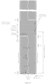
Pelican crossing between King George Rec and Cosham Park (NB this has now been replaced by a crossing_ref=toucan)


See also
References
- ↑ “Guidance on the Use of Tactile Paving Surfaces” (PDF). Department for Transport. 2021-12.
- ↑ “The Traffic Signs Regulations and General Directions 2016, schedule 14 pt 1”. The National Archives. 2016.