Tag:golf=fairway
Jump to navigation
Jump to search
 |
| Description |
|---|
| Fairway of a golf course: an area between the tee box and the putting green where the grass is cut even and short. |
| Rendering in OSM Carto |

|
| Group: leisure |
| Used on these elements |
| Status: de facto |
| Tools for this tag |
|
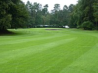
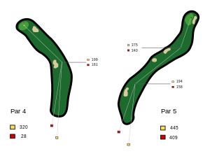
A fairway is an area between the tee and green where the grass is cut even and short. Fairways can be straight or have up to two doglegs.
How to map
Draw an area ![]() around the boundary of the fairway and tag it with
around the boundary of the fairway and tag it with golf=fairway.
Example

|
| Typical doglegs. Left: "dogleg left". Right: "double dogleg" |
Common mapping pitfalls
- Adding
name=*to objects like name=bunker, name=fairway 1, name=18th Hole, ...name=*should only be used if an object has a specific individual name and not for generic descriptions. See: Names are not for descriptions. - Adding duplicate ways on top of already existing highway ways and tagging them as
golf=cartpath. - Changing existing
highway=*tags tohighway=pathor mapping new roads ashighway=patheven if the tag is not appropriate. [1] - Drawing ad-hoc building shapes that don't resemble the real structures.
- Deleting objects and redrawing them instead of improving the shape. If there is already a hole/fairway/etc. there, update it.
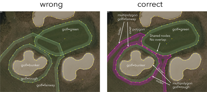
- Creating "lollipops" (wrapping polygon areas around a feature and leaving a tiny open gap). Use multipolygons instead.
- Duplicating existing water areas (or parts of existing area) and tagging them as water hazards. Just because a fairway parallels the ocean doesn't make the ocean a water hazard.
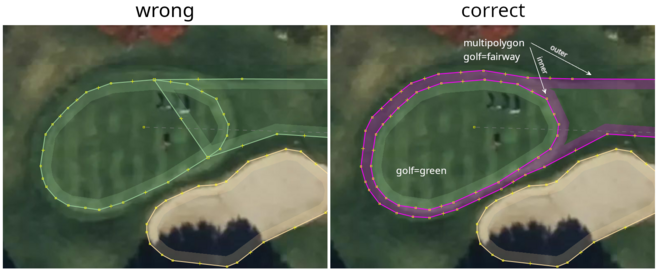
- Overlapping green/fairway/rough polygons (see graphics below). If there is no fringe, or the imagery isn't clear enough to say one way or another, butt the fairway and green together and share nodes. If there is a clear "fringe" around the green, the fairway should extend around the green and be combined with the green into a multipolygon.
See also
leisure=golf_course- A golf course

