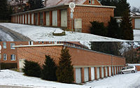
Tag:landuse=garages
Jump to navigation
Jump to search
| Description |
|---|
| An area occupied by multiple private garage buildings. |
| Rendering in OSM Carto |

|
| Group: landuse |
| Used on these elements |
| Useful combination |
| Status: approved |
| Tools for this tag |
|
The tag landuse=garages is used to mark areas occupied by multiple private garage buildings. These areas are commonly found near the social housing or apartments they serve.
How to map
Draw a polygon around the area of garages and mark it with landuse=garages.
Tag the roads and alleys leading to the garages and between them with highway=service. Do not use service=parking_aisle, because that tag is used for access to surface parking bays within public parking areas. There is typically no need to connect each garage door up to the road network.
Draw the garage buildings in the usual way, and tag with
- building=garages - for building blocks with multiple users (or owners)
- building=garage - for single garage buildings
