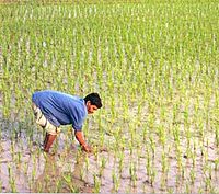
Tag:landuse=paddy
Jump to navigation
Jump to search
| Description |
|---|
| An area of farmland where the surface and shape of the ground is suitable for growing rice. |
| Group: landuse |
| Used on these elements |
| Useful combination |
| See also |
| Status: in use |
| Tools for this tag |
|
An area of farmland where the surface and shape of the ground is suitable for growing rice.
Due to the nature of rice crops affected by the season, there are cases where they are mixed or rotated. If the status of the field does not change and it continues to be used as a paddy field even when other crops are grown, the tag should be maintained.
If it is planting rice without knowing the condition of the land surface, irrigation, etc., it might just use crop=rice. E.g. dry-field rice or upland rice, etc.
How to map
Draw an area![]() around the boundaries of the rice paddy, and tag with landuse=paddy.
around the boundaries of the rice paddy, and tag with landuse=paddy.
Additional tags
- name=* - If it's run by an agriculture-related agency or organization, it may have a name.
- operator=* - Indicates an agricultural operation or organization. Places run by individuals do not need to be described.
- irrigated=* - Used to indicate whether the paddy is irrigated or not. Typically, a wetted rice paddy might have irrigated=yes. An irrigated=no tag can be appended to rainfed paddy fields that are not irrigated.
- rice:race=* - Use with the 'crop=rice' tag to indicate the geographical race of the rice. There are two main families, the 'Japonica race' (rice:race=Japonica) and the 'Indica race' (rice:race=Indica)[1]. The 'Javanica race' is included in the 'Japonica race'.
Proposed rendering
Gallery
See also
- crop=rice - This can be used to indicate that the crop grown is '
 rice'. If you are growing 'rice' on dry land, you might not use the 'landuse=paddy' tag, just the 'crop=rice' tag.
 - landuse=farmland + farmland=*
- surface=mud - It can be used where the condition of the land surface has been artificially made muddy.
- irrigated=* - It can be added to indicate that the land is dependent on irrigation.
- irrigation=flooded
- usage=irrigation - Artificial waterways which bring water to agriculture fields or facilities
- taxon=*


