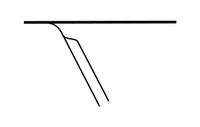
Tag:service=spur
Jump to navigation
Jump to search
| Description |
|---|
| Relatively short lengths of track, built to give one company or entity access to the main line, normally for freight-only use. |
| Rendering in OSM Carto |

|
| Group: railways |
| Used on these elements |
| Requires |
| Useful combination |
| See also |
| Status: approved |
| Tools for this tag |
|
service=spur is used in association with railway=rail to identify a relatively short lengths of track, built to give one company or entity access to the main line, normally for freight traffic only. For example a coal-fired power station, a coal mine, a timber-mill or cement works.
This tag should not be used for services which provide passenger services, even if the line takes the form of a spur.
How to map
Add a service=spur to the way for a railway which is also tagged with the main feature tag railway=*.
Consider also tagging with ref=* and operator=* if known.
In rare cases usage=military or other may apply, in many cases usage=industrial is applicable.
Do not use this tag with lines that carry passenger traffic.
