Template:Pl:Map Features:basin
Jeśli rozumiesz angielski, proszę pomóż ukończyć to polskie tłumaczenie. Przeczytaj instrukcje dotyczące tłumaczenia tej wiki.
Wydaje się, że nikt nad tym tłumaczeniem obecnie nie pracuje, więc możesz podjąć się tego zadania.
Basen (Basin)
basin=* - stosowany do oznaczenia bardziej szczegółowej klasyfikacji zbiornika wodnego.
| Klucz | Wartość | Opis | Zdjęcie | Rendering |
|---|---|---|---|---|
| basin | infiltration | Specjalny basen wykorzystywany do infiltracji wody deszczowej do wód gruntowych. Z |

|

|
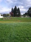
| basin | detention | Specjalny basen jest wykorzystywany do zatrzymania wody deszczowej przed odprowadzeniem do części wód powierzchniowych. Z |

|

|
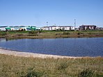
| basin | retention | A special basin used for retention of rainwater before being discharged into a surface water body. From Wikipedia: "A retention basin, is a type of best management practice (BMP) that is used to manage stormwater runoff to prevent flooding and downstream erosion, and improve water quality in an adjacent river, stream, lake or bay. Sometimes called a "wet pond" or "wet detention basin", it is an artificial lake with vegetation around the perimeter, and includes a permanent pool of water in its design." | 
|

|
| basin | evaporation | A basin containing water containing a dissolved substance (precipitate). These basins are used for harvesting precipitate, removing the water from hazardous waste, evaporating the precipitation that falls on a contaminated site, or preventing pesticides, fertilizers, and salts from agricultural wastewater from contaminating the water bodies they would flow into. | 
|

|
| basin | aeration | An aeration basin. | 
| |
| basin | cooling | An artificial body of water which was created to supply cooling water and/or store heat. | 
|

|
| basin | footbath | A basin containing water to clean the feet before entering a swimming pool. | ||
| basin | settling | A settling basin. Settling basins are used to treat wastewater by settling. | ||
| basin | water_regeneration | A basin with plants for the biological regeneration of water, e.g. at swimming pools. Example in OSM. |
This table is a wiki template with a default description in English. Editable here.
Note to editors: Please don't categorize this template by editing it directly. Instead, place the category in its documentation page, in its "includeonly" section.
Template for the basin table. Use the default English text or use the template arguments for your translations. The following parameters can also be used when inserting into the article namespace.
| Parameter | Description | Type | Status | |
|---|---|---|---|---|
| name displayed | name:displayed | With this switch the heading (‘name’) is shown.
| Boolean | suggested |
| description displayed | description:displayed | With this switch the introductory description (‘description’) is shown.
| Boolean | suggested |
Wykorzystanie
{{Template:Pl:Map Features:basin}}
lub
{{Template:Pl:Map Features:basin|name:displayed=yes/no|description:displayed=yes/no}}
Tłumaczenia
All parameters are optional (except name:displayed and description:displayed). By default, text is in English.
English writers shall write their comments in the template itself (avoiding double edition).
Other languages are translated in template arguments, not in the template itself.
Template for copy/paste …
<noinclude>{{Languages|Template:Map Features:basin}}</noinclude>
{{Map Features:basin|name:displayed={{{name:displayed|yes}}}|description:displayed={{{description:displayed|yes}}}
|name=
|description=
|head:key=
|head:value=
|head:element=
|head:desc=
|head:rendering=
|head:photo=
|basin:key={{LL|1=Key:basin}}

|infiltration:value={{LL|1=Tag:basin=infiltration}}
|infiltration:desc=

|detention:value={{LL|1=Tag:basin=detention}}
|detention:desc=

|retention:value={{LL|1=Tag:basin=retention}}
|retention:desc=

}}<noinclude>
{{Documentation|Template:Map Features:basin/doc}}
</noinclude>