Template:Zh-hant:Map Features:geological
Jump to navigation
Jump to search
地質類 (Geological)
標示某一區域的地質狀況。更多使用說明請見Geological。
| 關鍵字(key) | 值 (value) | 元素 (element) | 敘述 (desc) | 圖例 (render) | 照片 (photo) |
|---|---|---|---|---|---|
| geological | moraine | 冰磧丘陵。冰磧沉積物堆積於鬆軟的冰川底部。 | |||
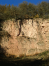
| geological | outcrop | 露頭。基岩或岩脈露出地表。 | |||
| geological | palaeontological_site | 古生物化石區。埋藏史前古生物遺跡的場所。 | |||
| geological | 使用者自訂 | 到Taginfo查詢常用標籤值 |
This table is a wiki template with a default description in English. Editable here.
此表格由模版自動生成,協助改善中譯版本請按此。


