Tracing Guideline Using Satellite Imagery
The given reason is: article depends on images uploaded by Harrymahar who repeatedly uploaded problematic files, this imagery has no source info either. Can we actually use it? See https://wiki.openstreetmap.org/wiki/User_talk:Harrymahar#Copyright_violations .
Understanding Satellite Imagery
We can remotely map some area in OpenStreetMap using satellite imagery. Unfortunately, for those who don’t really understand about satellite imagery, they usually get confused and can’t recognize what kind of objects are in the satellite imagery. This Tracing Guideline using Satellite Imagery made to help you understand in recognizing and identifying any objects in satellite imagery.
Objects
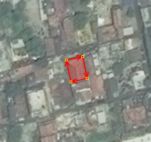
Houses
Has a rectangular shape or box and has one of this color: orange, gray, or red for the roof. Commonly located alongside the access road and make a linear row of its building.
| Satellite Imagery | Actual Image | |
|---|---|---|
 |
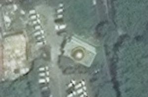
Mosque
Similar with the houses, mosque commonly has a rectangular shape. What makes this building different is, a mosque has dome on the top of its building. Mosque sometimes not aligned with the road, because mosque always facing Mecca/Qibla.
| Satellite Imagery | Actual Image | |
|---|---|---|
 |
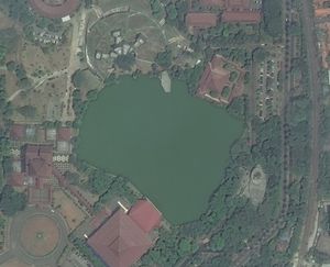
Lake
Lake can be identified by green, blue or dark blue area. It depends on how clear is the water surface inside the lake.
| Satellite Imagery | Actual Image | |
|---|---|---|
 |
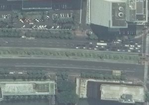
Primary Road
Main road with a characteristic of its large width of road. This road connecting the national activity center with regional activity center (based on Indonesia Law No. 13 in 1980). This road usually located in a big city or center of the town which can be used for cars and motorcycles. This road has a larger road width other than the other road.
| Satellite Imagery | Actual Image | |
|---|---|---|
 |
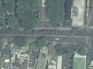
Secondary Road
Smaller than primary way. Usually, this secondary road associated with the primary road as a smaller intersection from the main road.
| Satellite Imagery | Actual Image | |
|---|---|---|
 |
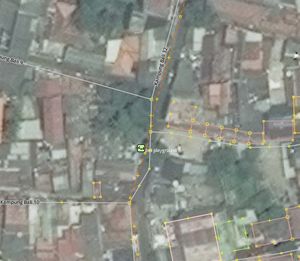
Residential Road
Road which located in residential areas with the main characteristic is its small road width.
| Satellite Imagery | Actual Image | |
|---|---|---|
 |
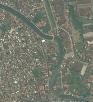
River
River can be identified as a linear curvy watery area. Other things, sometimes river has a bridge on the top of the river.
| Satellite Imagery | Actual Image | |
|---|---|---|
 |
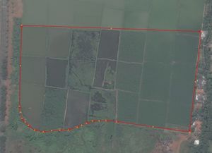
Farmland
Farmland commonly shows as a rectangle object close each other with light green color. When harvest time, farmland sometimes changing its color.
| Satellite Imagery | Actual Image | |
|---|---|---|
 |
Forest
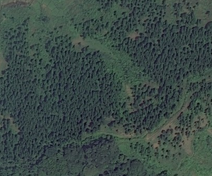
If we see from above (or satellite imagery), forest usually seen with a group of trees dominated with green or old green color.
| Satellite Imagery | Actual Image | |
|---|---|---|
 |
 |
Savanna
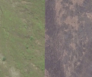
In satellite imagery, savanna has light green color. But in some place (like eastern area), sometimes savanna can turn into yellow. It depends on what season currently happens in those areas (dry season or rain season).
| Satellite Imagery | Actual Image | |
|---|---|---|
 |
 |