TrackMyJourney
| TrackMyJourney | ||||||||||||||||||||||||||||||||||||||||||||||||||||||||||||||||||||||||||||||||||||||||||||||||||||||||
|---|---|---|---|---|---|---|---|---|---|---|---|---|---|---|---|---|---|---|---|---|---|---|---|---|---|---|---|---|---|---|---|---|---|---|---|---|---|---|---|---|---|---|---|---|---|---|---|---|---|---|---|---|---|---|---|---|---|---|---|---|---|---|---|---|---|---|---|---|---|---|---|---|---|---|---|---|---|---|---|---|---|---|---|---|---|---|---|---|---|---|---|---|---|---|---|---|---|---|---|---|---|---|---|---|
| Author: | Stephen Dartnall | |||||||||||||||||||||||||||||||||||||||||||||||||||||||||||||||||||||||||||||||||||||||||||||||||||||||
| License: | Proprietary (12/18 EUR for 6/12 months) | |||||||||||||||||||||||||||||||||||||||||||||||||||||||||||||||||||||||||||||||||||||||||||||||||||||||
| Platforms: | Java ME and BlackBerry OS | |||||||||||||||||||||||||||||||||||||||||||||||||||||||||||||||||||||||||||||||||||||||||||||||||||||||
| Version: | 0.8.0 (2011-12-01) | |||||||||||||||||||||||||||||||||||||||||||||||||||||||||||||||||||||||||||||||||||||||||||||||||||||||
| Language: | English
| |||||||||||||||||||||||||||||||||||||||||||||||||||||||||||||||||||||||||||||||||||||||||||||||||||||||
| Website: | http://www.trackmyjourney.co.uk | |||||||||||||||||||||||||||||||||||||||||||||||||||||||||||||||||||||||||||||||||||||||||||||||||||||||
| Programming language: | Java | |||||||||||||||||||||||||||||||||||||||||||||||||||||||||||||||||||||||||||||||||||||||||||||||||||||||
|
Limited Free Version Available |
||||||||||||||||||||||||||||||||||||||||||||||||||||||||||||||||||||||||||||||||||||||||||||||||||||||||
| ||||||||||||||||||||||||||||||||||||||||||||||||||||||||||||||||||||||||||||||||||||||||||||||||||||||||
TrackMyJourney and TMJ-Mobile are an integrated website and Java ME application created by User:Stephen, offering several OSM-related mapping and navigation functions.
GPS Recording
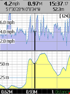
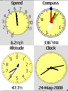
TMJ-Mobile uses the phone's internal GPS or an external Bluetooth GPS device to record a track of your walk, cycle, run, etc., showing detailed track statistics and speed/altitude graphs. GPS data can also be logged directly to a GPX or NMEA file suitable for use in JOSM or for uploading to OSM. (Note: for use in OSM it is recommended to use an external Bluetooth GPS device for better traces.)
Raster Maps
Online raster map tiles can be loaded on the phone direct from the OSM or CloudMade tileservers. Raster maps can also be pre-generated from PNG/JPEG map images using the TMJ MapOrganiser utility, or saved in the standard OSM zoom/col/row.png folder structure and stored on the phone's memory card for completely offline use.
Vector Maps
Vector map tiles are generated on the TMJ server and offer several benefits over raster tiles:
- usually significantly smaller in filesize, depending on location
- displayable in both 2D and 3D
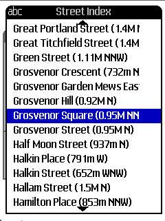
- higher zoom levels contain a searchable gazetteer of local POIs and streetnames
- most items contain an embedded OSM way or node ID which can be queried in the phone's browser to view the live raw OSM data.
- streets without names can be highlighted to give a simple 'no-names' view, without the need to load a separate tileset
- embedded route relations for displaying bus routes, walking routes, etc.
- customisable colour schemes without needing to load separate tilesets
Please be aware that vector maps are no longer being updated - see http://www.trackmyjourney.co.uk/?page=forum&forum=2&thread=704 for details.
Waypoints
Waypoints/POIs can be added on the phone and exported for use in JOSM.
Routing / Geocoding
Uses CloudMade and CycleStreets services to provide basic turn-by-turn navigation and place/street/POI lookup from OSM data.
Website Integration
The current tracks and live location can optionally be uploaded to your TMJ account on the website for later examination, and for sharing with friends. Waypoints can quickly be added via the website and synchronised with the phone.
Note that some features of TMJ are limited in the free version - see the website for details.


