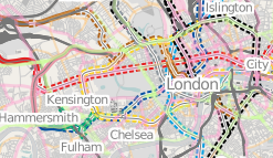
Tube Network Map
Jump to navigation
Jump to search
London tube network maps
- Transport Map in London shows tube lines, but rendered along with railways. See also Transport Map
- tube map by User:Ojw (no longer available?)
- tube map and mashup of TfL flow data by User:Ollie (no longer available?)
- Metrogeography distorted map is done using OSM data and Maperative.
- Old wikipedia image which is not using OSM tube data but weirdly uses very old OSM pre-mapnik display from back in 2006 (blast from the past)
Steve8's original tube map
User:Steve8 created a tube map rendering which was a pretty early demonstration of any kind of custom rendering of OSM data (a Mapnik XML stylesheet as modified early version of the original OSM standard stylesheet), and certainly a very early demonstration of transport map rendering. The above is a small sampling of it. Unfortunately the original map (tiles) seem to be no longer available at this dev server URL:
