User:Ahlzen
Jump to navigation
Jump to search

| |||||||
| |||||||
I support the license | |||||||
|
Mapping
Some of my past and present mapping projects:
Parks and open space
I enjoy the outdoors and often bring a GPS on hikes and bike rides. These are some of the results.
- Wompatuck State Park. Surveyed every road, trail and other feature in the park. Fixed the road network and added trails, paved bike paths and other features.
- Duxbury Town Forest. Surveyed roads and trails in Duxbury T.F. and surrounding reservations.
- Lynn Woods. Started to add some roads and trails in Lynn Woods. More work needed.
- Blue Hills. Added some roads trails, parking lots and other features. More work needed.
- Bare Cove. Surveyed roads and (some) trails in Bare Cove Park, Hingham, MA.
- Pond Meadow. Adding complete set of bike trails, paths and other features, Pond Meadow Park, Weymouth/Braintree, MA.
- Weymouth, MA. Mapped out bounds, roads/trails/footpaths etc in most local parks
- White Mountains. Added several trails in the White Mountains, NH.
I've also been fixing import errors, such as the Reservoirs issue from the MassGIS OpenSpace import.
Airports
I'm working on tracing and tagging airports in Massachusetts in detail. I've completed the following airports:
- Barre - Tanner/Hiller (8B5)
- Bedford - Hanscom Field (BED)
- Berkley - Myricks (1M8)
- Beverly Municipal (BVY)
- Chatham Municipal (CQX)
- Edgartown - Katama Airpark (1B2)
- Falmouth Airpark (5B6)
- Fitchburg Municipal (FIT)
- Gardner Municipal (GDM)
- Great Barrington (GBR)
- Hanson - Cranland (28M)
- Hopedale Industrial Park (1B6)
- Hyannis / Barnstable (HYA)
- Lawrence Municipal (LWM)
- Mansfield Municipal (1B9)
- Marlboro (9B1)
- Marshfield Municipal (GHG)
- Marston Mills / Cape Cod (2B1)
- Montauge / Turners Falls (0B5)
- Nantucket Memorial (ACK)
- New Bedford Regional (EWB)
- Newburyport / Plum Island (2B2)
- North Adams / Harriman and West (AQW)
- Northampton (7B2)
- Norwood Memorial (OWD)
- Orange Municipal (ORE)
- Pittsfield Municipal (PSF)
- Plymouth Municipal (PYM)
- Provincetown Municipal (PVC)
- Southbridge Municipal (3B0)
Misc
- Weymouth, MA. I've GPS surveyed every street in my town, Weymouth, MA, and updated/fixed the street network accordingly. I've also tagged many business districts, parking lots, public facilities etc.
- Traced (improved) a fair amount of shoreline in Boston, on the Boston South Shore and the Boston Harbor Islands.
- Added/corrected commuter rail lines and other railroads in Massachusetts.
Other projects

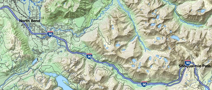
TopOSM example.
- TopOSM - A topographic map based on OpenStreetMap and other free data.
- Participated in (and talked at) State Of The Map U.S. 2010.
- Helped organizing the November 2010 Mapping Party at MIT.
Contact
Feel free to contact me. My email is lars (at) ahlzen (dot) com.
See also my OSM diary, where I occasionally post updates to projects I'm working on.
