User:Coomba
Coomba's Link Hub
- Changes last day
- Changes last hour
- Kaltental on OSM
- Kaltental on Informationfreeway
- Kaltental on Openrouteservice
- OpenStreetBugs Stuttgart
- Stuttgart Wiki
- Map_Features
- Deutsche Presse
- Tagwatch Stuttgart
- Map blending
21.6.2008 OSM at "Tag der Wissenschaft"
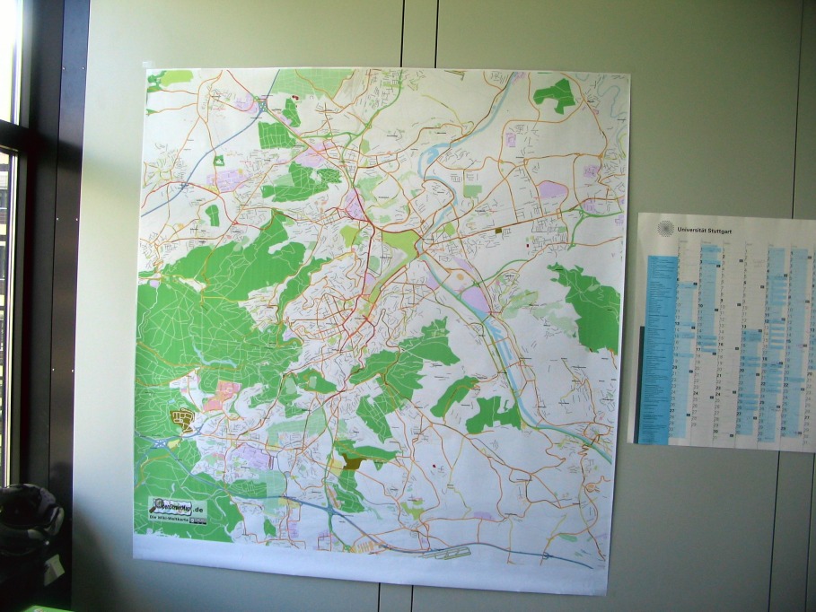
I noticed, that the computing center of the University of Stuttgart offer free poster printing service during the "Tag der Wissenschaft". So I quickly compiled a nice image with the Stuttgart city map (osmarender, zoom level 15, about 36 MPixels). Unfortunately, they didn't manage to print it during the event, but two days later, I got a nice printout with 1.5m x 1.5m in size! :)
And now, my office is a little bit greener :)
26.5.2008 Mapping Verbania
I've had the opportunity to spend 5 hours in surveying a small Italian city called Verbania.
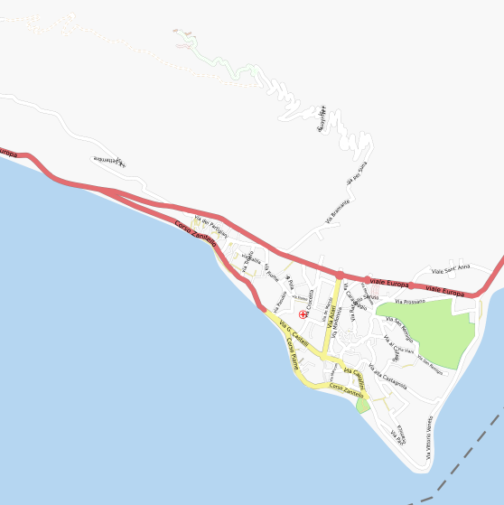
Here is the result:
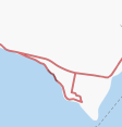
Only two roads before mapping:
After 5 hours of surveying:
The survey was done in 4 sessions:
- During a walk. However, I verified all of these roads later by bike.
- During a bike tour to the Monterosso. Mapped only the traveled roads and the small medieval village called Cavadone.
- 2.5 hours survey by bike
- 2 hours survey by foot
About 240 ways were uploaded. That is roughly 70 seconds of surveying time per way.
GPS reception is very poor in small Italian alleys. I didn't bring paper and pencil - some some alleys might be wrong
The southern part is almost completed. Only some small alleys are missing in Pallanza.
Bike Mapping
With the current state of the maps in my region, I'm currently thinking of a convenient setup to check and fix maps rather than doing massive data collection.
- I use now JOSM/Plugins/AgPifoJ which is very nice. Won't develop my own plugin.
- Still looking for a nice helmet camera, handling digicams on a bike is cumbersome.
- User:LA2 built some bike mapping equipment
- http://twiki.ljudmila.org/bin/view/Luka/FridaV
- Hardware
Verifying the map with a Garmin mapping handheld
I wrote a ruby script for encoding some of the most important tags into the street names. After annotation of the streetnames, you can make a garmin map with mkgmap and start checking these tags with you garmin handheld.
Currently the annotations are encoded as follows:
annotated_name = [prefix] [streetname without suffix "strasse"] [postfix]
prefix = [highway_type][tracktype][bridge_tunnel_layer] [oneway] [cycleway_info] [access_rights]
postfix = [maxspeed][maxweight]...
highway_type = "R" for residential, "U" for unclassified, there are also "S", "P", "F", "C", "T" and many more
tracktype = grade "1" to "5"
bridge_tunnel_layer = for example: B1, T-2, etc.
oneway = "O" for oneway
cycleway_info = "track":CT, "opposite_track":COT and so on
access_rights = ([access_mode][right])*
access_mode = (C)ar, (M)otorcycle, (B)icycle, "F" for foot and so on
right = (P)ermissive, pri(V)ate, (N)o, ..
max* = (S)peed, (W)eight, (H)eight followed by the number
Examples:
S O Boeblinger S50 : highway=secondary, name=Boeblinger Strasse, oneway=yes, maxspeed=50
U T-1 BNFN Fooweg : unclassified, tunnel, layer=-1, no bike, no foot
L AD Bargasse : living_street, access=destination
Here is an annotated garmin map for Baden Wuerttemberg
Thoughts
- The ultimate OSM application
- Must be platform independent and easy to install (Java/Eclipse RCP best candidate?)
- Seamless, accelerated zooming and passing of the map (OpenGL?)
- Lower levels: Rendered pixel data
- Higher zoom levels: Vector data
- Instantly show edits in OSM data base
- Low zoom pixel data may be shared over a server (T@H idea)
- Higher zoom levels are always rendered on client side (may be uploaded for web-users)
- Supporting tiles@home with background rendereing, if idle
- Direct editing on higher zoom levels
- basic editing: Tamplates / Tagging for the pro's
- Offline use possible
- Mapping/Routing applications
- Managing routes and tours
- GPS-interaction
- Dynamic map content (Public transport animation?)
- 3D
- OpenGL 3D, SRTM terrain and landsat data
- Just like Google Earth would be ideal ;)


