User:Michael Montani
Jump to navigation
Jump to search
| Michael Montani | ||||||||||||||||||||||||||||||||||||||
|---|---|---|---|---|---|---|---|---|---|---|---|---|---|---|---|---|---|---|---|---|---|---|---|---|---|---|---|---|---|---|---|---|---|---|---|---|---|---|
| ||||||||||||||||||||||||||||||||||||||
| Babel user information | ||
|---|---|---|
| ||
| Users by language |

I support OSM by being a
member of the
OpenStreetMap Foundation
Do you?
Nice to meet you!
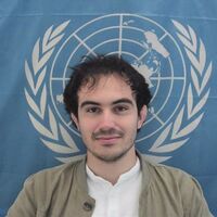
I'm Michael Montani, and I am a contributor to OpenStreetMap since 2016. I have been focusing my contributions to the OSM ecosystem mainly in the field of crowdsourcing and capacity building, for which I made some stuff:
- I co-founded and led the first European YouthMappers chapter, PoliMappers, at Politecnico di Milano. Back in 2016, as university students, we were gathering once a month and teaching each other open mapping tools we were randomly discovering on the web. Good times!! For Politecnico di Milano I also gave lectures on the extra-curricular course "Humanitarian Collaborative Mapping".
- I was awarded of the 2018 YouthMappers Research Fellowship, for which I conducted a research project funded by USAID and The World Bank on using OSM data to produce risk maps of infection for Neglected Tropical Diseases. My use case was fighting schistosomiasis in North Senegal, for which I conducted, together with friends from OSM Sénégal and YouthMappers Ségou, field data collection with drones about aquatic vegetation, mapping of very remote villages and some AI classification on satellite and drone imagery. Open-access scientific pubblication is available here: Cross-Continental YouthMappers Action to Fight Schistosomiasis Transmission in Senegal, published as a chapter of the book Open Mapping towards Sustainable Development Goals by Springer Nature.
- From time to time I volunteer for Wikimedia Italia, which includes all the activities related to OSM Italy. In particular, in 2023 I have been in charge of selecting and certify OSM trainers at the national level, during the first iteration of certification of Wikimedia trainers from Wikimedia Italia. Since 2021 I translate all weeklyOSM articles in Italian on a weekly basis with isoipsa. Additionally, I also delivered a training course on how to map hiking trails to CAI, the national alpine association.
- Since 2020, I work as GIS Consultant at the United Nations Global Service Centre (UNGSC) under the UN Secretariat. Here I coordinate the crowdsourcing activities of UN Maps, a programme delivering geospatial services to UN Peacekeeping Missions worldwide based on OpenStreetMap data. Here:
- I designed and established a crowdsourcing team helping the UN to produce data on OSM in areas where is needed for its operations, especially on peacekeeping areas, notably Somalia, Democratic Republic of the Congo, Central African Republic, Mali, Yemen and Abyei and Kashmir regions, working from the logistic bases of the UN in Brindisi, Italy, and Valencia, Spain.
- I advocated within UN colleagues on the benefits of open geospatial data and open-source geospatial software, and enforcing good practices on community engagement and usage of OSM data.
- I established the UN Mappers community, composed by around 5000 volunteers worldwide contributing to UN peacekeeping efforts. The community is composed by volunteers from academic institutions, local communities, uniformed personnel from missions, UN staff etc.
- We delivered OSM events (mapathons, trainings, presentations) at a rate of 70 events per year, mostly online and interacting with contributors over the World. We built capacities of OSM communities in (forgive me if I forget someone) (no particular order): Somalia, Kenya, Madagascar, Moçambique, Democratic Republic of the Congo, Central African Republic, Sudan, South Sudan, Cameroon, Nigeria, Mali, Ivory Coast, Morocco, Libya, Egypt, Spain, France, Italy, Germany, Romania, Portugal, Poland, Kirghizistan, India, Sri Lanka, Nepal, Brazil, Colombia and Bolivia.
- We built the UN Maps Learning Hub, one of the few resources online which deliver general purpose educational material on OSM, including quizzes and badges, in several languages, including English, French, Spanish, Portoguese, Italian, Chinese and Arabic.
- I delivered an OSM training in Bamako to the National Cartographic Agency of Mali and MINUSMA, during a coup d'etat... I delivered another one in Nairobi to UNSOS, in collaboration with OSM Kenya. I also coordinated road mapping for the Ministry of the Education of Madagascar with UNESCO and participated in several natural disaster responses.
- I invited an OSMF Board representative to a UN conference for the first time ever.
- I develop from time to time software to track OSM contributions from users worldwide and develop and webmaster UN websites.
- Even if not related to OSM, I produce maps showing how geospatial data can be used to describe Sustainable Development Goals for the UN Secretariat (you can see them all here). Out of which we made a pubblication to the International Cartographic Conference in 2021.
I am an OSMF Member since 2020 and member of the Local Chapters and Communities Working Group since 2023
I almost always map in Africa, but lately I also like to try to add at least one POI per day with EveryDoor. More difficult than what you can imagine, give it a try!
OSM accounts
- Personal account: Michael Montani
- UNGSC account: UNGSC-Michael Montani
- Revert account: Michael Montani_revert
Disclaimers
- In the production of some Wikipages, I use/d a bot written in Python (PyWikiBot library). The bot is authorized by the community I'm publishing for. For any unintended misconduction, feel free to drop a message in my talk page. At this stage, I am not currently using this bot.
Categories:
- User it
- User it-N
- User en
- User en-3
- User fr
- User fr-1
- Users in Italy
- European users
- Twitter users
- LinkedIn users
- Telegram users
- Ubuntu users
- Android users
- JOSM users
- StreetComplete users
- Users who like to help beginners
- Users appreciating good changeset comments
- Users who map by bicycle
- Users who map by riding public transport
- Users who map by hiking
- Users who practice wildlife watching
- Babel - Users by language
- Member of OSMF
