Victoria, British Columbia
Jump to navigation
Jump to search
| Next Mapping Party: | September 3rd 2009 1pm Victoria Central Library |
|---|
| V・T・E |
| latitude: 48.43, longitude: -123.36 |
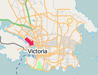
| Browse map of Victoria 48°25′48.00″ N, 123°21′36.00″ W |
| Edit map |

|
|
External links:
|
| Use this template for your locality |
Victoria is a city in British Columbia, Canada at latitude 48°25′48.00″ North, longitude 123°21′36.00″ West.
Mappers
- Corey Burger
- Sam Vekemans
- Austin Henry (concentrating on colwood/langford)
Mapping Parties
There have a been a number of mapping parties, which are listed at the Victoria mapping party page.
Data to verify
- Where Douglas turns into Highway 1
Areas of Victoria
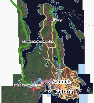
Victoria commonly refers to Greater Victoria, encompassing the cities of Victoria, Oak Bay, Saanich and Esquimalt, plus the Western Communities of View Royal, Colwood, Metchosin, the Highlands and Langford and the Saanich Peninsula, including Central and North Saanich and the village of Sidney.
Trails
State of the Map
Useful links
- Saanich bus shelter locations and numbers
- BBBike @ Victoria - a cycle route planner for Victoria
Download
- You can download the Ibycus Topo which holds the GeoBase Import data which will eventually get imported to OpenStreetMap. here Which is the 092B area of the Geobase Map covering from Sooke, to Duncan up to ladysmith (the 49th parellel) all of Victoria area and Saanich as well as the islands.
- As well as the 1 degree x 1 degree OSM tile here from ComputerTeddy's map. It's a zip file, just needs to be unziped. You can use sendmap to get the maps on your GPS device.

