Zh-hant:Potlatch 1
- 關於
- Potlatch 1是一個基於Flash的OpenStreetMap編輯器,直到2012年10月仍可從主網站的「編輯」標籤進入。但為了阻擋使用該編輯器,當時已從編輯標籤中移除,您仍可透過手動編輯URL來存取Potlatch 1。
- 對OpenStreetMap的影響
- Potlatch 1是多年來的預設編輯器。許多繪圖者使用Potlatch 1的主要原因是其獨特的取消刪除路徑功能(能儘可能放大,然後按「u」按鈕來查詢伺服器是否有目前區域中已刪除的路徑)。
- 成為有歷史性的原因
- 它的直接後繼者是Potlatch 2。由於Adobe Flash已經停用,Potlatch 1和Potlatch 2都已不再運作,並由Potlatch 3取代。
| Potlatch 1 | ||||||||||||||||||||||||||||||||||||||||||||||||||||||||||||||
|---|---|---|---|---|---|---|---|---|---|---|---|---|---|---|---|---|---|---|---|---|---|---|---|---|---|---|---|---|---|---|---|---|---|---|---|---|---|---|---|---|---|---|---|---|---|---|---|---|---|---|---|---|---|---|---|---|---|---|---|---|---|---|
| 作者: | Richard Fairhurst | |||||||||||||||||||||||||||||||||||||||||||||||||||||||||||||
| 執照: | PD | |||||||||||||||||||||||||||||||||||||||||||||||||||||||||||||
| 平臺: | Web | |||||||||||||||||||||||||||||||||||||||||||||||||||||||||||||
| Status |
Broken | |||||||||||||||||||||||||||||||||||||||||||||||||||||||||||||
| 版本: | 1.4 (2010-12-24) | |||||||||||||||||||||||||||||||||||||||||||||||||||||||||||||
| 語言: | 德文和英文
| |||||||||||||||||||||||||||||||||||||||||||||||||||||||||||||
| 網站: | https://www.openstreetmap.org/edit?editor=potlatch | |||||||||||||||||||||||||||||||||||||||||||||||||||||||||||||
| 源代碼: | https://svn.openstreetmap.org/applications/editors/potlatch/ | |||||||||||||||||||||||||||||||||||||||||||||||||||||||||||||
| 程式語言: | ActionScript | |||||||||||||||||||||||||||||||||||||||||||||||||||||||||||||
| ||||||||||||||||||||||||||||||||||||||||||||||||||||||||||||||
|
簡單介紹如何使用Potlatch 1。當您熟悉使用後,您也可以學習一些鍵盤快捷鍵. | |
|
觀看 Potlatch 1 的操作教學影片(觀看這裏以了解更多). | |
|
常見問題的解答。 | |
|
有關Potlatch 的秘訣、技巧和最新消息。 | |
|
Potlatch 1如何運作、如何變更以及最近的更新。 | |
|
就您希望看到的改進提出意見,並瞭解未來的計劃. |
Potlatch的畫面
If you click on the edit tab, typically you will enter Potlatch 2. To enter this older version, Potlatch 1, click the arrow next to the 'Edit' tab, select Potlatch 2, and replace editor=potlatch2 with editor=potlatch in the URL.
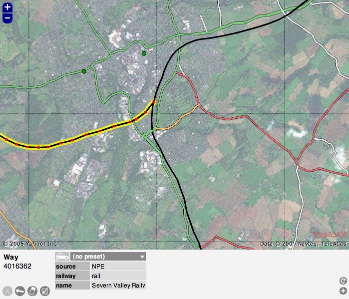
Choose 'Edit with save' if you would like to make edits and then save them (most people use this) Choose 'Live edit mode' for saving immediately as you go along. Now you will see the Potlatch screen and typically you might see Yahoo! aerial photography and, possibly, some mapped roads. At the bottom are some grey icons that are mapping tools and colored icons used to "tag" nodes on a map. More about that later.
You can zoom in and out using the plus "+" and minus "-" signs at the upper left of the image.
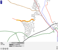
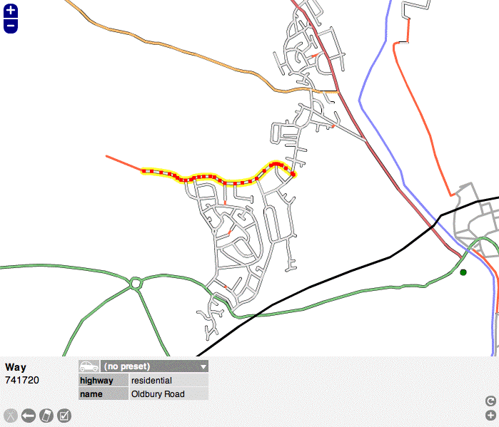
Carefully click on a "way" (a road, path or area) or a "node" (a specific spot), and it will be highlighted. Click anywhere else on the map to unhighlight it. In the example screen the highlighted road is outlined in yellow. When you highlight something, notice that the colored icons at the bottom of the screen are replaced by a kind of grid of light and dark grey boxes. You can see that these boxes contain information about the map item that you have highlighted. IMPORTANT: Look over the information but do not change anything yet until you have learned more about Potlatch.
This area at the bottom of the screen, called the Edit Panel, shows vital data about each "way" and "node" on the screen. This data is called "tags." Soon you will be adding your own "tags," but for now you need to become familiar with all the elements in the screen before you start editing.
Below the screenshot of Potlatch is a version of the Edit Panel with numbers on each element.
--1 and 2: When you select an item, this tells its basic type and its number in the OSM database
--3 through 9: These are basic tools that you will use to edit the map
--10: Template: In this case, the word "template" refers to a broad category of tags, such as "highway." "tourist" or "amenity."
--11: Relations: This refers to how each element is related to a larger road system. This is not always present on U.S. areas.
--12: Object tag: There are 7 "tags" or "object tags" in this example screen shot, starting with "highway." This element also introduces the terms "key" and "value." A "key" is a category of tags, such as "sport" or "railway." A "value" is a specific tag. For example, "highway" can be a key and "residential" is the value, or "sport" is the key and "tennis" is the value. Using multiple keys and values you can build up data for each item on the map.
--13: Delete tags: Use with caution because it does not ask you to confirm
--14: Copy tags: A handy tool for when you are making a lot of repetitive edits
--15: Open relation editor: In some cases a node or way may be part of a larger entity. For example, Historic Route 66 sometimes follows routes that today have different names or numbers. You can create a relation of the current way to the historic route. See "Relations" for other examples.
--16: Add a tag: If you need more tags to describe a way or node fully
--17: Help: a link to the Potlatch help page
--17.5?: Find Tag: A recent and welcome addition to Potlatch that provides a list of possible tags, if you are not sure which tag is right. Type in a possible tag, for example, "national park," and it provides a long list of acceptable tags for parks.
--18: Advanced menu: More editing tools. Read the Wiki for each before using them.
--19: Edit mode: Usually it is green and says "editing offline." This is the only mode a beginner should use. Make your edits, the click the next button, "Save."
--20: Save (not displayed when live edit mode): Saves changes you have made. Like anything else, the best method is to save often.
--21: Scroll bar for tags: This appears if you have added so many tags that the bottom Edit Panel is full, not likely, nor recommended, for a beginner.
After you are familiar with the screen, proceed to the Potlatch Primer [1] for the next steps.
Typical screen with Yahoo! Aerial Imagery:
Edit Panel:
|
1: Type of the selected element, |
12: Object tag (displayed 7 here, but it has more): a) key, b) value, |
Sometimes Yahoo! imagery is not available, so you will see only mapped items
Without Yahoo! Aerial Imagery:
為何選擇Potlatch?(為什麼不選擇?)
NOTE: The below is old text from before the release of Potlatch 2 (P2). All of that applies to P2.
Potlatch is intended as an easy-to-learn editing environment for drawing ways and adding metadata to existing ways. It is the best way for new members to start contributing to OSM, particularly in locations where there is good aerial photography. A clear, uncluttered user interface is paramount for newer users, and the Potlatch layout draws on the familiar conventions of the existing Slippy Map.
It's not intended for power users (who are already excellently served by JOSM and Merkaartor), people who want the speed of a desktop client, or those who don't like Flash. Nonetheless, since Potlatch, Merkaartor, and JOSM are developed separately, some innovations do make their way into Potlatch first, ranging from the simple (remove a node from one way alone) to the complex (editing history). An increasing number of experienced OSMers use Potlatch as a supplement to JOSM for instant editing, and a few use it as their principal editor.
As a very rough rule of thumb, Potlatch is easier for quick edits, and better for edits which range over a wide area (e.g. cycle routes). JOSM is better for heavy-duty editing in a concentrated area (e.g. housing estates) and offers facilities for audio and photo surveying. But everyone will have their own preferences.
使用Potlatch 1
注意:由於 Adobe Flash 已經停用,Potlatch 1 和 Potlatch 2 都無法透過 OSM 網站取得。 以下文字保留作歷史參考,但已不再有效。
自從 Potlatch 2 推出後,(幾乎)「沒有理由再使用Potlatch 1」(.4),而且,事實上,不建議使用它--除非是需要還原已刪除的路徑或還原特定區域中路徑變更的進階使用者。Potlatch 1仍然是唯一方便的工具。
若要存取Potlatch 1,使用者需要在編輯URL的末端加入「&editor=potlatch」。再次重申,除了還原或取消刪除的方式外,請勿使用Potlatch 1!


