AND data
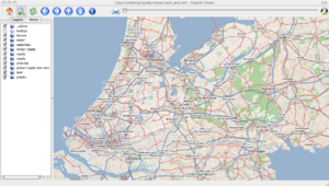
On the 4th of July 2007 AND Automotive Navigation Data (who more recently rebranded as GeoJunxion) donated the entire streetmap of the Netherlands as well as road networks for China and India. The Netherlands data was imported quite rapidly after the announcement, to give as a complete-looking map of this whole country, and making this one of the most significant imports early on the development of OpenStreetMap. The AND dataset also included the basic India road network and city names. The China AND data was not imported, as it appears to be substantially out-of-date.
OSM Services
In 2011 AND started to offer services based on OSM data. This includes setting up custom tile map services, OSM map conversions and consultancy services.
Conversion tools for AND to OSM
Two conversion programs were made, one php-based by Floris, and one in c-code by Marc:
The second tool was used for the import.
Questions & answers from AND
- In the AND data bus lanes don't appear to be classified differently. Do we miss some rules?
- This is probably an error in the data, most likely an isolated case.
- Nodes can have the same coordinates, but still different AND-ID's (example AND-IDs 10020749 and 10000028, lat 51.06069, lon 5.86275, railway station Susteren). Is there a reason for this, or are this errors in the AND data?
- This should be interpreted as two crossing segments, the nodes should not be merged. The reason for introducing these nodes is a technical restriction from AND clients that do not want any crossing segments.
- The FROM-ID and TO-ID from roads, seem to refer to non-existing node-ID's. Are there more node-IDs than in the ND_ID field?
- Should be an exception, most likely an error in the data.
- Pedestrian streets are oneway (?)
- We should probably ignore the direction for pedestrian (tonnage=-1) streets.
Press Releases and Announcements
- https://blog.openstreetmap.org/2007/07/04/and-donate-entire-netherlands-to-openstreetmap/
- https://web.archive.org/web/20070927051801/http://www.and.com/company/newsletter/newsletter10/art01en.php
- http://www.gpsbusinessnews.com/index.php?action=article&numero=246
In Dutch
- http://www.openstreetmap.nl/archives/31-AND-doneert-Nederland-aan-OpenStreetMap.html
- http://mailman.vrijschrift.org/pipermail/news/2007-July/000073.html
- http://www.nu.nl/news/1142840/50/Digitale_vrijwilligersatlas_krijgt_detailkaarten_Nederland.html
- http://www.zdnet.nl/news.cfm?id=70147&mxp=151
- http://tweakers.net/nieuws/48298
On the radio
- Business News Radio (BNR): http://www.bnr.nl, use the BNR 'radio-archief', day: 19 July, time around 20.05. Also, you can find an MP3 here
- Radio Online, interview with User:ZoranKovacevic, day 11 September 2007, time around 20:00. You can find an MP3 here
Info
From a post by SteveC (Monday = 9 July):
Have had some emails with AND today. The roadmap we have at the
moment looks like this and is not 100% firm in terms of dates and times:

* Monday: data spec (including things like properties like 'name' and
so on) will go on the wiki
* Thursday/Friday: Put the data up, not sure if this will be on OSM
or AND. Probably a few giant shapefiles - something like that.
* Weekend: AND at the state of the map to answer your questions, and
probably ask you some.
* Weeks to follow: we figure out how we're going to get the data in.
Sample image
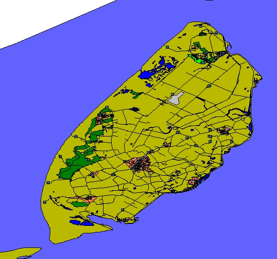
The sample data of Texel (island in front of the northern coast) can be downloaded here is no longer available.
Now in OSM here.
The data set
The AND data for the Netherlands (shape file) is now available under CC-BY-SA here no longer available.
Specification
AND have given OpenStreetMap their specification document, with a clause allowing us to wikify here on openstreetmap.org . The wikified document may be found at AND Data/Spec.
So, like the TIGER import, we have converted the attributes in to tags and so on.
The major differences between the AND and OSM data can be found on the AND Data/AND-tag-mapping-to-OSM page. This to make the tag differences in the tagging schemes transparent and to highlight the major differences and identify the alternative solutions.
Mapping ANDs Tagging Scheme to OSMs Tagging Scheme
This section is dedicated to mapping of the tags used by AND to the tags used by OSM.
AND Data/AND-tag-mapping-to-OSM
Integration
The AND data was integrated into OpenStreetMap. This section is about the how-to's of the integration.
AND Data/Roadmap-integration-NL
License status
Early April 2012 OSM and AND agreed that data which was in OSM on March 1st 2012 was allowed to remain in OSM under the ODbL. Data from the original dataset that was not imported by that date is not included in this agreement and therefore can not be entered in OSM under the ODbL. The confirmation was posted on talk-nl.
FAQ
- What does the data look like?
- It looks great! It's now available for all to see on the Netherlands map. The India & China roads are not on there yet, but there is a preview of the data.
- What kind of data does it include?
- Complete map of the Netherlands for car, including some detailed road classifications etc. Doesn't include footpaths/cyclepaths. For China and India it includes major road networks and place names.
- How much work/time/effort was involved in striking this deal with AND, and figuring out the details?
- About 2 man-days, by SteveC
- Is there any kind of written contract/agreement?
- No. The digital maps donated by AND Automotive Navigation Data are available under CC-BY-SA.
- How much work/time/effort was involved in importing the AND data into OSM.
- Several months of coding and experimentation by Netherlands mapppers.
- What is left to do with the AND data?
- Bring India and China data onto the map
- In NL their data contains some things that cannot properly be modelled at the moment, e.g. turn restrictions and signposting information. Hopefully it will be possible to at least preserve the OSM<->AND mapping (i.e. "their way id X <-> our way id y") or find some other way to preserve that valuable information until such time when we can represent it in our model.
- What is left to do mapping wise?
- Fix any mistakes inaccuracies in the data.
- Cycleways
- Footways
- Other details

