Category:Philippines
Jump to navigation
Jump to search
Subcategories
This category has the following 11 subcategories, out of 11 total.
/
C
- CWTS++ (1 P, 19 F)
D
- Directed Editing Projects (5 P)
E
I
- Import from the Philippines (4 P)
M
- Maps of the Philippines (79 F)
O
P
U
Pages in category "Philippines"
The following 69 pages are in this category, out of 69 total.
B
F
G
H
M
O
P
- Template:WikiProject Philippines
- Philippines/Taskings
- Philippines/2020 Typhoon Activation
- Philippines/CWTSS++ Project
- Philippines/Data sources/pafid data
- Philippines/Events/Pista Ng Mapa
- Philippines/FAQs for PH data
- Philippines/Local Community Channels
- Philippines/MapaTime!
- Philippines/OSMaPaaralan
- Philippines/PRCVCAD Project
- Philippines/Project SUCCESS
- Philippines/Projects
- Philippines/Template for Project Pages
- Philippines/Typhoon Ompong
- Philippines/Planning
- Power networks/Philippines
- Power networks/Philippines/Abbreviation of substations and power plants
- Power networks/Philippines/Components of power lines
- Power networks/Philippines/List of power lines
- Power networks/Philippines/Mapped transmission and subtransmission lines constructed by each companies
- Power networks/Philippines/Mapped transmission and subtransmission lines constructed by each companies/Exceptions
- Power networks/Philippines/Number of retired structures
- Power networks/Philippines/Number of towers that were painted with aluminum or zinc paint
- Power networks/Philippines/Power line references
- Power networks/Philippines/Power line structures references
- Power networks/Philippines/Power stations/substations mapped
- Davao City/Public transportation
- Public transportation in Metro Cebu
Media in category "Philippines"
The following 148 files are in this category, out of 148 total.
- 1 year of edits in Cavite, Laguna, Batangas 2011-02-05.png 1,280 × 960; 874 KB
- 1 year of edits in Metro Manila 2010-01-24.png 1,280 × 960; 879 KB
- 1 year of edits in Metro Manila 2010-01-31.png 1,280 × 960; 916 KB
- 1 year of edits in Metro Manila 2011-02-05.png 1,280 × 960; 980 KB
- 1 year of edits in Metro Manila 2012-01-01.png 1,280 × 960; 1.13 MB
- 2008 A Year of Edits - Philippines frame.jpg 1,280 × 720; 90 KB
- 4636578697 6e85855407.jpg 1,024 × 768; 329 KB
- 59082 463627032596 345455082596 7100402 5319097 n.jpg 720 × 540; 99 KB
- Arivac bohol POI lr.jpg 230 × 168; 10 KB
- ASoG - iBop Asia - New Mobility - NMT Mapping Workshop.jpg 2,048 × 1,536; 186 KB
- Balayan OSMPH Garmin 2011-12.png 878 × 646; 6 KB
- Balayan RoadGuide Garmin 2011-12.png 878 × 646; 24 KB
- Bangui Windmills.png 1,044 × 438; 45 KB
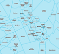
- Barangay boundaries in OpenStreetMap.png 577 × 524; 129 KB
- Bing misalignment in Daang Hari - Bacoor.jpg 500 × 300; 51 KB
- Bing not yet aligned in GMA, Cavite.jpg 400 × 400; 31 KB
- Bing now aligned and traced in GMA, Cavite.jpg 400 × 400; 32 KB
- Bing now aligned in GMA, Cavite.jpg 400 × 400; 29 KB
- Bohol 20100309 lr.png 230 × 162; 23 KB
- Buenavista OSMPH Garmin 2011-12.png 878 × 646; 29 KB
- Buenavista RoadGuide Garmin 2011-12.png 878 × 646; 6 KB
- Bulabog Beach, Boracay OSMPH Garmin 2011-12.png 878 × 646; 28 KB
- Bulabog Beach, Boracay RoadGuide Garmin 2011-12.png 878 × 646; 14 KB
- Bulacan spot5 20100121.png 320 × 344; 83 KB
- Catbalogan OSMPH Garmin 2012-12.png 878 × 646; 48 KB
- Catbalogan RoadGuide Garmin 2012-12.png 878 × 646; 31 KB
- Cavite Road Network Mapping Party animation frame.png 800 × 608; 83 KB
- Cavite Road Network Mapping Party annotated traces.gif 510 × 510; 28 KB
- Cavite Road Network Mapping Party cake slices.png 807 × 633; 101 KB
- Cebu Jeepney Route 06H.png 868 × 601; 270 KB
- ClickTheCity using OSM.png 960 × 616; 98 KB
- CloudMade routing at C-5 - Kalayaan.png 660 × 860; 80 KB
- Corregidor OSMPH Garmin 2012-12.png 878 × 646; 57 KB
- Corregidor RoadGuide Garmin 2012-12.png 878 × 646; 27 KB
- Cubao Mapping Party Before and After.png 705 × 950; 137 KB
- Dasmarinas OSMPH Garmin 2011-12.png 878 × 646; 39 KB
- Dasmarinas RoadGuide Garmin 2011-12.png 878 × 646; 27 KB
- Davao yahoo 20100118.jpg 549 × 612; 61 KB
- Diniwid Beach, Boracay OSMPH Garmin 2011-12.png 878 × 646; 21 KB
- Diniwid Beach, Boracay RoadGuide Garmin 2011-12.png 878 × 646; 10 KB
- Drone panguan mapping.jpg 824 × 589; 108 KB
- Enchanted Kingdom via Bing.png 494 × 490; 71 KB
- GADM vs OSM - Central Quezon City.png 767 × 592; 35 KB
- GADM vs OSM - Northern Caloocan.png 767 × 592; 24 KB
- Garmin IMG file sizes.png 1,335 × 540; 67 KB
- Gingoog OSMPH Garmin 2012-12.png 878 × 646; 49 KB
- Gingoog RoadGuide Garmin 2012-12.png 878 × 646; 23 KB
- GK-Telus Mapping Party Rally.jpg 720 × 480; 63 KB
- HOT style map of Southern Tacloban.png 950 × 625; 578 KB
- HOT Task 338.png 533 × 915; 239 KB
- IMG 3488.JPG 446 × 594; 83 KB
- Intramuros and Rizal Park in Stamen's Watercolor tileset.jpg 960 × 960; 284 KB
- Intramuros Mapping Party - before and after.png 2,010 × 1,000; 1.13 MB
- Intramuros Mapping Party morning meetup.jpg 720 × 540; 73 KB
- Intramuros Mapping Party planned slices.png 1,000 × 866; 666 KB
- Intramuros Mapping Party written Walking Paper for slice 4.jpg 654 × 900; 80 KB
- Intramuros OSMPH Garmin 2011-12.png 878 × 646; 76 KB
- Intramuros RoadGuide Garmin 2011-12.png 878 × 646; 46 KB
- Kidapawan OSMPH Garmin 2011-12.png 878 × 646; 27 KB
- Kidapawan OSMPH Garmin 2012-12.png 878 × 646; 93 KB
- Kidapawan RoadGuide Garmin 2011-12.png 878 × 646; 16 KB
- Kidapawan RoadGuide Garmin 2012-12.png 878 × 646; 53 KB
- Lubao ESSC OSM training group photo.jpg 960 × 720; 97 KB
- Lucena and Western Pangasinan from new Bing imagery.png 640 × 970; 295 KB
- Malapascua Island 2010-01-29.png 924 × 1,209; 50 KB
- Malapascua OSMPH Garmin 2011-12.png 878 × 646; 19 KB
- Malapascua RoadGuide Garmin 2011-12.png 878 × 646; 5 KB
- MapAction using OSM after Ondoy.png 825 × 1,161; 126 KB
- MapaTime 20190325 133852.jpg 4,048 × 3,036; 3.33 MB
- MapaTime 20190325 200945 077.jpg 1,280 × 960; 198 KB
- MapaTime IMG 20190325 132542.jpg 4,048 × 3,036; 3.97 MB
- MapaTime! IMG 20190325 094003-COLLAGE.jpg 2,047 × 2,047; 582 KB
- MapBox GPS traces layer Elliptical Road.png 926 × 662; 187 KB
- MapBox Streets style for Makati CBD.png 800 × 600; 219 KB
- MapCraft pie for Marikina.png 800 × 800; 938 KB
- MapQuest's OSM cartography - Metro Manila.png 1,002 × 1,002; 385 KB
- Marikina Cake.jpg 720 × 540; 97 KB
- Marikina cycleways.png 547 × 553; 558 KB
- Marikina mapping priorities.png 1,448 × 932; 1.12 MB
- Marikina OSMPH Garmin 2011-12.png 878 × 646; 78 KB
- Marikina RoadGuide Garmin 2011-12.png 878 × 646; 45 KB
- Metromanila yahoo 20100118.jpg 449 × 550; 57 KB
- MNL in X-Plane.png 1,024 × 543; 759 KB
- Mount Samat Shrine in F4 Map.jpg 542 × 549; 62 KB
- Naga osm.png 1,020 × 1,189; 598 KB
- Naic OSMPH Garmin 2011-12.png 878 × 646; 34 KB
- Naic RoadGuide Garmin 2011-12.png 878 × 646; 26 KB
- New Mobility Mapping Workshop 2012-02-01.jpg 1,600 × 1,063; 1.06 MB
- OpenOrienteeringMap of Ayala Center, Makati 2010-01-29.png 986 × 782; 112 KB
- OpenStreetMap Philippines Inc. SEC Certificate of Incorporation.jpg 2,988 × 5,312; 4.43 MB
- OpenStreetMap.org.ph screenshot.png 1,024 × 617; 63 KB
- Ormoc OSMPH Garmin 2011-12.png 878 × 646; 43 KB
- Ormoc RoadGuide Garmin 2011-12.png 878 × 646; 26 KB
- Ortigas-Mandaluyong Mapping Party group shot.jpg 720 × 540; 90 KB
- Ortigas-Mandaluyong Mapping Party Slices.PNG 667 × 589; 127 KB
- OSM ADDU Workshop 2011-01-29.jpg 720 × 540; 68 KB
- OSM South Cotabato LGUs Workshop.jpg 960 × 712; 118 KB
- OSM Workshop at FEATI University 1.jpg 2,048 × 1,536; 854 KB
- OSM Workshop at Software Freedom Day Philippines 2012.jpg 2,048 × 1,536; 251 KB
- OSM-PH sawtooth coastlines example.png 854 × 1,106; 30 KB
- OSMPH data growth graph.png 697 × 456; 43 KB
- Osmph-structures-noah.jpg 884 × 407; 139 KB
- Paete OSMPH Garmin 2011-12.png 878 × 646; 28 KB
- Paete RoadGuide Garmin 2011-12.png 878 × 646; 16 KB
- Pampanga yahoo 20100118.jpg 458 × 561; 49 KB
- Pangasinan qb 20100118.jpg 414 × 462; 41 KB
- Pangasinan Typhoon Pepeng imagery extent (DigitalGlobe Quickbird).png 520 × 518; 136 KB
- Pasay boundaries.png 1,364 × 1,466; 326 KB
- Passi OSMPH Garmin 2011-12.png 878 × 646; 34 KB
- Passi RoadGuide Garmin 2011-12.png 878 × 646; 12 KB
- Pateros Mapping Party activity via ITO.png 1,280 × 960; 538 KB
- Philippines mapping project banner.png 600 × 130; 43 KB
- Puerto Princesa OSMPH Garmin 2011-12.png 878 × 646; 38 KB
- Puerto Princesa RoadGuide Garmin 2011-12.png 878 × 646; 32 KB
- Quiapo in 3D.png 1,100 × 650; 335 KB
- Rally's typ file.png 968 × 626; 139 KB
- Rizal Park OSMPH Garmin 2011-12.png 878 × 646; 78 KB
- Rizal Park RoadGuide Garmin 2011-12.png 878 × 646; 52 KB
- San Pablo City 2010-01-30.png 780 × 780; 79 KB
- San Pablo OSM-PH Garmin 2011-12-23.png 878 × 646; 209 KB
- San Pablo OSMPH Garmin 2011-12.png 878 × 646; 86 KB
- San Pablo RoadGuide Garmin 2011-12.png 878 × 646; 51 KB
- Santa Ana, Manila Mapping Party cake.png 1,300 × 1,250; 1.62 MB
- Sendong humanitarian maps.png 924 × 1,309; 556 KB
- Silang OSMPH Garmin 2011-12.png 878 × 646; 29 KB
- Silang RoadGuide Garmin 2011-12.png 878 × 646; 22 KB
- SM City Cebu 2010-11-29.png 1,052 × 812; 226 KB
- Southwestern Makati Mapping Party planned slices.png 1,017 × 1,544; 1.76 MB
- Sta Cruz OSMPH Garmin 2011-12.png 878 × 646; 52 KB
- Sta Cruz RoadGuide Garmin 2011-12.png 878 × 646; 30 KB
- State of the Countries 2010 posters PH FR.jpg 1,000 × 664; 117 KB
- Taal Lemery OSMPH Garmin 2011-12.png 878 × 646; 28 KB
- Taal Lemery RoadGuide Garmin 2011-12.png 878 × 646; 19 KB
- Tagging examples on a street view photo.jpg 1,024 × 386; 329 KB
- TawiTawiPH mappingexpedition.jpg 2,592 × 1,944; 1.83 MB
- Three large poster maps of Tacloban, Guiuan and Ormoc.jpg 640 × 918; 198 KB
- Typhoon Hagupit changesets till 2014-12-08.png 1,196 × 741; 369 KB
- Typhoon Haiyan - OSM data growth line graph.png 1,837 × 1,361; 41 KB
- Typhoon Haiyan changesets vis.png 785 × 526; 243 KB
- Typhoon Haiyan mapping changeset bounding boxes viz by Pascal Neis.png 2,236 × 1,608; 1.59 MB
- UP Los Baños Campus 2010-10-31.png 1,692 × 1,375; 608 KB
- UP Village+ Mapping Party planned slices.png 1,280 × 1,280; 1.82 MB
- UPLB OSMPH Garmin 2011-12.png 878 × 646; 76 KB
- UPLB RoadGuide Garmin 2011-12.png 878 × 646; 33 KB
- White Beach, Puerto Galera OSMPH Garmin 2011-12.png 878 × 646; 23 KB
- White Beach, Puerto Galera RoadGuide Garmin 2011-12.png 878 × 646; 12 KB
- WikiProject Philippines banner.png 600 × 130; 31 KB
- WikiProject Philippines mini banner.png 122 × 76; 11 KB


