Philippines/Featured images/2011
Jump to navigation
Jump to search
| Week | Image | Description | Global featured image? |
|---|---|---|---|
| Jul 17 | 
|
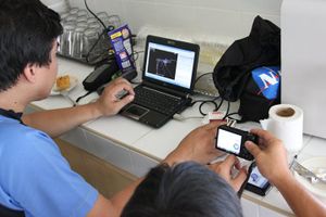
Using photos to show tagging. One excellent way to show newbie mappers how and what to tag is to show them photos with OSM tags written on objects seen in the photos. | |
| Jul 10 | 
|
Pateros Mapping Party editing activity. As seen in this ITO World's OSM Mapper visualization, practically every object in Pateros was edited as a result of the Pateros Mapping Party. | 
|
| Jul 3 | 
|
House numbers in a residential subdivision in Cebu City. Totor has mapped Doña Rita Village in Cebu City complete with building outlines and house numbers. | |
| Jun 26 | 
|
Before and after the Pateros Mapping Party. This shows how parts of northern Pateros (Sto. Rosario) and Pasig (parts of Buting and San Joaquin) looked in OpenStreetMap just before the Pateros Mapping Party and a week after. Buildings, landuses, and POIs were added and the street network including names were corrected and updated. | |
| Jun 19 | 
|
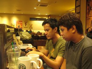
Pateros Mapping Party. seav and Ernest7 doing some editing after the field survey during the Pateros Mapping Party. | |
| Jun 12 | 
|
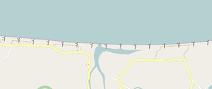
Bangui Windmills. The first of their kind in the Philippines, these windmills in Bangui were mapped using Bing's aerial imagery. | |
| Jun 5 | 
|
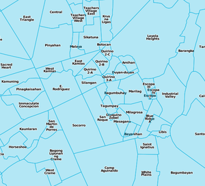
Barangay boundaries in Metro Manila. OpenStreetMap is not just about mapping streets and POIs but also about mapping other important geodata such as these boundaries of barangays in Metro Manila. | |
| May 29 | 
|
MapCraft pie for Marikina. MapCraft is a tool designed for coordinating mapping activities in a location, or can simply be used for tracking mapping progress. This image shows the MapCraft pie of Marikina, which is used by maning to track his progress of mapping the details in Marikina. | |
| Feb 20 | 
|
Before and after the QC Scout Area Mapping Party. This shows how Barangay Obrero (and surrounding areas) looked in OpenStreetMap just before the QC Scout Area Mapping Party and a week after. Buildings, landuses, and POIs were added and the road and footway network including names were corrected and updated. | |
| Feb 13 | 
|
QC Scout Area Mapping Party Group Photo. Attendees to the QC Scout Area Mapping Party pose for the camera during the afternoon meetup. | |
| Feb 6 | 
|
ADDU Mini-OSM Workshop. OSM mapper murlwe is explaining how to add and edit data in OpenStreetMap to students of the Ateneo de Davao University students during a mini-OSM workshop held in Davao City on January 29, 2011. | |
| Jan 23 | 
|
Gawad Kalinga Telus Village Mapping Party. Some researchers once went to the Philippines to map the Gawad Kalinga Baseco Village in Manila on OpenStreetMap. Last January 15, 2011, they returned and this time mapped the Gawad Kalinda Telus Village in Quezon City this time with local OpenStreetMappers. | |
| Jan 2 | 
|
Before and after the Intramuros Mapping Party. This shows how Intramuros looked in OpenStreetMap just before the Intramuros Mapping Party and two weeks after when most of the data had been entered. There's now a wealth of detail for this historic walled district but there's still plenty left to do! |
