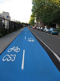
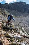
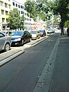
Key:class:bicycle
| Description |
|---|
| Subjective classification of desirable or undesirable bicycle routes |
| Group: bicycles |
| Used on these elements |
| Status: in use |
| Tools for this tag |
|
The key class:bicycle=* tag is used to classify routes suitable for the average cyclist during all-day journeys from point A to point B, mainly trips to destinations like school, shopping centers, or work.
Subclasses varies greatly depending on what type of bicycling is intended (touring, mountain biking, transportation etc) and the subjective opinion of the mapper who added the tag. Database users should not expect a particular class:bicycle=* value to have a consistent meaning.
Proposal
class:bicycle=* and related keys were proposed as an additional hint for bicycle routes which were not adequately described by "objective" tags -- where certain routes are highly desirable or undesirable for subjective reasons, for example: nice or ugly scenery, unfriendly dogs, hard to avoid pedestrians, dangerous traffic, bad visibility of cyclists behind parked cars, etc.
It should not be used where other attributes (e.g. highway=tertiary, lanes=2, oneway=yes, maxspeed=30, incline=45%) are considered adequate description.
There are various subclasses of class:bicycle to accommodate for various types of and needs of cyclists (such as touring, mtb, commute, roadcycling, trailer).
The value of the key expresses desirability/practicability for a particular class with values between -3 (least desirable) to 3 (highly desirable)
Not to be confused with the classification of bicycle facilities used in North American transportation planning: Class I (bike path, or separate facility), Class II (bike lane), Class III (bike route).
Usage
The main key is class:bicycle=* with values -3 to 3 (least desirable to most desirable). For the average cyclist during all-day journeys.
| Tag | Description | Examples | |
|---|---|---|---|
| Example Image | Example Description | ||
class:bicycle=-3
|
Avoid at all costs. | 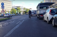
|
Example Mapillary: very heavy motor traffic and no separate cycle path: highway=trunk, lanes=4 |
class:bicycle=-2
|
Only use to reach your destination, not well suited. | 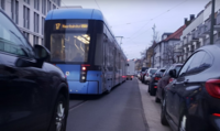
|
Example Mapillary: heavy motor traffic and no separate cycle path: highway=primary/secondary/tertiary and bicycle=yes or cycleway=shared_lane or cycleway=lane:advisory |
class:bicycle=-1
|
Better take another way | 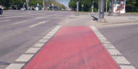
|
Example Mapillary: with heavy motor traffic and narrow cycle path: highway=primary/secondary/tertiary and bicycle=use_sidepath |
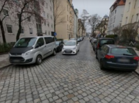
|
Example 2 Mapillary: with light motor traffic and uneven surface: highway=unclassified, residential, living_street, service and smoothness=intermediate/bad | ||
class:bicycle=1
|
Prefer | 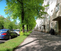
|
Example Mapillary: with heavy motor traffic and level cycle path behind trees: highway=primary/secondary/tertiary and bicycle=use_sidepath |
|
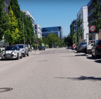
Example 2 Mapillary: with light motor traffic and level surface: highway=unclassified, residential, living_street, service and smoothness=excellent/good | ||
class:bicycle=2
|
Very Nice way to cycle | 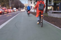
|
Example Mapillary: with heavy motor traffic and protected, wide, and level cycle path: highway=primary/secondary/tertiary and bicycle=use_sidepath and width > 2.20 m |
|
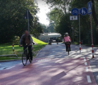
Example 2 Mapillary: with no motor traffic and wide, level cycle path: highway=path/track/cycleway and smoothness=excellent/good | ||
class:bicycle=3
|
This path is so beautiful, it's worth taking a detour. | 
|
Example Mapillary: with no motor traffic and very wide, level cycle path, beautiful view: highway=path/track/cycleway and smoothness=excellent, width=6 m |
Subclasses
Subkeys are used where significant differences between various types of bicycle usage exist and up or downhill.
Subkeys are mtb, commute, touring, roadcycling, trailer, non_experienced to be combined with downhill and uphill as necessary.
Example - class:bicycle:mtb:uphill=1.
Applies to any way or relation suitable for cycling (including mountain biking, road cycling, touring,....)
- class:bicycle=* - General key for average cycling
- class:bicycle:mtb=* - Cross country mountainbiking. To be used in addition to keys mtb:scale; mtb:scale:uphill. Typical bicycle: Hardtail or Fully Mountainbike with "fat" tires (>1.95")
- class:bicycle:mtb:technical=* - Technical mountainbiking, e.g.: allmountain, enduro or freeride use.
- class:bicycle:commute=* - Cycling as a means of transportation, getting quick from A to B on reasonably safe roads.
- class:bicycle:touring=* - Cycletouring and Trekking. Avoiding ugly and dull landscapes, avoiding cars. Typical bicycle: Trekking bike with medium width tires (1.3"-1.7").
- class:bicycle:roadcycling=* - Road cycling for Recreation/Sport. Typical bicycle: Racing bike with thin tires (<1.25")
- class:bicycle:trailer=* - towing a toddler/luggage trailer needs special planning of the route (usually width and surface and barries should be enough)
- class:bicycle:non_experienced=* - Sunday cyclist who is inexperienced; children and elderly
- class:bicycle:mtb=* - Cross country mountainbiking. To be used in addition to keys mtb:scale; mtb:scale:uphill. Typical bicycle: Hardtail or Fully Mountainbike with "fat" tires (>1.95")
E.g. a primary road inside the city with cycleway=lane with high motorist traffic allows a very quick mean of getting from A to B and there is no suitable alternative road nearby. For the "average" cyclist this way is only suitable to get from A to B. It is however not a way where any cyclist group loves to go along when cycling recreationally. We can put:
- class:bicycle:commute=1
Therefore we make clear that the way is suited for getting from A to B, but not a good choice for cycling in general. We do not need to put down: class:bicycle=-2 because it is better to the keys (if they don't exist yet, we should add them): oneway=yes; lanes=2: highway=primary; source:maxspeed=local already tell us that the way is not well suited for cycling.
Examples subclasses
Examples where no class:bicycle is needed
| Description | Why not needed? | Picture |
|---|---|---|
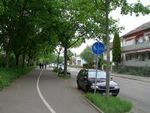
| highway=unclassified/tertiary & cycleway:left=track | Mapping park geometry to the side and tagging cycleway:left=track is sufficient to provide relevant info.
Note that some may consider such infrastructure as worse than no bicycle infrastructure at all, some consider it as highly desirable. Tagging what is actually there resolves this conflict. |
|
| highway=path & surface=ground & mtb:scale=0+ | This is a typical path like many others. Standard keys are enough for describing it. | 
|
| highway=trunk & lanes=2 & oneway=yes & bicycle=yes | The normal tags are enough to know that this street is not nice for the average cyclist. | 
|
| highway=path & mtb:scale=0 & sac_scale=hiking | Proposed to be tagged with class:bicycle:mtb=2 due to "Make it stick out from the rest of ways. Lovely scenery.". But one may tag and process tourism=viewpoint if taking that in consideration is wanted. | 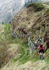 
|
Values
Values from -3 to +3 are frequently used. "-3" was defined as a "way is so unsuitable that it should be avoided at all cost", while "+3" was defined as "it is worth making a big detour for getting here":
- "-3" = Avoid at all costs.
- "-2" = Only use to reach your destination, not well suited.
- "-1" = Better take another way
- "0" = as well as other ways around.
- Try to avoid using 0 but decide on -1 or +1.
- "1" = Prefer
- "2" = Very Nice way to cycle
- "3" = This way is so nice, it pays out to make a detour also if this means taking
- many unsuitable ways to get here. Outstanding for its intended usage class.
General Factors to decide on a value for class:bicycle
Note that most of the criteria below are subjective: each bicycle rider or mapper may have different ideas of how many cars is too many, how many pedestrians is a problem, and if the scenery is pleasant or not. This means that different local mappers may not agree on the right value to use.
Traffic
- cars: how many cars are there? Is there enough space for them to safely pass or are dangerous situations common?
- pedestrians: how many pedestrians?. Is there a clear separation between cyclists and pedestrians, and if so, is that separation respected or are there families with children and dogs walking into your way forcing you to reduce speed and/or brake often.
- bicycle traffic: when you go out on your roadcycle to train, you don't want to have slow "weekend cyclists" in your way. Best are usually roads not cycleways.
Cycleway=cyclelane / cycletrack negative
In countries where the presence of a cycleways obliges you to use them: Can you go fast, or do you have to go slower than you could on the road. Is there increased danger because of cars not seeing you? Crossing Roads where car drivers will overlook you when using the cycletrack instead of the road? Parking Cars (cardrivers open the door without keeping care, cars often blocking the cycletrack/cyclelane)....
Scenery and Nature
Can you see the nice mountains around, or is endless forst blocking your view? Are there nice viewpoints on the way, Nice places to picknick alongside? On long ways outside of civilisation - is there supply to drinking water, either manmade or water from springs in the mountains?
See Also
class:bicycle was proposed as an additional factor. It is not supposed to replace common, more objective keys such as:
- highway=*
- surface=*
- tracktype=*
- smoothness=*
- mtb:scale=*, with variations
- access=*
- lanes=* - higher number of lanes could mean more traffic and dangerous crossings
- highway=traffic_signals - delays
- incline=*
- route=ferry
- route=bicycle and route=mtb
- lanes=*
- maxspeed=*
- shoulder=*
- sidewalk=*
- cycleway=*
Maps for GPS or Autorouting Programs using this key
- Openmtbmap Supported on streets (will need some more tweaking and extending)
- Velomap Implemented on all ways and streets.
- BRouter Implemented at level of script based custom routing profiles, like streetbike_touring profile.
- GraphHopper Implemented for all bike profiles - see GitHub PR #423.
- mtbmap.no Norwegian (only) Mountainbike Map
Comments
See discussion onthe talk page. Please copy and adapt class:key for other usages like horseriding or hiking, but open up new pages for this and link them back here so good ideas can be taken over.
- As someone who has worked on auto routing before, both with CycleStreets and CloudMade, I can tell you that you don't need this tag. You just need to be clever enough with all the other objective tags out there and you can get good routing, without this subjective tag. Smsm1 22:13, 9 November 2010 (UTC)
- Please see Routino, which already takes into account multiple lanes, bridges, tunnels, highway preferences and bicycle/walking routes. So its just a matter of figuring out the parameters that you prefer for your trip, which is also much more flexible then a single tag stating the preference of a single person. Dranuhl 31 December 2010
- Please don't use this tag. --Richard, cycle.travel.
- Please don't use this tag. This page really ought to be deleted. See comments here. --CycleStreets.
- Well it's 2022 now, so let's see, @Smsm1:, @Dranuhl:, @Richard:, @Cyclestreets: and @Mateusz Konieczny:: what are your alternatives? What specific tagging scheme would completely replace this subjective, but visibly useful-to-many-people tagging? Please use the talk page and be so kind to ping me back there. I am asking after realised that there is no way I could tell that a highway=unclassified is a bikers heaven or a suicide mission between rallye racers and trucks. As far as I know there is no tagging about the amount of traffic, and if there were it would be probably unmaintainable. There are no tagging for cycleway=lane which is not fitting for cycling, usually due to the amount of bike traffic plus its width. Many roads have no tagging to indicate it's great for bike-trekking, they look like all other highways. So I am really missing your suggestions from the comments above and would highly appreciative to see your offered equivalent. You might notice there that I wasn't a fan of this tagging, but haven't found any viable alternative in the last years. And now I would like to use somthing just like that. Thank you, --grin ✎ 20:30, 2 September 2022 (UTC)
- "I am asking after realised that there is no way I could tell that a highway=unclassified is a bikers heaven or a suicide mission between rallye racers and trucks" - can you list tag that you tried so far? Can you give examples of roads that fully tagged in OSM are still not distinguishable from each other, but have strong difference in cycling quality? (Google Maps links are fine) @Grin: Mateusz Konieczny (talk) 20:35, 2 September 2022 (UTC)
- Well it's 2022 now, so let's see, @Smsm1:, @Dranuhl:, @Richard:, @Cyclestreets: and @Mateusz Konieczny:: what are your alternatives? What specific tagging scheme would completely replace this subjective, but visibly useful-to-many-people tagging? Please use the talk page and be so kind to ping me back there. I am asking after realised that there is no way I could tell that a highway=unclassified is a bikers heaven or a suicide mission between rallye racers and trucks. As far as I know there is no tagging about the amount of traffic, and if there were it would be probably unmaintainable. There are no tagging for cycleway=lane which is not fitting for cycling, usually due to the amount of bike traffic plus its width. Many roads have no tagging to indicate it's great for bike-trekking, they look like all other highways. So I am really missing your suggestions from the comments above and would highly appreciative to see your offered equivalent. You might notice there that I wasn't a fan of this tagging, but haven't found any viable alternative in the last years. And now I would like to use somthing just like that. Thank you, --grin ✎ 20:30, 2 September 2022 (UTC)
History
Based on ideas brought forward Cycleworth and Talk:Cheltenham Standard
