Congo-Kinshasa/Conventions/Occupation du sol
La couverture du sol, ou occupation du sol, représente la composition du sol visible sur les images satellites, sans aucun rapport avec leur utilisation.
La couverture du sol peut être cartographiée comme :
- Polygone, s'il ne contient pas de classe de couverture du sol différente. La règle ici est 'Un item, un objet OSM'. De même, les polygones cartographiés en tant que couverture du sol ne doivent pas croiser ou chevaucher des polygones d'utilisation des sols.
- Relation multi-polygone, si elle a d'autres classes de couverture terrestre tombant complètement à l'intérieur du polygone extérieur. Dans ce cas, le polygone extérieur peut être composé de plusieurs lignes distinctes. La classe de la couverture terrestre extérieure est attribuée à la relation et non aux voies extérieures.
Les classes de couverture du sol les plus courantes dans cette zone sont les suivantes
Classification de la couverture du sol
Section en cours de traduction et mise à jours
| Tag (key, value) | Type | Description | Image satellitaire |
|---|---|---|---|
| natural=wood | Wood | Tree-covered area (a 'forest' or 'wood').
This area is not maintened with human intervention, differently from landuse=forest |
|
| natural=wetland | Wetland | A natural area subject to inundation or with waterlogged ground.
It can be further specified with wetland=* |
|
| natural=grassland | Grassland | Areas where the vegetation is dominated by grasses and other herbaceous (non-woody) plants, excluding cultivated areas and wetlands. | |
| natural=scrub | Scrub | Uncultivated land covered with shrubs, bushes or stunted trees. | |
| natural=bare_rock | Rock | An area with sparse or no vegetation, so that the bedrock becomes visible. | |
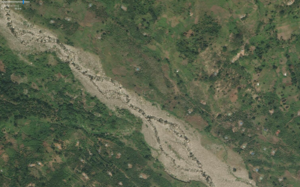
| natural=shingle | Shingle | Shingle is an accumulation of rounded rock fragments, usually pebbles and gravel, but sometimes larger, deposited and shaped by movement of water. It is used in two contexts: shingle beach and river shingle.
In contrast to natural=scree which results from rockfall and in-situ weathering shingle is produced by water transport. The water flow in a river or the waves at a coast transport and segregate rock fragments and deposit them according to water currents. It can be used together with waterway=riverbank, the two polygons should be overlaying or mapped with a double relation in such a way the two features are still overlaying. |
|
| natural=water | Natural water | Any body of water, from natural such as a lake or pond to artificial like moat or canal.
You can further the kind of water body with water=*, e.g. water=pond |
