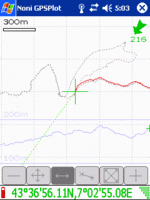
DE:Noni GPSPlot
Jump to navigation
Jump to search
| Noni GPSPlot für Windows Mobile | ||||||||||||||||||||||||||||||||||||||||||||||||||||||||||||||||||||||||||||||||||||||||||||||||||||||||
|---|---|---|---|---|---|---|---|---|---|---|---|---|---|---|---|---|---|---|---|---|---|---|---|---|---|---|---|---|---|---|---|---|---|---|---|---|---|---|---|---|---|---|---|---|---|---|---|---|---|---|---|---|---|---|---|---|---|---|---|---|---|---|---|---|---|---|---|---|---|---|---|---|---|---|---|---|---|---|---|---|---|---|---|---|---|---|---|---|---|---|---|---|---|---|---|---|---|---|---|---|---|---|---|---|
| Autor: | Anthony Eguerre | |||||||||||||||||||||||||||||||||||||||||||||||||||||||||||||||||||||||||||||||||||||||||||||||||||||||
| Lizenz: | free | |||||||||||||||||||||||||||||||||||||||||||||||||||||||||||||||||||||||||||||||||||||||||||||||||||||||
| Plattformen: | Windows Mobile 2003, Windows Mobile 5 und Windows Mobile 6 | |||||||||||||||||||||||||||||||||||||||||||||||||||||||||||||||||||||||||||||||||||||||||||||||||||||||
| Version: | 3.1.1 (2011-11-11) | |||||||||||||||||||||||||||||||||||||||||||||||||||||||||||||||||||||||||||||||||||||||||||||||||||||||
| Sprache: | Englisch
| |||||||||||||||||||||||||||||||||||||||||||||||||||||||||||||||||||||||||||||||||||||||||||||||||||||||
| Webseite: | http://aeguerre.free.fr/Public/PocketPC/NoniGPSPlot/EN/ | |||||||||||||||||||||||||||||||||||||||||||||||||||||||||||||||||||||||||||||||||||||||||||||||||||||||
| ||||||||||||||||||||||||||||||||||||||||||||||||||||||||||||||||||||||||||||||||||||||||||||||||||||||||
Mindestanforderungen
ARM oder XScale CPU, Windows Mobile Ver. 4.2 (2003) oder neuer, GPS w/ NMEA-output
Download
Hier können Sie das Programm finden: Download Noni GPSPlot
Guide
Installation
- Downloaden und Instalieren Sie die exe Setup Datei, oder kopieren die cab Date auf Ihr Windows Mobile Gerät und führen sie aus.
Einstellen
- Wenn Sie NoniGPSPlot auf Ihrem gerät gestartet haben, drücken und halten die Ihren Finger/Stift auf das Display um Menü zu öffnen.
- Drücken Sie 'advanced setup' dan 'GPS' und wählen Sie den COM Port Ihres GPS Empfänger aus, damit NoniGPSPlot sich mit ihm verbinden kann.
- Prüfen Sie die 'Satellites' vom Hauptmenü um zu sehen ob Ihr GPS korrekt arbeitet. Bei Bluetooth GPS Empfänger kann es sein das Ihnen keine Steleiten angezeigt wird. In der Kompasansicht werden Ihnen nun graue oder blaue Punkte angezeigt, wobei blau bedeutet das der GPS Empfänger mit dem Sateliten verbunden ist.
Tracking
- From the base menu, select 'quick setup' and make sure 'Track' is activated. If it is not, press it.
- Noni will start tracking your location automatically.
- If you want to clear your track so far, go to 'Track', 'Suppress' then 'Suppress all track'.
- If you want to add a waypoint, go to 'Point' then 'New'. You can set up a hardware button to do this.
- To save the track in GPX format, from the base menu go to 'Tools' then 'Export', selecting the format 'Format GPX'. If you have waypoints, tick the option to include them in the GPX file and they will show up in JOSM and Potlatch.
FAQ
How do I add Maps to Noni GPSPlot? Cimnine 14:49, 2 June 2008 (UTC)
- There also is a map-download-tool available: NoniMapView
- Also, if you have an internet connection, you can use the internet maps option in recent versions. Daveemtb 16:13, 12 May 2009 (UTC)
Alternativen
Original Beitrag von Ronrib
Übersetzt von --XPcRUSHER (talk) 20:13, 8 January 2015 (UTC)
