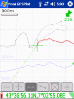
Noni GPSPlot
Jump to navigation
Jump to search
| Noni GPSPlot for Windows Mobile | ||||||||||||||||||||||||||||||||||||||||||||||||||||||||||||||||||||||||||||||||||||||||||||||||||||||||
|---|---|---|---|---|---|---|---|---|---|---|---|---|---|---|---|---|---|---|---|---|---|---|---|---|---|---|---|---|---|---|---|---|---|---|---|---|---|---|---|---|---|---|---|---|---|---|---|---|---|---|---|---|---|---|---|---|---|---|---|---|---|---|---|---|---|---|---|---|---|---|---|---|---|---|---|---|---|---|---|---|---|---|---|---|---|---|---|---|---|---|---|---|---|---|---|---|---|---|---|---|---|---|---|---|
| Author: | Anthony Eguerre | |||||||||||||||||||||||||||||||||||||||||||||||||||||||||||||||||||||||||||||||||||||||||||||||||||||||
| License: | Freeware (donors get extra features) | |||||||||||||||||||||||||||||||||||||||||||||||||||||||||||||||||||||||||||||||||||||||||||||||||||||||
| Platforms: | Windows Mobile 2003, Windows Mobile 5, and Windows Mobile 6 | |||||||||||||||||||||||||||||||||||||||||||||||||||||||||||||||||||||||||||||||||||||||||||||||||||||||
| Status: | Unmaintained | |||||||||||||||||||||||||||||||||||||||||||||||||||||||||||||||||||||||||||||||||||||||||||||||||||||||
| Version: | 3.1.1 (2011-11-11) | |||||||||||||||||||||||||||||||||||||||||||||||||||||||||||||||||||||||||||||||||||||||||||||||||||||||
| Language: | English
| |||||||||||||||||||||||||||||||||||||||||||||||||||||||||||||||||||||||||||||||||||||||||||||||||||||||
| Website: | http://aeguerre.free.fr/Public/PocketPC/NoniGPSPlot/EN/ | |||||||||||||||||||||||||||||||||||||||||||||||||||||||||||||||||||||||||||||||||||||||||||||||||||||||
| ||||||||||||||||||||||||||||||||||||||||||||||||||||||||||||||||||||||||||||||||||||||||||||||||||||||||
Requirements
ARM or XScale CPU, Windows Mobile Ver. 4.2 (2003) or better, GPS w/ NMEA-output. It will work on PocketPC's running Windows for PocketPC 2002 or 2003 (they usually have an ARM CPU) although you sometimes get a message saying it was not designed for that platform, it still works though.
Download
You can find the program here: Download Noni GPSPlot
Guide
Installation
- Download and install the exe setup file, or copy the cab file to your windows mobile device and run it there.
Set up
- When Noni GPSPlot is running on your device, press and hold the middle of the screen to bring up the menu.
- Push 'advanced setup' then 'gps' and select the comport your GPS is connected to.
- Check 'Satellites' from the base menu to see if your GPS is functioning correctly. You should see grey or blue dots above the compass. Blue means locked on.
Tracking
- From the base menu, select 'quick setup' and make sure 'Track' is activated. If it is not, press it.
- Noni will start tracking your location automatically.
- If you want to clear your track so far, go to 'Track', 'Suppress' then 'Suppress all track'.
- If you want to add a waypoint, go to 'Point' then 'New'. You can set up a hardware button to do this.
- To save the track in GPX format, from the base menu go to 'Tools' then 'Export', selecting the format 'Format GPX'. If you have waypoints, tick the option to include them in the GPX file and they will show up in JOSM and Potlatch.
FAQ
How do I add Maps to Noni GPSPlot? Cimnine 14:49, 2 June 2008 (UTC)
- There also is a map-download-tool available: NoniMapView
- Also, if you have an internet connection, you can use the internet maps option in recent versions. Daveemtb 16:13, 12 May 2009 (UTC)
