East Africa Tagging Guidelines
East Africa at least comprises the countries Kenya, Tanzania, Uganda, Rwanda, Burundi, and South Sudan. As individual tagging guidelines exist for none of those countries, this document attempts to offer a guide that will be valid in most of them. Should you have more detailed information do not hesitate to include them or even to create individual guidelines per country.
Roads in East Africa
African roads can be difficult to categorize as sometimes through roads of major importance can be in very poor condition. At the same time, you may find narrow roads in residential neighbourhoods that are perfectly smooth and freshly tarmaced. As a general guideline, consider the importance of a particular road in the country's transport infrastructure. Especially in Africa the social and economic importance of a road should outweigh its condition when assessing the appropriate category. For additional information please refer to the Highway Tag Africa wiki.
Road classification
| Description | Tag | Classification in Kenya | Classification in Uganda | Comment | Urban example | Rural Example |
|---|---|---|---|---|---|---|
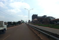
| Motorway | highway=motorway and highway=motorway_link | A restricted access major divided highway, normally with 2 or more running lanes plus emergency hard shoulder. Equivalent to the Freeway, Autobahn, etc. Highways of this type are increasingly being constructed in East Africa. | ||||
| Multiple lane roads | highway=trunk and highway=trunk_link | International Trunk Roads (A) | National Roads | A main road with a motorway-like layout with multiple lanes which is restricted to motorised vehicles. Unlike motorways, trunk roads might have crossings or traffic lights. Their surface is always tarmaced. Please note: In Kenya, despite the official designation International Trunk Roads, most of type A roads are not trunks as defined by OSM. The vast majority of Kenyan A roads must fall into the category highway=primary. | ||
| National roads | highway=primary | International Trunk Roads (A) and National Roads (B) | National Roads | National roads connect the most important cities/towns in a country. In most countries, these roads will usually be tarmaced and show centre markings. (In South Sudan, however, primary roads might also be unpaved.) | ||
| Regional roads | highway=secondary | Primary Roads (C) | District Roads | They are the second most important roads in a country's transport system. Major transportation routes connecting cities and large towns. Might be tarmaced in some countries, but many times they are not. | ||
| Local roads | highway=tertiary | Secondary Roads (D) | Urban Roads | These are busy through roads that link smaller towns and larger villages. More often than not, these roads will be unpaved. However, this tag should be used only on roads wide enough to allow two cars to pass safely. | ||
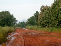
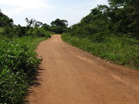
| Other roads | highway=unclassified | Minor Roads (E) | Community roads | Minor collector roads that link settlements. These roads are usually unpaved and are only wide enough for one vehicle. This tag is primarily used in rural areas and outside of inhabited places, though unclassified roads can be used to link suburbs in a city or town. | ||
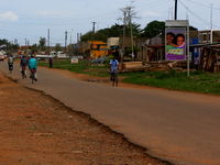
| Residential roads | highway=residential | Roads lined with housing. This tag is used only in urban or village areas and only on roads which do not serve a through connection function. | ||||
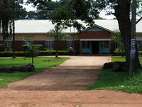
| Service roads | highway=service | This tag is used for driveways, carpark entrance roads, private roads, etc (most often in urban areas, but may exist in rural areas too, such as driveways to gas stations or service roads in mining sites, industrial compounds, or waste recycling sites). Please remember to add access=* and service=* where applicable | ||||
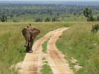
| Track | highway=track | This tag is usually used for roads providing access to agricultural or forestry facilities. In Africa, roads within National Parks mostly qualify as tracks too. If possible, please use also in conjunction with tracktype=*. Never use track to mark an unpaved or unsealed road in built-up areas. Such roads should be tagged according to the local conventions (usually highway=residential) and complemented by surface=*. | ||||
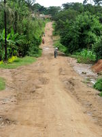
| Path | highway=path | Paths are usually impassable for motorised vehicles. (However, African motorcyclists can sometimes do the most improbable stunts.) In order to mark a path as appropriate for cycling, add bicycle=yes. Never use path to mark an unpaved or unsealed road in built-up residential areas: Such roads should be tagged according to the local conventions (usually highway=residential if passable by vehicles and pedestrians, or highway=footway for pedestrian only where they can sometimes be separated from another parallel highway for vehicles) and complemented by surface=*. | ||||
| Private roads | highway=* access=private | For roads with no public access choose the appropriate category and add access=private. Most private roads are service roads (notably driveways to residences or farms, or carriage ways in mining sites, or service ways in closed industrial or military sites) that may exist in both rural or urban areas (private roads in urban residential areas are usually much shorter than those in industrial sites). |
Road names
Where roads in East Africa have an officially assigned name, this should of course be tagged using name=*. Many roads, however, are only known by a popular inofficial name. These commonly used names have the problem that the way they are used may change from one person to another or from one village to the next.
A good example within Uganda would be the primary road from Kampala to Gulu. In towns along this road, naming changes with a person's perspective. When oriented southward, the road will in most cases be called Kampala Road. If, however, a person's direction of travel is northward he will describe the same road as Gulu Road.
Therefore, it is considered good custom to name the major overland routes by their starting / end point; in this case Gulu - Kampala - Road. In doing so, the road name will allow for navigation in both directions.
Having said that, mappers should also make sure that a road does not change its names in very short intervals. Try, therefore, to identify the biggest and most important places a road links together and use only those for naming.
When using the name=* tag make sure you always type the full name. You should never use an abbreviation on names (i.e. Jinja Road, not Jinja Rd). Please also note that in the English language all parts of a name begin with a capital letter but are not spelled in capital letters only (i.e. David Mulindwa Road, not David mulindwa road or DAVID MULINDWA ROAD).
Road numbers
The ref=* tag should only be used on roads which are signposted with an official number (like A104 in Kenya and Uganda). Please make sure you never use name=* for official road numbers.
Road surfaces
As has been said earlier, a road's surface condition does not necessarily reveal its importance in the country's transport system. Therefore, in addition to choosing the appropriate category, it is recommended to use surface=* to indicate the physical condition of the road.
Generically, a sealed surface is indicated by surface=paved while unsealed roads can be tagged with surface=unpaved.
Where this information is available, it is, however, advisable to be more specific on the material of the road surface (i.e. surface=asphalt and surface=concrete on paved or surface=ground and surface=dirt on unpaved roads).
In an African context, the surface tag should be used as often as possible. Where potholes represent more than 50% of the surface, the road should be considered as unpaved. highway=track are supposed to be unpaved by default.
Public transport
East-African public transport typically relies on three different types of motorised vehicles: motorcycles (Boda-Bodas) for short-range, minibuses (Matatus or Dala Dalas) for mid-range coverage, and coaches for long-distance journeys.
Boda-Bodas serve the same purpose as motorcar taxis in Western countries. They operate as short-time hires for individual transport. Stages where motorcycle taxis wait for customers should therefore be tagged as amenity=taxi. Please consider adding motorcycle=yes and motorcar=no appropriately.
Minibuses are often referred to as taxis in East-African English. However, their mode of operation much rather resembles bus lines in the West. As opposed to individual transport, buses usually serve predefined routes at regular intervals with the opportunity for travellers to jump on and off at any stop. This is exactly how minibus taxis in East Africa operate. Therefore, minibus stations should be tagged as amenity=bus_station (or with the new public_transport=station respectively). An additional name=XYZ Taxi Park should be added to include the locally used designation.
Coaches, as the third element in African public transport infrastructure, cover long distances and might even offer cross-border transport. Their points of departure / arrival should similarly be tagged as amenity=bus_station (or with the new public_transport=station). Where possible add the name of the coach line operator using operator=*.
Water wells / Boreholes
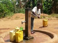
In East Africa, the majority of people fetch their daily water supplies from public water wells or boreholes. These are usually fitted with manually operated pumps. To include them in OpenStreetMap, use man_made=water_well in addition with pump=manual.
If known, please also add drinking_water=*.
As water boreholes play an important role in African public infrastructure, it is highly recommended to map as many of them as possible. This might turn out to be useful information, particularly in possible future crises.
Unless a water well is also a widely known landmark, refrain from tagging every borehole with name=* as this will unnecessarily clutter up the map.
