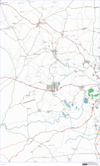
East Cotswolds
| V・T・E |
| latitude: 51.84, longitude: -1.49 |
| Browse map of East Cotswolds 51°50′24.00″ N, 1°29′24.00″ W |
| Edit map |

|
|
External links:
|
| Use this template for your locality |
East Cotswolds is an area in South West England at latitude 51°50′24.00″ North, longitude 1°29′24.00″ West.
Description
The Cotswolds lie mainly within rolling countryside Gloucestershire and Oxfordshire, but extend also into parts of Wiltshire, Somerset, Worcestershire and Warwickshire. It stretchies from Oxford in the east, Evesham in the North, Cheltenham in the West and Cirencester to the South. For the east of the cotswolds, we get everything from about Swindon east. It covers the towns of Witney, Chipping Norton, Farringdon, Burford, Eynsham etc.
READ THIS FIRST
OS StreetView. Please check with active local mappers before adding or amending data from OS StreetView. This area can be completed through ground-truth surveys and infilling areas with StreetView acts as a significant disincentive to doing such mapping. In particular DO NOT AMEND existing map data which has been acquired on the ground WITHOUT contacting the person who did the mapping. IF YOU DO NOT CONTACT EXISTING MAPPERS, THERE IS A RISK THAT YOUR CONTRIBUTION MIGHT BE REVERTED.
Who's Mapping
- Nick (Gagravarr) - things around Charlbury, and back towards Oxford
- Davidsheldon - things around Charlbury, and back towards Oxford
- Richard and Anna - Charlbury (again!) and roads throughout the area
- James Wheare - Charlbury based and working with bus routes in Oxford
- Paul Cunningham - Ascott-under-Wychwood
- User:messpert - Witney and surrounding villages
Mailing list: talk-gb-oxoncotswolds.
OSM Coverage
Most of the main A roads are done. Many B roads are done, but need tagging. Coverage of the towns and villages is quite variable.
Weekly snapshots of the progress are available from http://gagravarr.org/misc/osm/ (you want the Charlbury images)
Towns
| Town Name | Tracks | Mapped | Labelled | Notes |
|---|---|---|---|---|
| Burford | 40% | 40% | 25% | |
| Charlbury | 95% | 95% | 95% | Just missing a few footpaths and the private residential streets. |
| Chipping Norton | 95% | 95% | 95% | West End (out on the Worcester Road) and associated industrial estates not done. |
| Farringdon | 10% | 10% | 10% | Just a few bits to the west of the town done |
| Stow-on-the-Wold | 60% | 60% | 60% | Estate south of Sheep Street, and Shepherds Way area, still to do. |
| Witney | 99% | 99% | 99% | Mostly done. Rivers need more work. |
| Woodstock | 95% | 95% | 95% | Just footpaths out of town and within Blenheim Park remaining |
Villages
| Village Name | Tracks | Mapped | Labelled | Notes |
|---|---|---|---|---|
| Chadlington | 100% | 100% | 100% | |
| Leafield | 100% | 100% | 100% |