Ecuador/2016 Earthquake Tags
< Ecuador
Jump to navigation
Jump to search
This page describes a historic artifact in the history of OpenStreetMap. It does not reflect the current situation, but instead documents the historical concepts, issues, or ideas.
This page [1] lists the tags to be used during post-event data cleanup work for the 2016 Ecuador earthquake
The Secretaría Nacional de Riesgos (agency in charge of the relief effort) are very interested in our work, and identify the following priorities:
- Damage assessment in rural areas based on post-event imagery
- Integration of valuable on-the-ground field data into the existing data
- Identifying other sets of official data to import into OSM
General damage tag
| Tag | Value | Descripción | Foto |
|---|---|---|---|
damage:event
|
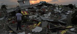
2016EcuadorEarthquake | Add this tag to any kind of object where we see damage specifically caused by the 2016 Ecuador earthquake | 
|
Evaluation of road damage
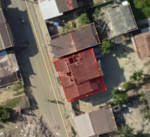
Please use these tags only if you are sure and observe clear evidence damage on the road or bridge in the aerial imagery [2].
| Tag | Value | Descripción | Foto |
|---|---|---|---|
status
|
impassable | For an impassible road, due to rubble/debris. Cut the way of the road/track into a short way covering the distance of the blockage. On this section, remove the highway tag, and add this status=impassible tag. |
Evaluation of building damage
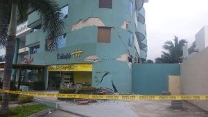
This documentation is subject to change. See also google doc for brainstorming.
Temporary shelters
| Tag | Value | Descripción | Foto |
|---|---|---|---|
tourism
|
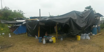
camp_site | Add this tag on a node at the centre of the camp grounds/shelter. (Obviously tourism is a strange key, but this is a campsite of sorts) NOTE: THIS IS BAD TAGGING. SEE Mistagging for the renderer and look at updated tagging guidelines. | |
damage:event
|
2016EcuadorEarthquake | Tag for the event which caused the damage | |
idp:camp_site
|
organized_camp[3] | Camps built by a formal organization with an organized spatial layout which may include food distribution points, water points and toilets. | |
idp:camp_site
|
spontaneous_camp | Camp sites or individual shelters built by groups, families or independent individuals, without planning or uniformity in construction. |
- ↑ Referencias: Humanitarian OSM Tags/Humanitarian Data Background
- ↑ Relacionar estudios sobre la limitada capacidad de las imágenes aéreas para realizar una precisa teledetección, observado dentro de las comunidades de información goegráfica voluntaria
- ↑ Daniel Orellana: @Humberto_Yances organized_camp vs organized_campsite: El primero parece ser el recomendado en varios documentos


