FOSSGIS/Server/Projects/Street Parking
Project Name
Street Parking
Main Contact
Kay D My name is Kay Drangmeister, living in Würzburg, Germany.
Other people involved
Some other people in Würzburg are helping entering data and advising the progress of the project.
Short description of your project
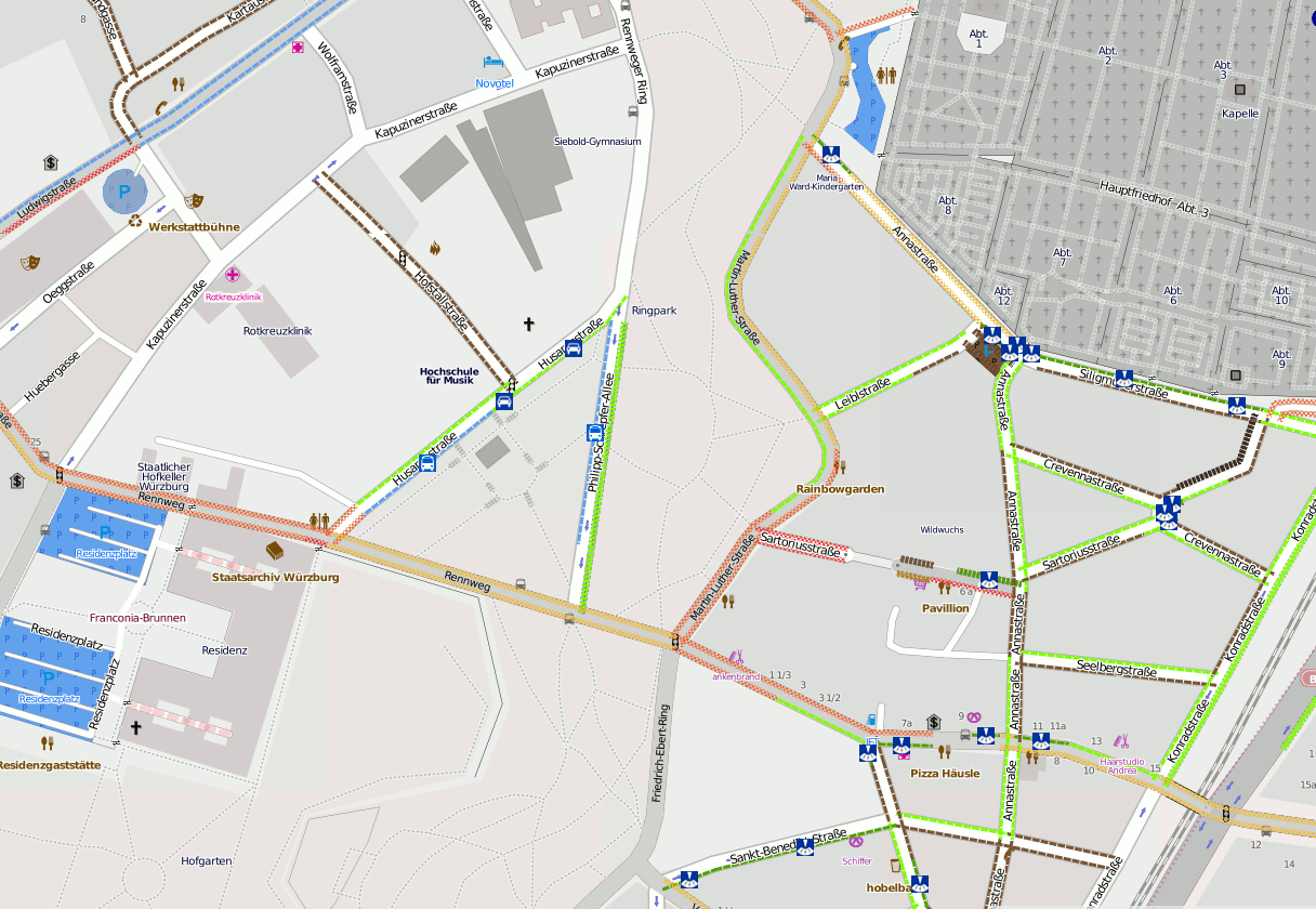
While parking areas are commonly entered into the OSM database, for most people, on-street parking (or lane parking) is also an important aspect of visiting a place, obviously needed most in larger cities. This project introduces a naming scheme for entering parking places as well as conditions (free, disc parking, residents only, ...), and it offers a rendered layer (currently mapnik) for visualizing the places.
E.g. a street where you can park free(ly) on the left side and are not allowed to park on the right side will be coloured with a green strip left and red strip right. (Of course it is more sophisticated, but it will do as an example.)
Preview
In my user area User:Kay_D/parking there is a description of the tagging, plus sample renderings. I run a mapnik and TileCache server on my home PC, please ask me for a link, as I have limited bandwith and computer resources.
A screenshot can be found here:
Why is this project interesting to the OSM community?
OSM is very much about public and private transportation, there are public transport maps, and route planning tools exist for travelling in a car. With a coloured layer showing parking opportunities, planning a trip can be greatly improved.
Moreover, people could use such a map to estimate local traffic when planning to move into a new town or buying a house.
What special software will you need?
OSM exports, postgresql, PostGIS, Mapnik, TileCache (or similar)
What resources will you need?
I cannot tell. It depends on what area is covered. It will be a typical add a functional layer application. I plan to deliver more than one layer, possibly 4 or so, in the future.
Where is your source code?
Source code is still evolving, most things are standard, so shell scripts do most of the work. Code is to be open source (of course) and hosted on a suitable platform (sourceforge, google code, or similar). Suggestions welcome.
What data do you need?
For a start (until the tagging scheme is verified to be used internationally, and established and stable) only some countries (Germany, UK, ...) with the most active editors may be used. In the mid-term, I plan to render layers worldwide, though.
The data should be imported into PSQL/PostGIS on a daily basis if possible, to encourace editors to try out the new parking scheme. It would be discouraging to have to wait for days to see the fruits of one's work.
The imported data is basically the data imported for mapnik rendering, plus some extra tags.
Related Projects
The technical implementation of the project was very much inspired by the "lit" map (light map) which can be seen here here when you activate the "by night" layer. (Maybe the same database (if it can be slightly extended) can be used.)
Status/State
new
