Go Map!!/Settings and Miscellaneous
This page describes settings and miscellaneous things on configuring the app.
Settings and Miscellaneous
The settings button and MapLayers button each allows you to configure various aspects of Go Map!!.
 Settings
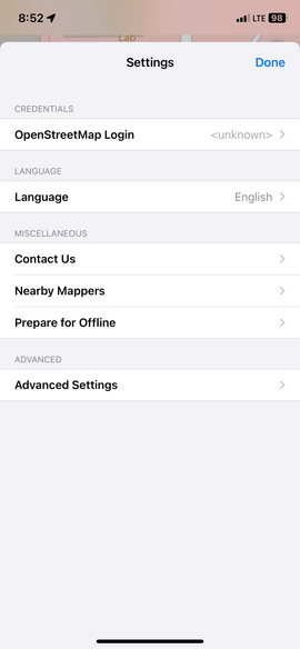
Settings:
OpenStreetMap Login (necessary to upload edits)
Use the OpenStreetMap Login — option to either:
- register with OpenStreetMap or
- enter your existing login credentials information.
Languages
This changes the preset languages and information from this wiki about tags.
Contact Us
Has contact information about the app.
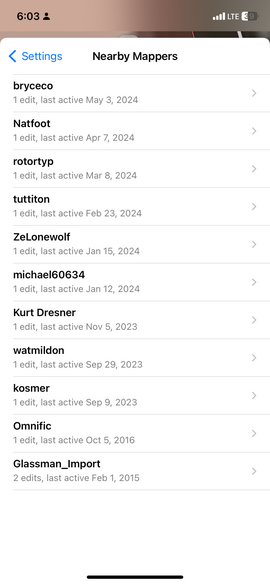
Nearby Mappers
The "Nearby Mappers" option shows everyone that has edited the area in your current view. Zoom in to see fewer people or zoom out to see more.
Prepare for Offline
Downloads selected aerial imagery and/or basemap tiles for offline use if you expect to be mapping an area without cellular connectivity.
(Alternately you can simply scroll around the area you plan to be visiting: all Bing, Mapnik, and OpenStreetMap data is cached and will be available even if you have no connectivity.)
Once you are back to civilization simply upload as usual.
Advanced
- Openstreetmap Server
- Allows you to change the server you’re editing to other servers. You can input your own link or select the drop down button to select OpenStreetMap, OSM Dev Server, OpenHistoricalMap, and OpenGeofiction.
- Show FPS
- Will move the map to an area filled with elements and show your fps.
- Maximize FPS
- Will let you go over 60 fps.
- Show Touches
- Will show a finger on where you touch.

