IT:Featured images/Jan-Mar 2013
Jump to navigation
Jump to search
Queste sono immagini degne di nota che sono state segnalate come i migliori esempi di mappatura in OpenStreetMap o come utile dimostrazione del progetto OpenStreetMap.
Se conosci un'altra immagine di qualità, la puoi nominare in Proposte di immagini di qualità (en).
| ← da gennaio a marzo 2012 | ← da ottobre a dicembre 2012 | da aprile a giugno 2013 → | da gennaio a marzo 2014 → |
Galleria di immagini notevoli, da gennaio a marzo 2013
Dettagli e didascalie
Settimana 1 (da lunedì 31 dicembre 2012 a domenica 6 gennaio 2013) [Edit]
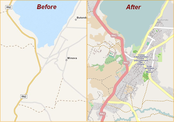
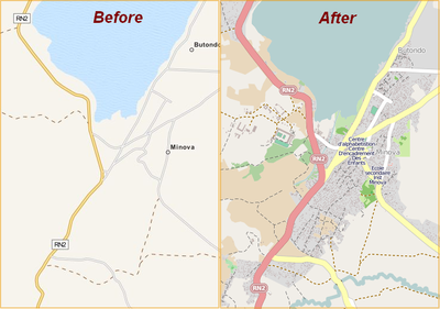
- English : Minova and Bweremana in DRC were mapped in a few days. This and other humanitarian mapping are being coordinated using the OSM Tasking Manager.
- italiano : Minova e Bweremana in Repubblica Democratica del Congo sono state mappate in pochi giorni. Questa e altre mappature a fini umanitari sono coordinate usando OSM Tasking Manager.
Settimana 2 (da lunedì 7 gennaio 2013 a domenica 13 gennaio 2013) [Edit]
- English : Frame from the video "Year of edits 2012". This year's video features yellow and green effects for the redaction bot processing, and license changeover.
- italiano : Un fotogramma del video "Year of edits 2012". Il video di quest'anno mostra effetti in giallo e in verde per il passaggio del Redaction Bot e il cambio di licenza.
Settimana 3 (da lunedì 14 gennaio 2013 a domenica 20 gennaio 2013) [Edit]
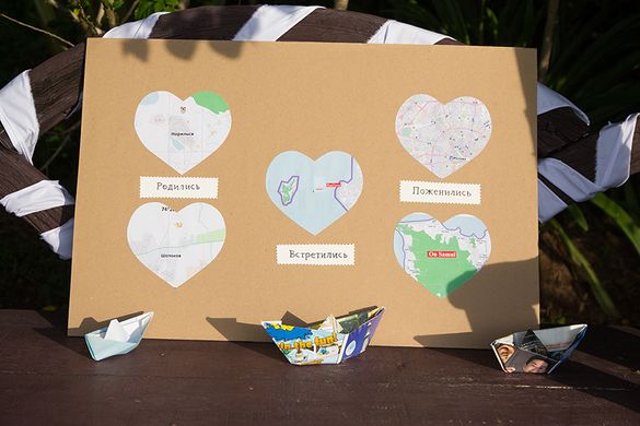
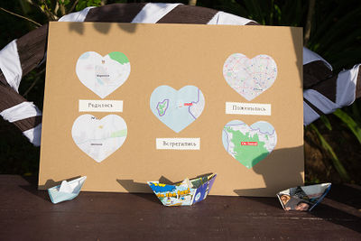
- English : OpenStreetMap wedding decorations! At the wedding of User:Vlish he featured this poster showing where he and his wife were born, where they met, and where they married.
- italiano : Addobbi matrimoniali di OpenStreetMap! Al proprio matrimonio, User:Vlish ha portato questo poster che mostra dove lui e sua moglie sono nati, dove si sono incontrati e dove si sono sposati.
Settimana 4 (da lunedì 21 gennaio 2013 a domenica 27 gennaio 2013) [Edit]
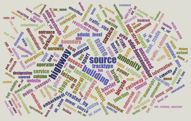
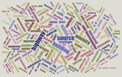
- English : Taginfo shows what tags are used in the OSM database.
- italiano : Taginfo mostra quali etichette (tag) sono usate nel database di OSM.
Settimana 5 (da lunedì 28 gennaio 2013 a domenica 3 febbraio 2013) [Edit]
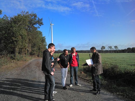
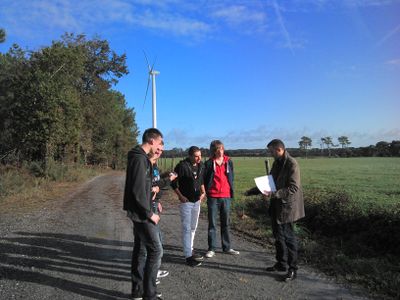
- English : French mapping company GéoBretagne use OpenStreetMap and are working with high schools to contribute data to the project. Here we see teachers and students mapping the exact coordinates of Lauzach wind turbines and their access roads.
- italiano : L'azienda francese GéoBretagne, che si occupa di mappe, usa OpenStreetMap e lavora con le scuole superiori per aggiungere dati al progetto. Qui si possono vedere insegnati e studenti che mappano le coordinate esatte di alcune pale eoliche a Lauzach e le loro strade di accesso.
Settimana 6 (da lunedì 4 febbraio 2013 a domenica 10 febbraio 2013) [Edit]
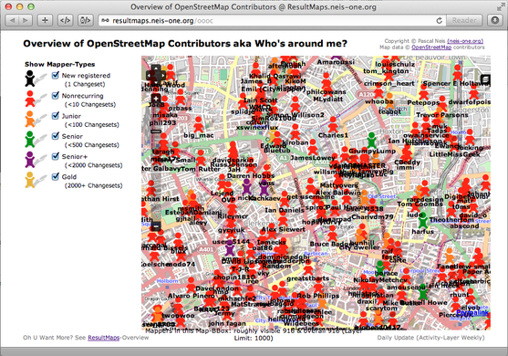
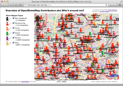
- English : The Overview of OpenStreetMap Contributors map by Pascal Neis is a great new way to discover active contributors in an area.
- italiano : La panoramica della mappa dei contributori di OpenStreetMap di Pascal Neis è un fantastico nuovo modo per scoprire mappatori attivi in un'area.
Settimana 7 (da lunedì 11 febbraio 2013 a domenica 17 febbraio 2013) [Edit]
- English : Life Long Learning Mapping Project : Şeyma, Kader, Neslihan,(teachers: Manfred, Miray) Simge, Özge, Our project aims to tackle the issue of gender-stereotyping. Students from Karacabey, Turkey, learning how to use a tracking device (Garmin) to improve OSM in Turkey.
- italiano : Life Long Learning Mapping Project : Şeyma, Kader, Neslihan,(insegnanti: Manfred, Miray) Simge, Özge. Il nostro progetto si propone di affrontare il problema degli stereotipi di genere. Studentesse di Karacabey, Turchia, imparano ad usare un dispositivo di tracciamento (Garmin) per migliorare OSM in Turchia.
Settimana 8 (da lunedì 18 febbraio 2013 a domenica 24 febbraio 2013) [Edit]
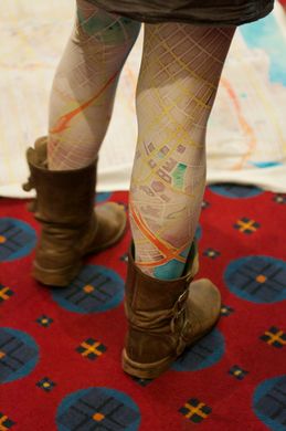
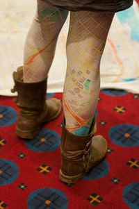
- English : OpenStreetMap leggings. A prototype on show at State Of The Map U.S. 2012 of a new product from softcities.net
- italiano : Leggings di OpenStreetMap. Un prototipo di un nuovo prodotto di softcities.net mostrato allo State Of The Map U.S. 2012
Settimana 9 (da lunedì 25 febbraio 2013 a domenica 3 marzo 2013) [Edit]
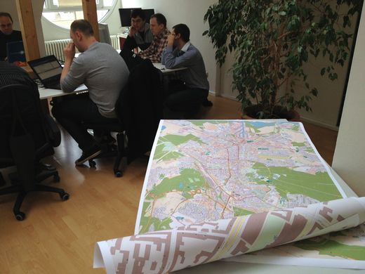
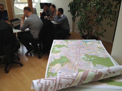
- English : A stack of prints at the Karlsruhe Hack Weekend in February 2013, where 18 mappers from all over Europe spent two days at the Geofabrik office, working together on OpenStreetMap projects.
- italiano : Una serie di stampe al Karlsruhe Hack Weekend nel febbraio 2013, dove 18 mappatori da tutta Europa hanno trascorso due giorni negli uffici di Geofabrik lavorando insieme a progetti su OpenStreetMap.
Settimana 10 (da lunedì 4 marzo 2013 a domenica 10 marzo 2013) [Edit]
- English : Map showing distance from parks in Glasgow, using openstreetmap data and GRASS/QGIS network analysis. Dark red means further away from a park.
- italiano : Una mappa che mostra la distanza dai parchi di Glasgow usando i dati di OpenStreetMap e l'analisi delle reti di GRASS/QGIS. Il rosso più scuro indica una maggiore distanza dai parchi.
Settimana 11 (da lunedì 11 marzo 2013 a domenica 17 marzo 2013) [Edit]
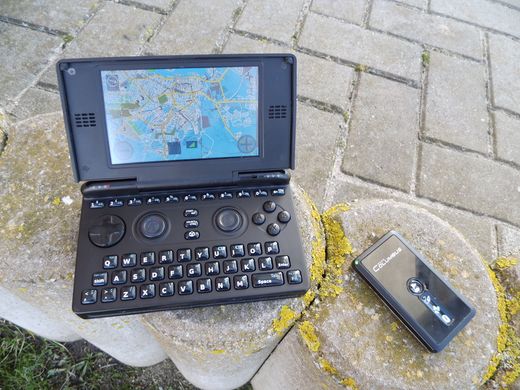
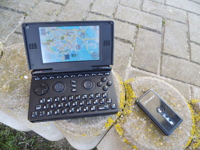
- English : OpenStreetMap with Navit running on the OpenPandora gaming handheld. Open everything!
- italiano : OpenStreetMap con Navit sulla consolle da gioco OpenPandora. Tutto aperto!
Settimana 12 (da lunedì 18 marzo 2013 a domenica 24 marzo 2013) [Edit]
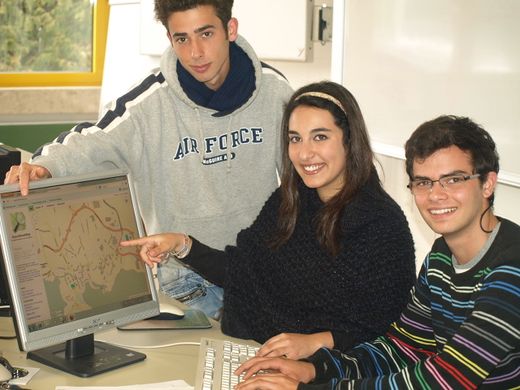
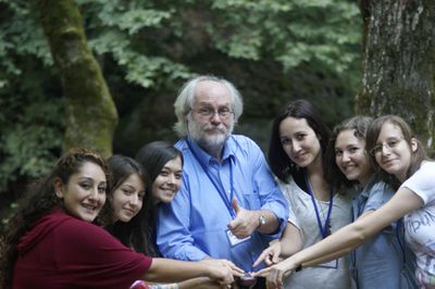
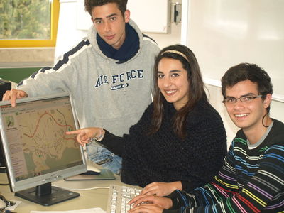
- English : Students from Azores Islands, Portugal, visiting Germany on a training course in JOSM and QA Editor as part of the Life Long Learning Mapping Project
- italiano : Studenti delle Isole Azzore, Portogallo, in visita in Germania per un corso di formazione su JOSM e QA Editor nell'ambito del Life Long Learning Mapping Project.
Settimana 13 (da lunedì 25 marzo 2013 a domenica 31 marzo 2013) [Edit]
- English : This curious map of the world, shows the result of dividing the OpenStreetMap dataset into quarters until each of these vector tiles is less than 32MB in size. An experiment by Eric Fischer (details)
- italiano : Questa curiosa mappa del mondo mostra il risultato della suddivisione del dataset di OpenStreetMap in quarti finché ciascuna vector tile ha una dimensione minore di 32MB. Un esperimento di Eric Fischer (dettagli in inglese)

