Symbian
(Redirected from IT:Symbian)
Jump to navigation
Jump to search
Symbian is a operating-system developed by Nokia. The operating-system can be found on many cellphones by different producer e.g. Samsung.
Software
All Symbian phones are able to run J2ME Software, too.
General information
| Name | Screenshot | Display map | Navigate | Make track | Monitor | License | Price | Languages | Version | Description |
|---|---|---|---|---|---|---|---|---|---|---|
| AFTrack GPS-Tracking [1] | 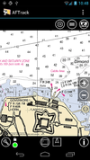
|
yes | yes | yes | yes | nonfreeproprietary | nonfree3.90€;4.95$;free | EN; DE; IT | 2014-08-02 1.6.4 |
Offline navigation with many map formats - BSB3 (*.kap), NV-digital (*.eap), Bitmaps with calibration file (format: map, gmi, kml, kal, cal, pwm), OSZ (zipped osm tile collection), mbtiles, sqlitedb, Mapsforge vector format and online maps |
| Endomondo [2] | 
|
yes | no | no | no | nonfreeProprietary | free | ?
|
?
|
An app for recording and logging workouts. It also allows seeing the position on an OSM map. |
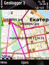
| GeoLogger [http:// |
|
yes | yes | yes | yes | nonfreeproprietary | free | EN,RUS | 2010-10-28 1.0 |
Tracks, geophoto and navigation. Currently offline! |
| HotSpot Navigator [3] | 
|
yes | yes | yes | no | nonfreeproprietary | nonfree15$ | EN | 2011-04-25 0.5.2 |
FON Wi-Fi Spots over OSM tiles |
| Loadstone GPS [4] | no | no | yes | no | GPL | free | many | 2010-05-25 0.74 |
for the blind | |
| Location Tagger [5] | 
|
no | no | yes | no | nonfreeproprietary | free | EN | 2010-05-21 1.0 |
Writes without interaction the location in a Photo. |
| MoNav [6] | 
|
yes | yes | yes | no | GPL | free | EN | 2011-04-23 0.3 |
Contraction Hierarchies routing, custom speed profiles, extremely fast and resource conservative routing, can handle huge graphs like Europe on mobile devices. Only source code available for download - has to be compiled by yourself! |
| Navitel [7] | 
|
yes | yes | yes | no | nonfreeproprietary | nonfree17€ | EN; RU | 2011-06-10 5.0.0.1620 |
Popular in Russia |
| PathAway GPS [8] | 
|
yes | yes | yes | yes | nonfreeproprietary | nonfree60-95$ | EN; DE | 2009-10-01 5.0 |
Deals with a lot of geo datums |
| S60Maps | 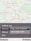
|
yes | no | no | no | GPL | free | EN; RU; HE; UK; ES; PT; GL; PL | 2021-12-30 1.7 |
Shows your location on map. |
| Sports Tracker [9] | yes | no | yes | yes | nonfreeproprietary | free | EN; DE; IT; ES | 2011-04-27 4.16 |
For sportsmen even with heartrate | |
| Vectorial Map [10] | 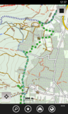
|
yes | no | yes | no | nonfreeproprietary | nonfreedepends on platform | EN | 2014-03-15 1.0 |
Vectorial Map is map viewer and track logger for Mapsforge offline vector maps (*.map) with support for custom XML styles like provided by OpenAndroMaps.org. It is based on a platform independent custom render engine. |
| ViewRanger GPS [11] | yes | ?
|
yes | ?
|
nonfreeproprietary | nonfreefree (purchases available) | EN,DE | 2011-04-14 ?
|
proprietary outdoors-oriented map app for mobile phones, OSM & cycle & piste maps | |
| WhereAmI [12] | 
|
yes | no | yes | yes | GPL | free | EN | 2009-08-26 0.14a |
Postcodes and GSM CellID support |
| YourPocketMap [13] | 
|
yes | no | no | yes | nonfreeproprietary | free | EN | 2010-11-11 0.1.3 |
This page describes a historic artifact in the history of OpenStreetMap. It does not reflect the current situation, but instead documents the historical concepts, issues, or ideas.
This table in the past was generated automatically by a bot. Learn more.
Map display features
| Name | Shows map as vector | Shows map as bitmap | Stores map-data on-board | Stores map-data off-board (downloads from internet) | Rotate map | 3D view |
|---|---|---|---|---|---|---|
| AFTrack GPS-Tracking | no | yes | yes | yes | yes | no |
| Endomondo | ?
|
?
|
no | yes | ?
|
no |
| GeoLogger | no | yes | no | yes | yes | no |
| HotSpot Navigator | no | yes | yes | yes | no | no |
| MoNav | no | yes | yes | yes | yes | no |
| Navitel | yes | no | yes | no | yes | yes |
| PathAway GPS | yes | yes | yes | yes | yes | no |
| S60Maps | no | yes | yes (cache) | yes | no | no |
| Sports Tracker | no | yes | yes (cache) | yes | no | no |
| Vectorial Map | yes | yes | yes | yes | no | no |
| ViewRanger GPS | no | no | no | no | ? | ? |
| WhereAmI | yes | yes | yes (cache) | yes | ?
|
no |
| YourPocketMap | no | yes | yes (cache) | yes | yes | yes |
This page describes a historic artifact in the history of OpenStreetMap. It does not reflect the current situation, but instead documents the historical concepts, issues, or ideas.
This table in the past was generated automatically by a bot. Learn more.
| Name | Navigate to point | Find location | Find nearby POIs | Navigate along predefined route | Create route manually | Calculate route | Calculate route without internet | Car routing | Bike routing | Foot routing | Turn restrictions | Navigation with voice | Keep on road | Works without GPS |
|---|---|---|---|---|---|---|---|---|---|---|---|---|---|---|
| AFTrack GPS-Tracking | yes | yes | yes | ?
|
?
|
yes | yes | ?
|
?
|
?
|
?
|
no | ?
|
?
|
| GeoLogger | ?
|
yes | ?
|
?
|
?
|
?
|
?
|
?
|
?
|
?
|
?
|
?
|
?
|
?
|
| HotSpot Navigator | yes | no | yes | ?
|
?
|
?
|
?
|
no | no | no | no | no | no | yes |
| MoNav | yes | yes | no | ?
|
?
|
?
|
?
|
yes | yes | yes | no | no | ?
|
?
|
| Navitel | yes | yes | yes | no | ?
|
yes | yes | yes | yes | yes | yes | yes | yes | yes |
| PathAway GPS | yes | yes | yes | ?
|
?
|
?
|
?
|
?
|
?
|
?
|
?
|
yes;no | yes | no |
This page describes a historic artifact in the history of OpenStreetMap. It does not reflect the current situation, but instead documents the historical concepts, issues, or ideas.
This table in the past was generated automatically by a bot. Learn more.
Track making features
| Name | Customizable log interval | GPX format | KML format | NMEA format | All formats | Geo-tagged notes | Geo-tagged photos | Geo-tagged audio | Fast POI buttons |
|---|---|---|---|---|---|---|---|---|---|
| AFTrack GPS-Tracking | yes | yes | yes | no | gpx;kml;pcx;igc;ovl | yes | no | no | yes |
| GeoLogger | ?
|
?
|
?
|
?
|
?
|
?
|
?
|
?
|
?
|
| HotSpot Navigator | no | no | no | no | bin | no | no | no | yes |
| Loadstone GPS | no | no | no | no | NMEA | no | no | no | yes |
| Location Tagger | no | ?
|
?
|
?
|
?
|
no | yes | no | ?
|
| MoNav | ?
|
?
|
?
|
?
|
?
|
?
|
?
|
?
|
?
|
| Navitel | yes | yes | no | no | gpx | ?
|
?
|
?
|
?
|
| PathAway GPS | yes | yes | yes | no | gpx;kml | yes | no | no | yes |
| Sports Tracker | no | yes | yes | no | gpx;kml;csv | no | yes | no | no |
| Vectorial Map | yes | yes | yes | no | jpg;png;gpx;kml;kmz | yes | no | no | yes |
| ViewRanger GPS | ? | no | no | no | ? | no | no | no | ? |
| WhereAmI | yes | yes | no | no | gpx | yes | yes | yes | no |
This page describes a historic artifact in the history of OpenStreetMap. It does not reflect the current situation, but instead documents the historical concepts, issues, or ideas.
This table in the past was generated automatically by a bot. Learn more.
Monitoring features
| Name | Show current track | Open existing track | Altitude diagram | Show DOP value | Satellite view | Show live NMEA data | Send current position via SMS | Upload current position |
|---|---|---|---|---|---|---|---|---|
| AFTrack GPS-Tracking | yes | yes | yes | yes | yes | no | yes | yes |
| GeoLogger | ?
|
?
|
?
|
?
|
?
|
?
|
?
|
?
|
| PathAway GPS | yes | yes | yes | yes | yes | yes | yes | yes |
| Sports Tracker | yes | yes | yes | yes | yes | no | no | yes |
| WhereAmI | yes | no | no | no | yes | yes | no | no |
| YourPocketMap | no | no | no | no | no | no | ?
|
?
|
This page describes a historic artifact in the history of OpenStreetMap. It does not reflect the current situation, but instead documents the historical concepts, issues, or ideas.
This table in the past was generated automatically by a bot. Learn more.
OpenStreetMap editing features
| Name | Add POIs | Edit / Delete POIs | Edit arbitrary tags of existing OSM objects | Edit geometries | Support imagery offset DB | Upload to OSM |
|---|
This page describes a historic artifact in the history of OpenStreetMap. It does not reflect the current situation, but instead documents the historical concepts, issues, or ideas.
This table in the past was generated automatically by a bot. Learn more.
