JA:2015 Nepal earthquake
【閲覧ありがとうございます!このページは随時翻訳中ですが、最新情報は英語版ページ [1] を御覧ください】
The 2015 Nepal earthquake (Wikipedia) は、2015年4月25日(土)11:56(現地時間)に、震源地をラムジュンから東南東に29 km(18 mi) Kathmandu, Nepal、北西に81 km (50mi)を範囲とした、マグニチュード7.8の地震災害です。 正確な場所は epicentre location 28.165N, 84.725E です。
被害状況
世界遺産である、ダルバール広場(カトマンズ)もまた、大規模な地震により廃墟となっています。

誰でも、オンラインでオープンストリートマップに参加して、支援を届けることができます。あるいはスマートフォンで地図を表示することもできます。このネパール大地震で被害を受けた国々に向けて活動を展開している人道的組織を支援するために、世界中の支援者が急速に人工衛星データのデジタル化に取り組んでいます。
私たちの目標は、人道的組織を支える詳細かつ正確な地図(例えば道路ネットワーク、村々、建物など)を提供することで、人道的な救援に貢献することです。これらの支援は、被災地における支援者の効率的な配置や、遠く離れた地域への物資および支援の供給を円滑に進めることに繋がります。
- OSM Tasking Manager to coordinate the mapping by the contributors
- 貢献者とのコミュニケーション
- Follow discussions on HOT Email list
- Live #hot IRC Channel discussions with the Support Team (Use a nickname and type at the bottom of the screen to discuss with others.)
Coordination
Pierre Béland from abroad (GMT-4)
Nama Raj Budhathoki and Kathmandu Living lab colleagues (GMT+5:45)
email contact: activation@hotosm.org
The OSM servers, Editing tools and Map and Export products let us offer a variety of free Map and Export services to the humanitarian community. The OSM community support to these Activations is also impressive. The Humanitarian OpenStreetMap Team assures the bridge between the OSM community and the humanitarians. We partner with various international organizations and take the responsability to map quickly various areas while the international organizations deploy in the field to respond to this epdidemy and support the local communities.

地図とデータサービス
OpenStreetMapについて
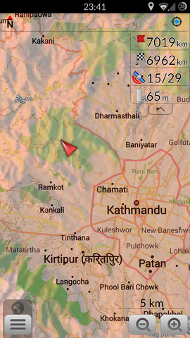
OpenStreetMapは、リアルタイムで更新されるオンライン地図とデータベースを提供しています。これはNavigation tools such as OSRMをはじめとする様々なオンライン地図を土台に作られています。 オープンストリートマップからは、GISの専門的業務や、ガーミンのようなGPS機器、スマートホンのGPSナビゲーション、またその他のデジタル機器に利用できる互換性のあるデータをダウンロードすることができます。 このデータの作成はオープンアクセス可能なコミュニティによって行われているため、インターネットへアクセスできる環境さえあれば、いつでもデータを同期させることができます。 また、ダウンロードしたオープンストリートマップのデータの大部分は、オフラインでも十分に使うことができ、必要に応じて印刷することなども可能です。
Browse the Activation Areaから、現在利用可能なデータを閲覧することができます。
スクリーン右側から、人道支援向けの特別な仕様を含む様々なスタイルの地図を選ぶことができます。
いくつかのデータがオンライン地図上に表示されていない場合がありますが、他ユーザーがより詳細な情報を要求すれば、基盤のデータベースからエクスポートされてきます。(下記エクスポートのセクション参照)
紙地図
大きなポスターサイズの地図とレターサイズの紙に任意の領域で印刷できます:
- FieldPapers 紙地図 現地調査または一般的なナビゲーションの目的のためのグリッド入り
- MapOSMatic 大きな紙地図 グリッドや通り名、POI入のもので指令所や病院などに適する
- カトマンズLiving Labsの地震地図 主要都市を抽出した印刷可能なPDF
OpenStreetMapデータの抽出
更新頻度
| OSM フォーマット | GISソフトウェアのためのShapeファイル形式 | 小さなデバイス上で動くオフラインナビゲーション用ファイル | |
|---|---|---|---|
| OSM協力者による日単位の更新 | .pbf | Shapefile(Esri) 13 Thematic Layers |
OSMAnd obf Central Nepal(~20Mb) OSMAnd obf Nepal (~50Mb) GarminGPS用のIMGファイル |
| geofabrik see download directoryによる30分間隔の更新 |
.pbf | Shapefile(Esri) | |
| GFDRR Innovation Lab from geofabrik による主題レイヤ (道路, 避難キャンプ, 土地利用, 設備, 地名) |
.pbf | Shapefile(Esri) | |
| kleineisel.deによる数日以内の更新 routable, contains height contour lines (from SRTM data), the map design is similar to topo maps. |
GPS Garmin IMG | ||
| 一時間毎の更新 milovanderlinden | OSMAnd obf(~22Mb) | ||
| 二時間毎の更新 Mail | Garmin, Android, Garmin-Basecamp, QLandkarte |
Temporary Taginfo instance ![]() showing tagging statistics only for Nepal. Updated every 30min from Geofabrik extract. (if the dns server - http://nepal-taginfo.openstreetmap.hu/ - is not refreshed try http://178.62.129.19/ )
showing tagging statistics only for Nepal. Updated every 30min from Geofabrik extract. (if the dns server - http://nepal-taginfo.openstreetmap.hu/ - is not refreshed try http://178.62.129.19/ )
様々なOSMの出力ファイル形式に関する情報
- OSM.pbf : これらの圧縮された OSM ファイルはさまざまなGISソフトウェアで読み込みできます。
- Shapefile : このデータもQuantum GIS やESRI ArcGIS for DesktopのようなGISソフトウェアにインポートできます。
- OSMAnd.OBF : OSMAnd / AndroidとiPhoneのオフラインマップ・ナビゲーションが可能です
注: l2015-04-19版では, Android版のすべての機能の統合がこのiPhone第1版では完了していません.- » Android File manager: Move the obf file from the download to the OSMAnd directory
- LearnOSM Tutorial Configure OSMAnd, and Offline map navigation
- How to use Voice Navigation
- GPS.IMG : Garmin GPSフォーマット
- » Rename the IMG file to gmapsupp.img and move it to the Garmin directory of the GPS card
- 他のモバイル機器 : 他を御覧ください モバイル機器製品.
OpenStreetMap Response
アップデートは、こちらのメーリングリストに投稿されています。HOT mailing list
整合作業や議論は、こちらのサーバーで行われます。HOT's IRC Channel or Mumble Server
The general Nepal remote mapping guide may be useful for help with identifying Nepalese features
地図の利用
OpenStreetMapは無料の地図を提供しています!こちらのリンクまたは他のリソースを使用してください。無料でオープンライセンスとなっています。downloading data
Geofabrikの提供はデータこちらです。 [2].
さまざまな形式で書き出された OpenStreetMap のデータ
あなたが貢献できること
地図の編集
- あなたは、インターネットを介して建物、道路、水路などをトレースすることで貢献できます。 人道支援の展開を迅速にサポートするために、遠隔地で編集してくれる多くの人を必要としています。サポートを始めるため LearnOSM.org にアクセスしてください。 LearnOSM Task Manager tutorial をみてください。 あなたが編集の基礎を覚えるために最良の方法は、経験を積んだ貢献者が参加しているMapathonsに参加することです。
- より経験豊富なOSMの貢献者 は 高速道路タグに関するガイドラインを読み取り、道路の分類を修正するために招待されています。また、タスクマネージャのタスク検証や、様々なOSM品質管理ツールを使用してマッピングの品質を保証することができます。
- 人道フィールドチームと知識豊富な地元の人々にも不可欠です。道路や様々なインフラ項目の名前を追加することにより、マップを完了することができます。小型のモバイルデバイスを使用してマップを編集することが可能です。また、アプリケーションは、オンラインまたはオフラインでもマッピング可能です。
- メモを追加したり、オンライン地図上のNotes 機能を使用してエラーを報告して下さい。OSMの貢献者は、あなたのコメントを頼りにマップを編集していきます。
Task Manager projects
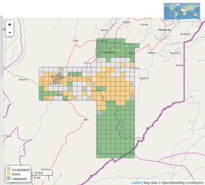
次のプロジェクトが OSM Tasking Manager に設定されています:
| Job No. | 地名 | 何を地図にするのか | Imagery expiration | 地図化の進行状況 | 検証状況 |
|---|---|---|---|---|---|
| Job 1018 (priority) | Surrounding the greater areas outside Kathmandu | 2nd pass for detailed mapping | N/A | 進行中 | 進行中 |
| Job 190 (priority) | Kathmandu Valley, includes more imagery | buildings only | N/A | 進行中 | 進行中 |
| Job 1006 | North of Narayangadh and east of Pokhara | Residential areas and buildings | N/A | 進行中 | 進行中 |
| Job 1009 | Gorkha | Residential areas and buildings | N/A | 完成 | 進行中 |
| Job 1008 | Kathmandu | IDP Camps | N/A | 完成 | 進行中 |
| Job 1010 | Banepa | IDP Camps | N/A | 完成 | 進行中 |
| Job 1014 | Sindhupalchowk | heavily affected area, detailed mapping needed | N/A | 進行中 | 進行中 |
| Job 1015 | Dhunche Rasuwa | heavily affected area, detailed mapping needed | N/A | 完成 | 完成 |
| Job 1016 | Langtang Rasuwa | heavily affected area, detailed mapping needed | N/A | 完成 | 完成 |
| Job 994 | North of Kathmandu and remote mountain areas | roads only | N/A | 進行中 | アーカイブ |
| Job 995 | East of Kathmandu and remote mountain areas | roads only | N/A | 進行中 | アーカイブ |
| Job 1001 | West of Kathmandu and remote mountain areas | roads only | N/A | 完成 | アーカイブ |
| Job 1002 | North West of Kathmandu - Manaslu Conservation Area | roads, villages, buildings | N/A | 完成 | アーカイブ |
| Job 1004 | South West of Kathmandu | roads | N/A | 進行中 | アーカイブ |
| Job 1003 | North of Dunche, includes more imagery | detailed map | N/A | 完成 | 完成 |
マッピングタスクが作成されている場合は、こちらから見つけることができます。HOT Tasking Manager
uMAP上のタスクの概要や、その他の情報:uMap
すべてのタスクの要約や統計情報:Nepal Mapping Progress Dashboard
よりよい地図への改善
現在Humanitarian OpenStreetMap Team の活動は対応の初期段階にあります。現在、道路ネットワークのような広範囲にわたる情報の検証や改善は役立つものの、編集によるデータのコンフリクトも起こりやすいため、なるべく「こまめに保存」するとともに、このように編集が混み合った状態で編集時のコンフリクトに遭遇する可能性が高いことを理解してください。
あなたが知っている建物や道路名など、被災地域のローカルな情報は、組織の素早い対応のために非常に有効となります。
一般的な Nepal remote mapping guide は、ネパール国内の地物を同定するのに助けとなるでしょう。
道路をマッピングすることは優先度が高く、ネパールの道路に関するOSMページ は、道路分類のための規則やガイドラインの提案についての良いリファレンスです。
OpenStreetMapは編集可能な地図です。そのため、情報の不足・編集内容の間違いがあった場合は、私たちはその都度改善することが出来ます。 (初心者ガイド) いかなる現地情報でもあなたが知っていたり、通りの名前などを現地調査ができる場合、これは特に便利となります。
現地情報を知っているが、OpenStreetMapの編集方法は知らない方の存在は、私たちの活動に不可欠です。 あなたはOpenStreetMapの"Notes":「メモ」機能を使って地元の知識を共有することができます。そして、経験豊富なOSMマッパーは、マーカーを削除し、場所・建物・道路に関する情報をメモを付け加えることができます。その後、OSMデータベースに入力していきます。私たちのマッパーであなたのノートを使用して、経験豊富なOSMマッパーと知識を共有する方法について簡単な手順は、こちらのクイックガイドをご覧ください。
How to easily share local knowledge with OSM Notes
画像・空間参照地図
Pleiades, Airbus Space & Defense
2014-04-27 Pleiades 2014-11-29 and 2015-04-27 have been used for post-disster IDP camps identification in Kathmandu.
画像のリクエスト
新鮮で蓄積された衛星画像は、国際的な活動家や画像のプロバイダを介して要求されています。 HOTは、基本的なマッピングと損害評価の両方のための高解像度画像が必要な地域を特定しました。要求された領域は、このマップに明るい青で強調表示されます:
http://umap.openstreetmap.fr/en/map/hot-imagery-coordination_37804#9/28.0623/85.2251
Bing
Bing imagery coverage as of 2015-04-25 with TM #994 and #995 overlay. (coverage source TMS: http://ant.dev.openstreetmap.org/bingimageanalyzer/tile.php/{z}/{x}/{y}.png)
DigitalGlobe
Indian Space Research Organization
Cartosat-2 post-earthquake for Kathmandu imagery as of 2015-04-27.
Mapbox
For some of TM #1001 the Bing imagery may be cloudy or unavailable, MapBox has coverage, but not at all zoom levels.
パブリックドメインの地形図
ネパールの大部分をカバーしている、パブリックドメインの地形図は2つのセットがあります。両方のセットのスケールは1:250,000となっており、数千の地名を入力するのに有効です。 私たちは、手動でこれらのマップから地名にコピーする前に、GNS領域の地名と合わせるために一部の手動作業を削除します。これが行われた後、私たちはこれらの地形図上に地名のすべてを検討し、体系的に入力するため、タスクマネージャーのジョブを作成します。
| Layer | JOSM TMS Url | View |
|---|---|---|
| アメリカ陸軍の地図サービス (AMS) | tms[15]:http://mapwarper.net/layers/tile/345/{zoom}/{x}/{y}.png | オンラインでの閲覧 |
他のデータ
- USGS shakemap data (click on 'download')
- Humanitarian Data Exchange - Nepal Earthquake
- NGA GEOnet Names Server (GNS)
- High resolution Nepal weather
- Near real-time MODIS imagery
- World Pop 100M gridded population for Nepal - currently being updated
- Gridded Population of the World
- UNOCHA Nepal data-sets
- Freizeitkarte Nepal Topographic maps for Garmin and Android (with periodic updates)
- www.kleineisel.de Topographic OSM map for Garmin devices with contours
- Nepal Topo Maps 1:25,000 This site contains a bunch of topographic maps. They are copyrighted so we cannot use them without permission from the creators. The copyright is His Majesty's Government of Nepal, Survey Department. Please coordinate on the HOT mailing list before sending any requests to the org to avoid sending multiple requests.
他のリソース
- Nepal Earthquakes Reporting Site (Kanthmandu Living Labs Ushahidi)
- Disaster OpenRouteService for Nepal including POI, damaged buildings etc. (GIScience HD)
- EMSC (European Mediterranean Seismological Centre) provides real time earthquake information
Write-ups and in the News
- 25-Apr-2015: Articles on ReliefWeb by Shadrock Roberts describing all the DH group efforts
- 27-Apr-2015: Laura Bliss - Another Way to Help Humanitarian Efforts in Nepal: Start Mapping - In: CityLab
- 27-Apr-2015: Gizmodo - Two Ways You Can Join Nepal's Earthquake Relief Effort From a Computer
- 27-Apr-2015: Hyperallergic.com - Open Source Maps Help Guide Nepalese Earthquake Relief
- 27-Apr-2015: 'People Want to Help' - Digital Volunteers Around the World Scour Nepal Data
- 28-Apr-2015: The News Minute - How a group of individuals from all over India are making maps to help rescue teams in Nepal
- 28-Apr-2015: Wired.co.uk - How Nepal's earthquake was mapped in 48 hours
- 28-Apr-2015: Adele Peters - One Way You Can Help Nepal Right Now: All You Need Is A Computer And A Little Time - In: Co.Exis
- 28-Apr-2015: Siddharta Mishra - How a group of individuals from all over India are making maps to help rescue teams in Nepal - In: The News Minute
- 29-Apr-2015: Franziska Schwarz und Hakan Tanriverdi - Hilfe für Nepal per Mausklick - In: Die Zeit
Documented Usage
Map Visualizations
Online Maps
Routing tools
Disaster OpenRouteService for Nepal including POI, damaged buildings etc. (GIScience HD) http://www.openrouteservice.org/disaster-nepal (more info: http://giscienceblog.uni-hd.de/2015/04/28/disaster-openrouteservice-for-nepal/ )


